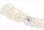
- Naikap Purano Bhanjyang
-
Naikap Purano Bhanjyang — Village development committee — Country  Nepal
NepalZone Bagmati Zone District Kathmandu District Population (1991) - Total 3,456 Time zone Nepal Time (UTC+5:45) Naikap Purano Bhanjyang is a village in Kathmandu District in the Bagmati Zone of central Nepal. At the time of the 1991 Nepal census it had a population of 3456 .The highest terrains in this village locate westernly, is ward No.5.A panaromic beautiful scene of whole Kathmandu Valley from Sanga to Nagarkot and Swayambhunath to Kirtipur Chobar can be viewed very clearly.The height of this hilly region lies in between 1600 m. to 1800 m.The whole himalayan range from Langtang to Mahalangur can also be viewed.[1]
References
- ^ "Nepal Census 2001". Nepal's Village Development Committees. Digital Himalaya. http://www.digitalhimalaya.com/collections/nepalcensus/form.php?selection=1. Retrieved 2008-08-28.
Aalapot · Baad Bhanjyang · Bajrayogini · Balambu · Baluwa · Bhadrabas · Bhimdhunga · Budanilkantha · Chalnakhel · Chapali Bhadrakali · Chhaimale · Chobhar, Nepal · Chouketar Dahachok · Chunikhel · Daanchhi · Daxinkali · Dhapasi · Dharmasthali · Futung · Gapalphedi · Gokarna · Goldhunga · Gonggabu · Gothatar · Ichankhu Narayan · Indrayani · Jhor Mahankal · Jitpurphedi · Jorpati · Kabhresthali · Kapan · Khadka Bhadrakali · Kirtipur Chitubihar · Koteswor · Lapsiphedi · Machhegaun · Mahadevsthan, Kathmandu · Mahankal · Manmaiju · Matatirtha · Mulpani · Naglebhare · Naikap Naya Bhanjyang · Naikap Purano Bhanjyang · Nayapati · Pukhulachhi · Ramkot · Sangla · Satungal
· Seuchatar · Sheshnarayan · Sitapaila · Sokhek · Sundarijal · Suntol · Talkududechour · Thankot · Tinthana · Tokha Chandeswori · Tokha Sarswoti Categories:
- Populated places in Kathmandu District
- Bagmati Zone geography stubs
Wikimedia Foundation. 2010.

