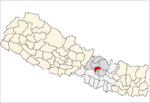
- Dhapasi
-
Dhapasi — Village development committee — Location in Nepal Coordinates: 27°45′N 85°20′E / 27.75°N 85.33°ECoordinates: 27°45′N 85°20′E / 27.75°N 85.33°E Country  Nepal
NepalZone Bagmati Zone District Kathmandu District Population (1991) – Total 4,134 Time zone Nepal Time (UTC+5:45) Dhapasi is an upcoming and a residentially preferred village in the northern outskirts of Kathmandu District, just outside the city ring road, in the Bagmati Zone of central Nepal. Though the Government of Nepal has categorized it as a village, it currently has all the infrastructural support accessible to any corner of the Kathmandu Metropolitan.
At the time of the 1991 Nepal census it had a population of 4134 and had 712 households in it.[1]
References
- ^ "Nepal Census 2001". Nepal's Village Development Committees. Digital Himalaya. http://www.digitalhimalaya.com/collections/nepalcensus/form.php?selection=1. Retrieved 2008-08-28.
Aalapot · Baad Bhanjyang · Bajrayogini · Balambu · Baluwa · Bhadrabas · Bhimdhunga · Budanilkantha · Chalnakhel · Chapali Bhadrakali · Chhaimale · Chobhar, Nepal · Chouketar Dahachok · Chunikhel · Daanchhi · Daxinkali · Dhapasi · Dharmasthali · Futung · Gapalphedi · Gokarna · Goldhunga · Gonggabu · Gothatar · Ichankhu Narayan · Indrayani · Jhor Mahankal · Jitpurphedi · Jorpati · Kabhresthali · Kapan · Khadka Bhadrakali · Kirtipur Chitubihar · Koteswor · Lapsiphedi · Machhegaun · Mahadevsthan, Kathmandu · Mahankal · Manmaiju · Matatirtha · Mulpani · Naglebhare · Naikap Naya Bhanjyang · Naikap Purano Bhanjyang · Nayapati · Pukhulachhi · Ramkot · Sangla · Satungal
· Seuchatar · Sheshnarayan · Sitapaila · Sokhek · Sundarijal · Suntol · Talkududechour · Thankot · Tinthana · Tokha Chandeswori · Tokha Sarswoti Categories:
- Populated places in Kathmandu District
- Bagmati Zone geography stubs
Wikimedia Foundation. 2010.


