- Petit train de la Rhune
-
Petit train de la rhune 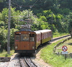
The Petit train de la Rhune.Technical Line length 4.2 km (2.6 mi) No. of tracks Single track with passing loops Track gauge 1,000 mm (3 ft 3 3⁄8 in) Electrification 3000 V, 50 Hz, three-phase Operating speed 9 km/h (5.6 mph) Highest elevation 905 m (2,969 ft) The Petit train de la Rhune is a metre gauge rack railway in France at the western end of the Pyrenees. It links the Col de Saint-Ignace, some 10 km (6.2 mi) to the east of Saint-Jean-de-Luz, to the summit of the La Rhune mountain. Although this summit lies on the border between France and Spain, the railway lies entirely within the French département of Pyrénées-Atlantiques.[1]
Contents
History
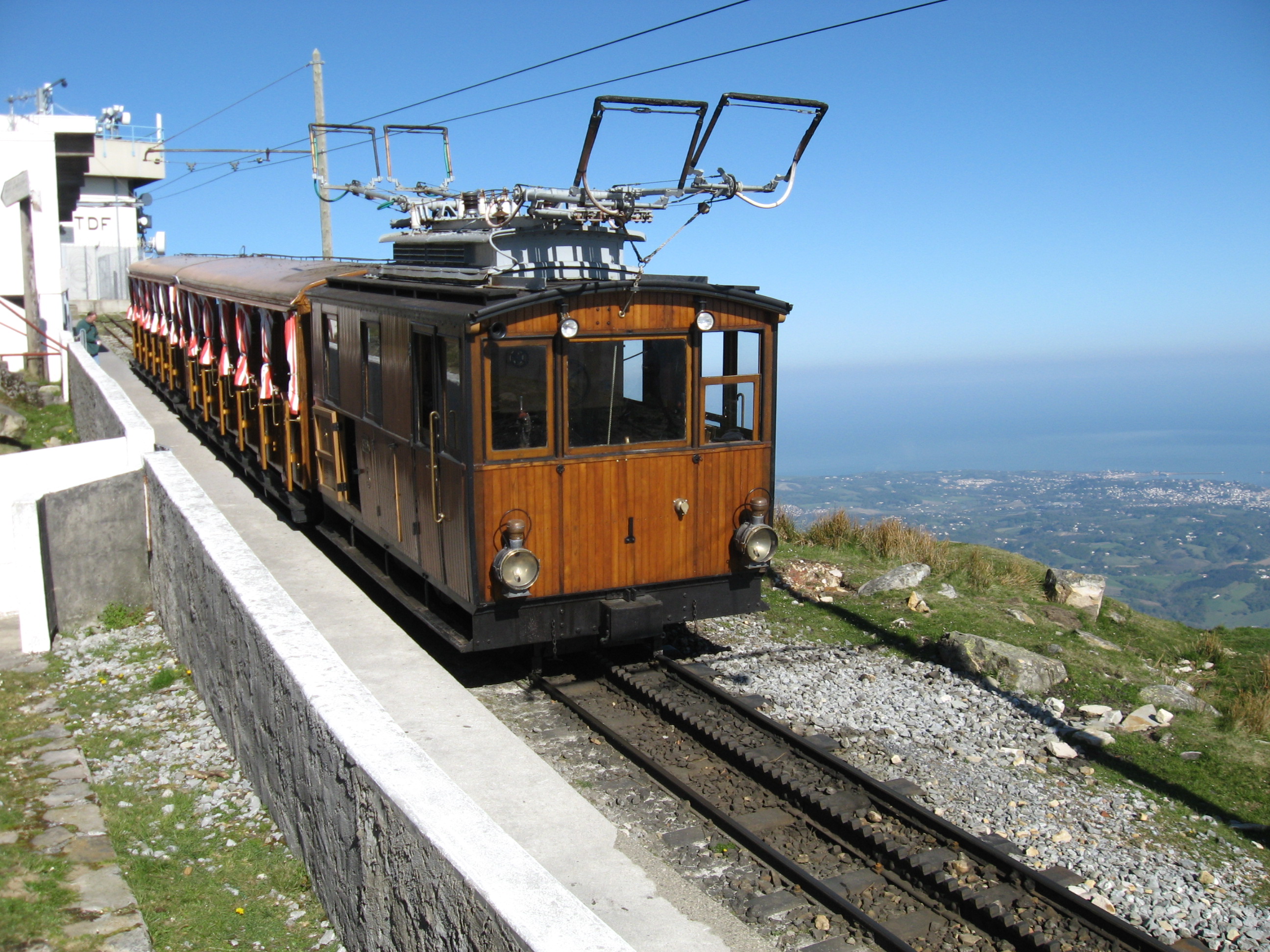
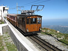 Train at summit station, showing the twin wires of the three-phase supply. The Atlantic coast can be seen in the background.
The idea of building a railway to the summit of La Rhune was first proposed in 1908, and a law passed in 1912 entrusted the construction and operation to the département. Work started on the construction of the line in 1912, but was suspended during World War I. The line opened on June 30, 1924. In a referendum in 1978, the population of the nearby village of Sare rejected a proposal to build a road to the summit of the Rhune, thus enabling the railway to survive.[1][2][3]
The concession to build the line, and operate it until 1982, was granted by the département to the Société Anonyme des Chemins de Fer Basques, which changed its name to the Voies Ferrées Départementales du Midi in 1914. The original concession was extended until 1994 and, as a result of a merger, it was taken over by the Société Hydroélectrique du Midi in 1989.[1][2][3]
In 1994, the concession expired and operation of the line reverted to the département. Since then the line has been operated under contract by Veolia Transport, a large international transport services business that also operates several other tourist railways in France.[1][3]
Technical details
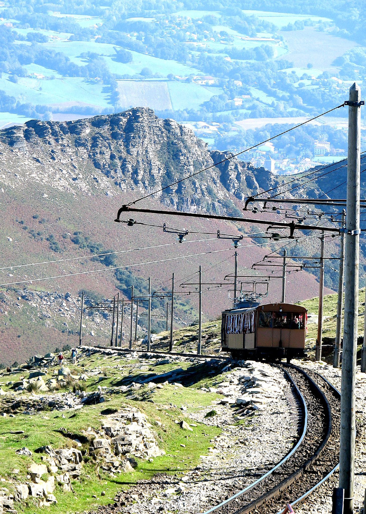
 A train on the mountain.
The line has the following technical characteristics:[1][2]
- Length: 4.2 km (2.6 mi)
- Rack system: Strub
- Altitude of bottom station: 169 m (554 ft)
- Altitude of upper station: 905 m (2,969 ft)
- Maximum gradient: 25%
- Time of journey: 30 minutes
- Speed: 9 km/h (5.6 mph)
- Electricity supply: 3000 V, 50 Hz, three-phase
Trains consist of a four-wheeled electric locomotive that pushes two coaches up the mountain, and leads them down. Each coach is carried by a four-wheeled bogie at its upper end, and a single two-wheeled axle at its lower end. With six ten-seat compartments in each coach, each train carries 120 passengers.[4]
The line operates from mid-March until early-November, with trains every 35 minutes.[2][5]
References
- ^ a b c d e "Petit train de la Rhune". Wikipedia France. 2008-07-29. http://fr.wikipedia.org/w/index.php?title=Petit_train_de_la_Rhune&oldid=32009444. Retrieved 2008-08-13.
- ^ a b c d "History of the line". Le petit train de la Rhune. http://www.rhune.com/pages/en/22/historique-de-la-ligne.html. Retrieved 2008-08-13.
- ^ a b c "Operation of the line". Le petit train de la Rhune. http://www.rhune.com/pages/en/74/exploitation-de-la-ligne.html. Retrieved 2008-08-13.
- ^ "histoire & technique de la crémaillère". Le petit train de la Rhune. http://www.rhune.com/templates/3/documents/histoire_cremaillere.pdf. Retrieved 2008-08-13.
- ^ "Home". Le petit train de la Rhune. http://www.rhune.com/pages/en/17/home.html. Retrieved 2008-08-13.
External links
Categories:- Metre gauge railways in France
- Mountain railways
- Pyrénées-Atlantiques
- Railway lines in France
- Railways using three-phase power
- Railway lines opened in 1924
- Rack railways
- Rack railways in France
- Railway companies of France

Wikimedia Foundation. 2010.