- North Bloomfield, California
-
North Bloomfield — Unincorporated community — Location of North Bloomfield in California

Coordinates: 39°22′06″N 120°53′58″W / 39.36833°N 120.89944°WCoordinates: 39°22′06″N 120°53′58″W / 39.36833°N 120.89944°W Country  United States
State  California
County Nevada Elevation[1] 3,287 ft (1,002 m) Time zone Pacific (PST) (UTC-8) - Summer (DST) PDT (UTC-7) Area code(s) 530 North Bloomfield (previously, Bloomfield, Humbug, and Humbug City) is a small unincorporated community located in Nevada County, California, United States, 10 miles (16 km) northeast of Nevada City, California.
Settled in 1852, it was originally named Humbug after the creek of the same name.[2] As the settlement grew, it was re-named Humbug City, and then the more dignified Bloomfield. The settlement thrived during Malakoff Diggins mining days. When a post office was established on June 1, 1857, residents selected the current name to differentiate the town from Bloomfield, California.
In 1857, the population was approximately 500. Three years later, the North Bloomfield Mining and Gravel Company arrived and began hydraulic mining operations. By 1876, the population swelled to 2000. But in 1884, when hydraulic mining ended because of a lawsuit by Sacramento area farmers, North Bloomfield became an uninhabited San Juan Ridge ghost town.[3]
In the present day, the town of North Bloomfield is contained within the Malakoff Diggins State Historic Park. Some of the town’s original buildings remain and a few have been reconstructed:[4]
- Skidmore House
- E Clampus Vitus Building
- McKillicam & Mobley General Store
- St. Columncille’s Catholic Church
The post office was open from 1857 to 1942, moving once in 1875.[5]
References
- ^ U.S. Geological Survey Geographic Names Information System: North Bloomfield, California
- ^ Hittell, Theodore Henry (1898). History of California. San Francisco. pp. 90. http://books.google.com/books?id=NUkOAAAAIAAJ&pg=PA90&dq=%22north+bloomfield%22+humbug&client=firefox-a.
- ^ "North Bloomfield, California". ghosttownexplorers.org. http://www.ghosttownexplorers.org/california/bloomfield/bloomfield.htm. Retrieved 2008-08-12.
- ^ "North Bloomfield". malakoff.com. http://www.malakoff.com/goldcountry/northblo.htm. Retrieved 2008-08-12.
- ^ Durham, David L. (1998). California's Geographic Names: A Gazetteer of Historic and Modern Names of the State. Quill Driver Books. p. 530. ISBN 9781884995149.
External links
Municipalities and communities of Nevada County, California County seat: Nevada City Cities and towns 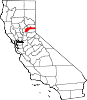
CDPs Alta Sierra | Floriston | Graniteville | Kingvale‡ | Lake of the Pines | Lake Wildwood | North San Juan | Penn Valley | Rough and Ready | Soda Springs | Washington
Unincorporated
communitiesAlta Hill | Bitney Corner | Carpenter Valley | Casey Corner | Cedar Ridge | Chicago Park | Coleman | Crystal Lake | Dew Drop | French Corral | Forest Knolls | Gaston | Gateway | Gold Flat | Higgins Corner | Hills Flat | Hinton | Hirschdale | Junction House | Kres | Lake City | Marsh Mill | Mooney Flat | Mystic | Newtown | Norden | North Bloomfield | North Columbia | Peardale | Pinecrest | Polaris | Relief | Scotts Flat | Sebastopol | Spring Hill | The Oaks | Town Talk | Union Mills | Willow Valley | Wolf | You Bet | Yuba Pass
Ghost towns Alpha | Badger Hill | Balaklava | Bald Eagle | Baltimore Town | Bear River Pines | Bear Valley | Beckmans Flat | Birchville | Blue Tent | Boca | Boston Ravine | Brass Wire Bar | Bridgeport | Brighton House | Bronco | Buena Vista | Burckhalter | Burks Bar | Camp Spaulding | Cascade Diggings | Cedar Kress | Chalk Bluff | Champion | Cherokee | Coyoteville | Crystal Springs | Democrat | Diamond Creek | Diggers Bar | Dillon | Drum | Eagle Bird | Elida | Eureka | Excelsior | Farad | Fernley | Flood | Forest Spring | French Lake | Frenchmans Bar | Gelatt | Glenbrook | Gold Hill | Hacketville | Hobart Mills | Hunt's Hill | Iceland | Indian Springs | Jericho | Jones Bar | La Barr Meadows | Lafayette Hill | Langs | Little York | Louisa | Lowell Hill | Malakoff | Maybert | Meadow Lake | Melburn Hill | Missouri Flat | Moores Flat | Mount Zion | Mountain Well | Mountain View | Negro Flat | Ohm | Omega | Orleans Flat | Pittsburg | Pleasant Flat | Prosser | Prosser Creek | Providence | Randolph House | Rays Flat | Red Diamond | Red Dog | Remington Hill | Rose's Corral | Shands | Shelby Flat | Shellback | Six Mile House | Snow Point | Snow Tent | Spenceville | Spiritsville | Stockings Flat | Sunset View | Sweetland | Tsekankan | Union Hill | Ustoma | Virginia House | Waloupa | White Cloud | Wickes | Wilsonville | Wokodot | Woolsey Flat | Yamako | Zinc House
Footnotes ‡This CDP also has portions in an adjacent county or counties
Categories:- Former settlements in Nevada County, California
- Ghost towns in California
- Mining communities in California
- Nevada County, California geography stubs


Wikimedia Foundation. 2010.