- Morthen
-
Coordinates: 53°23′N 1°17′W / 53.39°N 1.29°W
Morthen 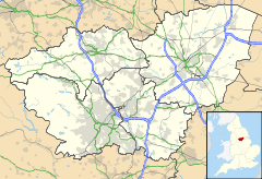
 Morthen
Morthen shown within South YorkshireOS grid reference SK4789 Metropolitan borough Rotherham Metropolitan county South Yorkshire Region Yorkshire and the Humber Country England Sovereign state United Kingdom Post town ROTHERHAM Postcode district S66 Dialling code 01709 Police South Yorkshire Fire South Yorkshire Ambulance Yorkshire EU Parliament Yorkshire and the Humber UK Parliament Rother Valley List of places: UK • England • Yorkshire Morthen is a hamlet in South Yorkshire in England, lying between Brampton-en-le-Morthen and Laughton-en-le-Morthen.[1]
Morthen lay in the Viking district also named "Morthen". This had already ceased to function by the Norman Conquest, but gave its name to several villages in the area. In the early Mediaeval period, Aston and Dinnington were also described as being "-in-Morthen".[1]
The name of the hamlet originates in the Old Norse for "moorland assembly". The assembly probably met in a meadow lying next to the ridge running between Upper Whiston and the hamlet of Morthen.[1]
References
External links
 Media related to Morthen at Wikimedia CommonsCategories:
- Geography of Rotherham
- Villages in South Yorkshire

Wikimedia Foundation. 2010.