- Kraainem
-
Kraainem 
Flag
Coat of armsLocation in Belgium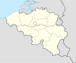
 Kraainem
Coordinates: 50°52′N 04°28′E / 50.867°N 4.467°E Country Belgium Region Flemish Region Community Flemish Community Province Flemish Brabant Arrondissement Halle-Vilvoorde Government – Mayor Arnold d'Oreye de Lantremange (UNION)
Acting Mayor– Governing party/ies UNION (FDF-CDH-MR-PS-ECOLO-Independent),KZOOO Area – Total 5.80 km2 (2.2 sq mi) Population (1 January 2010)[1] – Total 13,368 – Density 2,304.8/km2 (5,969.5/sq mi) Postal codes 1950 Area codes 02 Website www.kraainem.be Map of Kraainem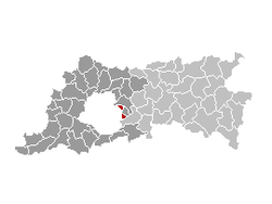
Kraainem (also unofficially known in French as 'Crainhem') is a municipality in the province of Flemish Brabant, in Flanders, one of the three regions of Belgium. The municipality only comprises the town of Kraainem proper. On January 1, 2006 Kraainem had a total population of 13,150. The total area is 5.80 km² which gives a population density of 2,266 inhabitants per km².
Kraainem is a municipality with language facilities within Flanders, where the sole official language is Dutch. However, in 1963, special 'language facilities' were given to French-speaking inhabitants, when those were still a minority. They can request official documents from the local administration in French. Today, a majority of the inhabitants are French-speaking.
Kraainem is one of the richest municipalities in Belgium.
Contents
Pronunciation
Urbanisation
The forest of Stokkel belonged to the d'Huart family until the 1920s. When grandfather d'Huart died in 1927, his family decided to found "la Société Immobilière de Stockel" and built a lane through the forest. This lane is the current Albert d'Huartlaan that used to be covered with gravel until 1960.
The homes surrounding the "Hurlevent" were built and afterwards those of the society of Utrecht. The real construction started in 1930 and accelerated after the second world war. Approximately 2800 people lived in Kraainem in 1940, 3254 in 1945 and 5190 in 1954, which was the year in which urbanisation really experienced its surge.
In 1949 the social housing of Eigen Haard were built followed by the Josephine Charlotte neighbourhood in 1954. Over 11,000 persons lived in the Kraainem region in 1967. In 1993, of a total population of 12,780 residents, 2,623 were immigrants. Despite being located in Flanders, Kraainem became increasingly francophone during the 20th century, reducing the Dutch-speakers to a minority. Communal politics is centred upon the language issue. Given the commune's proximity and good transport links to the airport, to NATO and to the European Quarter, an increasing number of non-Belgians have settled in the commune and this trend looks set to continue as the few remaining greenfield sites are developed.
The commune has two state schools, one Dutch and one francophone, and in 1968 the new St-Dominicus chapel was inaugurated.
References
- ^ Population per municipality on 1 January 2010 (XLS; 221 KB)
External links
- Official website (in Dutch and French)
Halle-Vilvoorde Affligem · Asse · Beersel · Bever · Dilbeek · Drogenbos · Galmaarden · Gooik · Grimbergen · Halle · Herne · Hoeilaart · Kampenhout · Kapelle-op-den-Bos · Kraainem · Lennik · Liedekerke · Linkebeek · Londerzeel · Machelen · Meise · Merchtem · Opwijk · Overijse · Pepingen · Roosdaal · Sint-Genesius-Rode · Sint-Pieters-Leeuw · Steenokkerzeel · Ternat · Vilvoorde · Wemmel · Wezembeek-Oppem · Zaventem · Zemst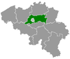
Leuven Aarschot · Begijnendijk · Bekkevoort · Bertem · Bierbeek · Boortmeerbeek · Boutersem · Diest · Geetbets · Glabbeek · Haacht · Herent · Hoegaarden · Holsbeek · Huldenberg · Keerbergen · Kortenaken · Kortenberg · Landen · Leuven · Linter · Lubbeek · Oud-Heverlee · Rotselaar · Scherpenheuvel-Zichem · Tervuren · Tielt-Winge · Tienen · Tremelo · ZoutleeuwCategories:- Municipalities of Flemish Brabant


Wikimedia Foundation. 2010.