- Merchtem
-
Merchtem 
Flag
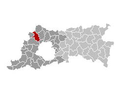
Coat of armsLocation in Belgium Coordinates: 50°58′N 04°14′E / 50.967°N 4.233°E Country Belgium Region Flemish Region Community Flemish Community Province Flemish Brabant Arrondissement Halle-Vilvoorde Government - Mayor Eddy De Block (OpenVLD-GMB-SPA-LVB) - Governing party/ies OpenVLD-GMB-SPA-LVB Area - Total 36.72 km2 (14.2 sq mi) Population (1 January 2010)[1] - Total 15,341 - Density 417.8/km2 (1,082.1/sq mi) Postal codes 1785 Area codes 052, 02 Website www.merchtem.be Merchtem is a municipality located in the Belgian province of Flemish Brabant. The municipality comprises the villages of Brussegem and Hamme, the hamlet of Ossel and Peizegem, and Merchtem proper. On July 9, 2009 Merchtem had a total population of 15,298.[2] The total area is 36.72 km² which gives a population density of 416 inhabitants per km².
Contents
Folklore
Merchtem is known for 'de steltenlopers', people walking on stilts (up to several meters above ground). Langevelde, a part of the municipality, was frequently flooded after heavy rain. In order to reach the centre, people were using sticks to walk. After an internal struggle, the group split up in two parts, 'stichting Langevelde' and 'stichting Jan Vaderhasselt'.
Language controversy
On August 28, 2006 mayor Eddie de Block introduced a ban on speaking French in the town's schools. Mayor de Block said that the measure did not violate human rights and that it would help integration. A previous ban on signs in languages different from Dutch in the town's markets had been overturned by Flemish Interior Minister Marino Keulen.[3]
References
- ^ Population per municipality on 1 January 2010 (XLS; 221 KB)
- ^ "Merchtem: bevolkingsaantal op 9 juli 2009". merchtem.be. http://www.merchtem.be/bd111xrcf924kinb0b15.aspx. Retrieved 2009-08-07.
- ^ "Belgian town bans school French". BBC News. September 1, 2006. http://news.bbc.co.uk/2/hi/europe/5305484.stm. Retrieved 2006-09-01.
External links
- Official website (Dutch)
Halle-Vilvoorde Affligem · Asse · Beersel · Bever · Dilbeek · Drogenbos · Galmaarden · Gooik · Grimbergen · Halle · Herne · Hoeilaart · Kampenhout · Kapelle-op-den-Bos · Kraainem · Lennik · Liedekerke · Linkebeek · Londerzeel · Machelen · Meise · Merchtem · Opwijk · Overijse · Pepingen · Roosdaal · Sint-Genesius-Rode · Sint-Pieters-Leeuw · Steenokkerzeel · Ternat · Vilvoorde · Wemmel · Wezembeek-Oppem · Zaventem · Zemst
Leuven Aarschot · Begijnendijk · Bekkevoort · Bertem · Bierbeek · Boortmeerbeek · Boutersem · Diest · Geetbets · Glabbeek · Haacht · Herent · Hoegaarden · Holsbeek · Huldenberg · Keerbergen · Kortenaken · Kortenberg · Landen · Leuven · Linter · Lubbeek · Oud-Heverlee · Rotselaar · Scherpenheuvel-Zichem · Tervuren · Tielt-Winge · Tienen · Tremelo · ZoutleeuwCategories:- Municipalities of Flemish Brabant
- Flemish Brabant geography stubs
Wikimedia Foundation. 2010.


