- Nevis, Alberta
-
Hamlet of Nevis — Hamlet — Location of Nevis in Alberta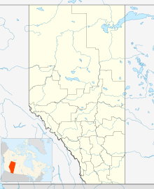

Coordinates: 52°19′49″N 113°01′53″W / 52.3303°N 113.0314°WCoordinates: 52°19′49″N 113°01′53″W / 52.3303°N 113.0314°W Country  Canada
Province  Alberta
Census division No. 7 Municipal district County of Stettler No. 6 Government - Type Unincorporated - Governing body County of Stettler No. 6 Council Area[1] - Total 0.67 km2 (0.3 sq mi) Elevation 815 m (2,674 ft) Population (2006)[1] - Total 35 - Density 52.2/km2 (135.2/sq mi) - Dwellings 16 Time zone MST (UTC-7) Nevis is a hamlet in central Alberta, Canada within the County of Stettler No. 6.[2] It is located on Highway 12, approximately 17 kilometres (11 mi) southeast Alix and 8 kilometres (5.0 mi) west of Erskine. It has an elevation of 815 metres (2,674 ft).
The hamlet is located in census division No. 7 and in the federal riding of Crowfoot.
Demographics
As of 2006, Nevis had a total population of 35 living in 16 dwellings. With a land area of 0.67 km2 (0.26 sq mi), it has a population density of 52.2 /km2 (135 /sq mi).[1]
Industry Canada shows that Nevis's greater rural area had a total population of 512 living in 201 dwellings in 2001. With a land area of 280.5 km2 (108.3 sq mi), its greater rural area has a population density of 7.0 /km2 (18 /sq mi).[3]
See also
- List of communities in Alberta
- List of hamlets in Alberta
References
- ^ a b c Statistics Canada (2007). "Population and dwelling counts, for Canada, provinces and territories, and designated places, 2006 and 2001 censuses". http://www12.statcan.ca/english/census06/data/popdwell/Table.cfm?T=1302&SR=1&S=1&O=A&RPP=9999&PR=48&CMA=0. Retrieved 2010-01-31.
- ^ Alberta Municipal Affairs (2010-04-01). "Specialized and Rural Municipalities and Their Communities". http://municipalaffairs.gov.ab.ca/documents/msb/2010-ruralmun.pdf. Retrieved 2010-07-04.
- ^ Industry Canada/Web Archive (2006-11-04). "Nevis - Community demographics (2001 census)". http://www.collectionscanada.gc.ca/webarchives/20061104084225/http://broadband.gc.ca/maps/province.html?prov=48. Retrieved 2010-02-07.
 Subdivisions of Alberta
Subdivisions Regions · Census divisions · Municipal districts (counties) · Specialized municipalities · School districts · Regional health authoritiesCommunities Cities · Towns · Villages · Summer villages · Hamlets · Indian reserves · Métis settlements · Ghost towns · Designated placesCities and Urban
Service AreasAirdrie · Brooks · Calgary · Camrose · Cold Lake · Edmonton (capital) · Fort McMurray · Fort Saskatchewan · Grande Prairie · Lacombe · Leduc · Lethbridge · Lloydminster · Medicine Hat · Red Deer · Sherwood Park · Spruce Grove · St. Albert · WetaskiwinCategories:- Hamlets in Alberta
- Designated places in Alberta
- Stettler County, Alberta
- Central Alberta geography stubs

Wikimedia Foundation. 2010.