Cheung Tsing Bridge

Cheung Tsing Bridge
Cheung Tsing Bridge
Rambler Channel with three bridges.jpg
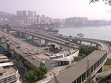
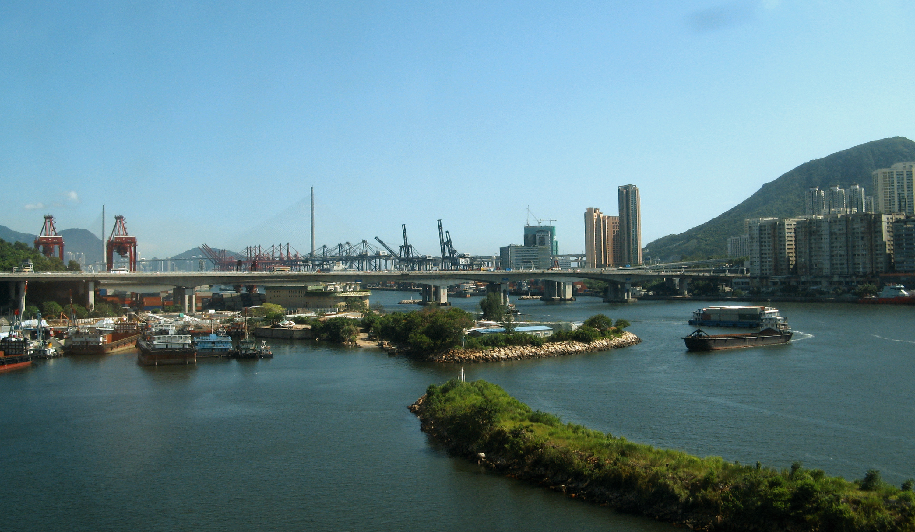
Cheung Tsing Bridge is on the left
Traditional Chinese 長青橋
Simplified Chinese 长青桥
Rambler Channel Bridge
Traditional Chinese 藍巴勒海峽大橋
Simplified Chinese 蓝巴勒海峡大桥
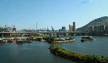
Cheung Tsing Bridge, side view

Cheung Tsing Bridge, formally Rambler Channel Bridge, is a bridge on Rambler Channel in Hong Kong, connecting Cheung Ching Tunnel on Tsing Yi Island and Kwai Chung section of Tsing Kwai Highway. It is part of Tsing Kwai Highway of Route 3.

The bridge is later[when?] given the name Cheung Tsing because of its proximity to Cheung Ching Estate and Cheung Ching Tunnel.

External links

Coordinates: 22°20′58″N 114°6′48.4″E / 22.34944°N 114.113444°E / 22.34944; 114.113444

Cheung Tsing Bridge
Hong Kong Route 3 Chronology
HK Route3.svg
Preceded by
Tsing Kwai Highway
Cheung Tsing Bridge Succeeded by
Cheung Tsing Tunnel


Wikimedia Foundation. 2010.

Игры ⚽ Нужна курсовая?

Look at other dictionaries:

  • Cheung Tsing Tunnel — Traditional Chinese 長青隧道 Simplified Chinese 长青隧道 …   Wikipedia

  • Cheung Tsing Highway — Major junctions From: Cheung Tsing Tunnel To: North West Tsing Yi Interchange Cheung Tsing Highway (traditional Chinese: 長青公路; simplified Chinese: 长青公路; …   Wikipedia

  • Tsing Kwai Highway — (zh cpcy|c=青葵公路|p=Qīngkuí Gōnglù|cy=ching1 kwai4 gung1 lou6) is a section of Route 3 in Hong Kong, previously known as Route 3 Kwai Chung Section. From its junction with West Kowloon Highway at Mei Foo Roundabout, the expressway runs in the form… …   Wikipedia

  • Tsing Yi — For a type of fish called tsing yi, see Green Wrasse. Tsing Yi Tsing Yi, viewed from Shek Lung Kung Geography Location Central New Territories Area 10.69 km2 …   Wikipedia

  • Tsing Yi Interchange — (Chinese: 青衣交匯處) is a road interchange on eastern Tsing Yi Island in Hong Kong, between Rambler Channel and Cheung Ching Estate.Several roads meet at the interchange: * Tsing Yi Bridge, a bridge leading to the Kwai Fong and Tsing Kwai Highway; *… …   Wikipedia

  • Tsing Yi Peak — (zh c|c=青衣山, or Tsing I Peak formerly) or Sam Chi Heung (三支香) is a hill with three peaks occupying the southern half of the Tsing Yi Island, Hong Kong. The hill is situated on the western half of Victoria Harbour. Its peaks are good locations to… …   Wikipedia

  • Tsing Ma Control Area — (Chinese: 青馬管制區, TMCA) is an area covering Lantau Link and related road networks in Hong Kong, including Tsing Ma Bridge, Ting Kau Bridge, Rambler Channel Bridge, Kap Shui Mun Bridge, Cheung Tsing Tunnel, Tsing Kwai Highway and North Lantau… …   Wikipedia

  • Tsing Long Highway — (zh cpcy|c=青朗公路|p=Qīnglǎng Gōnglù|cy=ching1 long5 gung1 lou6) is an expressway of Route 3 from North West Tsing Yi Interchange on Tsing Yi Island to Yuen Long, in Hong Kong. Ting Kau Bridge and Tai Lam Tunnel are part of the expressway. It… …   Wikipedia

  • Tsing Yi Road West — (zh cpcy|c=青衣西路|p=Qīngyī Xī Lù|cy=ching1 yi1 sai1 lou6) is the extended Tsing Yi Road from the west side of Tsing Yi Island back into the new town on the island. It start from the junction with Tsing Yi Road and Sai Tso Wan Road, runs uphill and… …   Wikipedia

  • Tsing Yi North Bridge — is also called Tsing Tsuen Bridge (Chinese: 青荃橋) which connects the Tam Kon Shan Interchange of Tsing Yi Island and Texaco Road Roundabout of Tsuen Wan, across the Rambler Channel. The bridge is built by the Japanese Firm, Maeda Co.(前田建設工業) and… …   Wikipedia

Share the article and excerpts

Direct link
Do a right-click on the link above
and select “Copy Link”