- Whitmore Lake, Michigan
Infobox Settlement
official_name = Whitmore Lake, Michigan
settlement_type = unincorporated community
motto =
imagesize =
image_caption =
image_
mapsize = 250px
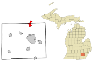
map_caption = Location in Washtenaw County the state ofMichigan
mapsize1 =
map_caption1 =
subdivision_type = Country
subdivision_type1 = State
subdivision_type2 = Counties
subdivision_name =United States
subdivision_name1 =Michigan
subdivision_name2 = Washtenaw, Livingston
government_type =
leader_title =
leader_name =
established_date =
area_magnitude =
area_total_km2 = 14.0
area_total_sq_mi = 5.4
area_land_km2 = 11.3
area_land_sq_mi = 4.4
area_water_km2 = 2.7
area_water_sq_mi = 1.0
area_water_percent = 19.41
population_as_of = 2000
population_total = 6,574
population_density_sq_mi = 1,508.5
population_density_km2 = 582.2
timezone = EST
utc_offset = -5
timezone_DST = EDT
utc_offset_DST = -4
elevation_m = 283
elevation_ft = 928
latd = 42 |latm = 22 |lats = 17.36 |latNS = N
longd = 83 |longm = 28 |longs = 13.72 |longEW = W
postal_code_type =ZIP code
postal_code = 48189
area_code = 734
blank_name = FIPS code
blank_info = 26-87060GR|2
blank1_name = GNIS feature ID
blank1_info = 1616386GR|3
footnotes =
website = http://twp.northfield.mi.us/Whitmore Lake is an
unincorporated community in theU.S. state ofMichigan . The community spans the boundary between Green Oak Township in Livingston County and Northfield Township in Washtenaw County. TheUnited States Census Bureau has defined aCensus-designated place (CDP) with this name for statistical purposes which has no legal status as an incorporated municipality. The population was 6,574 at the 2000 census.The community is located about nine miles (14.5 km) north of Ann Arbor and about nine miles south of Brighton. It is situated around the shores of Whitmore Lake and the CDP also includes the area around the smaller Horseshoe Lake to the south, Lawton Lake to the east and Monahan Lake to the northeast.
U.S. Highway 23 forms the western edge of much of the CDP for the 2000 census.The Whitmore Lake
ZIP code , 48189, is also used by a wider area than that defined by the CDP, including Hamburg Township and a large part of Northfield Township.The 667-acre Whitmore Lake was named by Jonathan F. Stratton, a surveyor, after Luke H. Whitmore, a local landowner around 1825. Area residents have considered incorporation many times, but have not chosen to do so yet.
The well known
8 Mile Road that forms the boundary between the city of Detroit,Michigan and Detroit's northern suburbs in Oakland and Macomb Counties, comes to an end in Whitmore Lake along with 9 Mile, 7 Mile, 6 Mile, and 5 Mile Road.Geography
According to the
United States Census Bureau , the community has a total area of 5.4square mile s (14.0km² ), of which, 4.4 square miles (11.3 km²) of it is land and 1.0 square miles (2.7 km²) of it (19.41%) is water.Demographics
As of the
census GR|2 of 2000, there were 6,574 people, 2,663 households, and 1,741 families residing in the community. Thepopulation density was 1,508.5 per square mile (582.2/km²). There were 2,960 housing units at an average density of 679.2/sq mi (262.1/km²). The racial makeup of the community was 96.05% White, 0.93% African American, 0.46% Native American, 0.47% Asian, 0.12% Pacific Islander, 0.23% from other races, and 1.75% from two or more races. Hispanic or Latino of any race were 1.46% of the population.There were 2,663 households out of which 32.7% had children under the age of 18 living with them, 51.7% were married couples living together, 9.4% had a female householder with no husband present, and 34.6% were non-families. 25.8% of all households were made up of individuals and 4.1% had someone living alone who was 65 years of age or older. The average household size was 2.42 and the average family size was 2.94.
In the community the population was spread out with 24.5% under the age of 18, 7.7% from 18 to 24, 39.2% from 25 to 44, 20.9% from 45 to 64, and 7.7% who were 65 years of age or older. The median age was 34 years. For every 100 females there were 102.6 males. For every 100 females age 18 and over, there were 98.7 males.
The median income for a household in the community was $51,504, and the median income for a family was $63,113. Males had a median income of $42,174 versus $28,865 for females. The
per capita income for the community was $26,066. About 3.5% of families and 5.2% of the population were below thepoverty line , including 5.8% of those under age 18 and 2.2% of those age 65 or over.Education
The community is served by the
Whitmore Lake Public School District . The Whitmore Lake Trojans are members of the Tri-County Conference.References
ee also
*
Whitmore Lake High School External links
* [http://www.washtenawweb.com/whitmrlk/index.htm Whitmore Lake in Washtenaw Web]
* [http://www.wlps.net Whitmore Lake Public Schools]
Wikimedia Foundation. 2010.