- Duson, Louisiana
-
Town of Duson Town 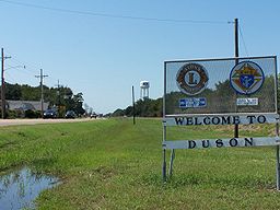 Downtown Duson
Country United States State Louisiana Parish Acadia, Lafayette Elevation 36 ft (11 m) Coordinates 30°14′11″N 92°11′06″W / 30.23639°N 92.185°W Area 2.6 sq mi (6.7 km2) - land 2.6 sq mi (7 km2) - water 0.0 sq mi (0 km2), 0% Population 1,672 (2000) Density 651.4 / sq mi (251.5 / km2) Timezone CST (UTC-6) - summer (DST) CDT (UTC-5) Area code 337 
 Location of Duson in Louisiana
 Location of Louisiana in the United States
Duson is a town in Acadia and Lafayette parishes in the U.S. state of Louisiana. The population was 1,672 at the 2000 census. The town was named after Curley Duson.
The Lafayette Parish portion of Duson is part of the Lafayette Metropolitan Statistical Area, while the Acadia Parish portion is part of the Crowley Micropolitan Statistical Area.
Contents
History
Originally known as "Duson Station" the town was laid out by J.G. Parkerson, general manager of the Louisiana Western Railroad. By August 30, 1880, the railroad line from New Orleans to Houston was completed and passenger and freight service began. It merged with Southern Pacific Railroad in 1900. The village of Duson was incorporated on December 16, 1909, named after the land developer Curley Duson and installed Adolph De Jean as the first mayor.
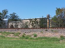 A typical cotton mill along the railroad in Duson.
In 1927, St Theresa Catholic Church was completed. Cotton farming was the main agriculture for the area. Three cotton gins were in Duson until the mid 1960s. Fires destroyed two and the third was torn down.[1] After World War II, small lots east of Duson were developed, with small houses using brick siding paper on the exterior. Because of that, the area became known as "Paper Town." [2]
Geography
Duson is located at 30°14′29.27″N 92°11′3.91″W / 30.2414639°N 92.1844194°W (30.241464, -92.184419)[3].
According to the United States Census Bureau, the town has a total area of 2.6 square miles (6.7 km²).None of the area is covered with water.
Demographics
As of the census[4] of 2000, there were 1,672 people, 644 households, and 452 families residing in the town. The population density was 651.4 people per square mile (251.2/km²). There were 724 housing units at an average density of 282.1 per square mile (108.8/km²). The racial makeup of the town was 73.98% White, 25.24% African American, 0.06% Native American, 0.06% from other races, and 0.66% from two or more races. Hispanic or Latino of any race were 0.36% of the population.
There were 644 households out of which 38.2% had children under the age of 18 living with them, 41.6% were married couples living together, 20.5% had a female householder with no husband present, and 29.7% were non-families. 25.3% of all households were made up of individuals and 8.9% had someone living alone who was 65 years of age or older. The average household size was 2.59 and the average family size was 3.07.
In the town the population was spread out with 30.0% under the age of 18, 10.5% from 18 to 24, 29.3% from 25 to 44, 19.6% from 45 to 64, and 10.6% who were 65 years of age or older. The median age was 32 years. For every 100 females there were 93.3 males. For every 100 females age 18 and over, there were 85.1 males.
The median income for a household in the town was $21,071, and the median income for a family was $24,886. Males had a median income of $26,250 versus $15,476 for females. The per capita income for the town was $10,520. About 27.5% of families and 31.5% of the population were below the poverty line, including 42.7% of those under age 18 and 29.5% of those age 65 or over.
Festivals
Like many other towns and cities in the Acadiana region, Duson has a local Mardi Gras celebration that includes a parade through the town. Many residents of nearby Lafayette, Scott and Rayne will converge on the town as most parades in the region are scheduled as to not occur simultaneously.
References
- ^ www.townofduson.org "Duson History by Jessie L Stoute"
- ^ www.carencrohighschool.org "Duson named for town-building promoters"
- ^ "US Gazetteer files: 2010, 2000, and 1990". United States Census Bureau. 2011-02-12. http://www.census.gov/geo/www/gazetteer/gazette.html. Retrieved 2011-04-23.
- ^ "American FactFinder". United States Census Bureau. http://factfinder.census.gov. Retrieved 2008-01-31.
Municipalities and communities of Acadia Parish, Louisiana Cities 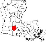
Towns Basile‡ | Church Point | Duson‡ | Iota
Villages Estherwood | Mermentau | Morse
Unincorporated
communitiesArceneaux | Bates | Branch | Castille | Deshotel | Ebenezer | Egan | Ellis | Evangeline | Frey | Hundley | Judd | Keystone | Lyons Point | Maxie | Midland | Millerville | Mire | Mowata | Nezpique | Peach Bloom | Pitreville | Prudhomme | Richard | Roberts Cove | Rork | Tepetate | Tortue | Whitehouse | Williams
Footnotes ‡This populated place also has portions in an adjacent parish or parishes
Municipalities and communities of Lafayette Parish, Louisiana Cities Broussard‡ | Carencro | Lafayette | Scott | Youngsville

Town Duson‡
Unincorporated
communitiesFootnotes ‡This populated place also has portions in an adjacent parish or parishes
Categories:- Populated places established in 1909
- Towns in Louisiana
- Populated places in Lafayette Parish, Louisiana
- Populated places in Acadia Parish, Louisiana
- Lafayette, Louisiana metropolitan area
- Acadiana


Wikimedia Foundation. 2010.