- Nye, West Virginia
-
Nye — Unincorporated community — Location within the state of West Virginia
 Nye
NyeCoordinates: 38°20′9″N 82°2′13″W / 38.33583°N 82.03694°WCoordinates: 38°20′9″N 82°2′13″W / 38.33583°N 82.03694°W Country United States State West Virginia County Putnam Time zone Eastern (EST) (UTC-5) – Summer (DST) EDT (UTC-4) ZIP codes FIPS code GNIS feature ID Nye is an unincorporated community in Putnam County, West Virginia, United States.
The community is centered on the confluences of Buzzard Creek and Sycamore Creek with Trace Creek along West Virginia Route 34, to the immediate east of the Lincoln County line.
Municipalities and communities of Putnam County, West Virginia Cities 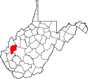
Towns CDPs Culloden‡ | Hometown | Teays Valley
Other
localitiesBlack Betsy | Confidence | Fraziers Bottom | Lanham | Liberty | Midway | Morgans Landing | Mt. Vernon | Nye | Pliny | Plymouth | Raymond City | Red House | Robertsburg | Scary | Scott Depot | Teays
Footnotes ‡This populated place also has portions in an adjacent county or counties
Categories:- Metro Valley geography stubs
- Populated places in Putnam County, West Virginia
- Unincorporated communities in West Virginia
- Charleston, West Virginia metropolitan area


Wikimedia Foundation. 2010.