- San Felipe, Zambales
-
San Felipe — Municipality — Map of Zambales showing the location of San Felipe.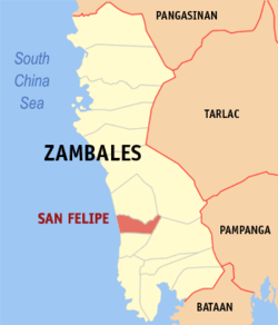 Location in the Philippines
 San Felipe
Coordinates: 15°3′43″N 120°4′12″E / 15.06194°N 120.07°ECoordinates: 15°3′43″N 120°4′12″E / 15.06194°N 120.07°E Country  Philippines
Region Central Luzon (Region III) Province Zambales District 2nd district Founded Barangays 11 Government – Mayor Carolyn S. Fariñas Area – Total 111.60 km2 (43.1 sq mi) Population (2007) – Total 21,322 – Density 191.1/km2 (494.8/sq mi) Time zone PST (UTC+8) ZIP code 2204 Income class 4th class Population Census of San Felipe Census Pop. Rate 1995 16,837 — 2000 17,702 1.08% 2007 21,322 2.60% San Felipe is a 4th class municipality in the province of Zambales, Philippines. According to the latest Philippine census, it has a population of 21,322 people in 4,094 households.[when?]
The population is largely Ilocanos, descendants of migrants from Ilocos.[citation needed]
The town was a victim of the Mount Pinatubo Eruption being buried in about a meter in volcanic ash but damage was comparatively light.[citation needed]
Barangays
San Felipe is politically subdivided into 11 barangays.
- Amagna (Pob.)
- Apostol (Pob.)
- Balincaguing
- Farañal (Pob.)
- Feria (Pob.)
- Maloma
- Manglicmot (Pob.)
- Rosete (Pob.)
- San Rafael
- Santo Niño
- Sindol
"Pob." stands for poblacion.
External links
- Philippine Standard Geographic Code
- 1995 Philippine Census Information
- 2000 Philippine Census Information
- 2007 Philippine Census Information
Component local government units of Zambales Municipalities Highly urbanized city (Administratively independent from the province, but grouped under Zambales by the National Statistics Office)Categories:- Municipalities of Zambales


Wikimedia Foundation. 2010.