- Masinloc, Zambales
-
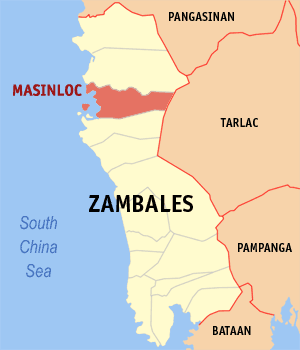
Masinloc — Municipality — Map of Zambales showing the location of Masinloc. Location in the Philippines
 Masinloc
Coordinates: 15°32′N 119°57′E / 15.533°N 119.95°ECoordinates: 15°32′N 119°57′E / 15.533°N 119.95°E Country  Philippines
Region Central Luzon (Region III) Province Zambales District 2nd district Founded Barangays 13 Government – Mayor Desiree E. Edora Area – Total 331.50 km2 (128 sq mi) Population (2007) – Total 40,603 – Density 122.5/km2 (317.2/sq mi) Time zone PST (UTC+8) ZIP code 2211 Income class 1st class Population Census of Masinloc Census Pop. Rate 1995 34,942 — 2000 39,724 2.79% 2007 40,603 0.30% Masinloc is a 2nd class municipality in the province of Zambales, Philippines. According to the latest census, it has a population of 40,603 people in 7,790 households.
Barangays
Masinloc is politically subdivided into 13 barangays.
- Baloganon
- Bamban
- Bani
- Collat
- Inhobol
- North Poblacion
- San Lorenzo
- San Salvador
- Santa Rita
- Santo Rosario
- South Poblacion
- Taltal
- Tapuac
External links
- [1]
- Philippine Standard Geographic Code
- 1995 Philippine Census Information
- 2000 Philippine Census Information
- 2007 Philippine Census Information
Component local government units of Zambales Municipalities Highly urbanized city (Administratively independent from the province, but grouped under Zambales by the National Statistics Office)Categories:- Municipalities of Zambales

Wikimedia Foundation. 2010.