- 2008 El Calvario earthquake
-
2008 El Calvario earthquake Date 24 May 2008 Magnitude 5.9 Mw[1] Depth 35 kilometres (22 mi) Epicenter 4°26′49″N 73°40′12″E / 4.447°N 73.670°E (El Calvario, Meta) Countries or regions  Colombia
Max. intensity VII - Very strong[2] Casualties 11 dead[3]
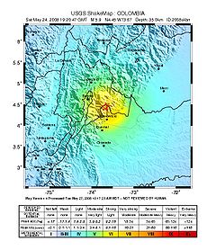
4,181 injuredThe 2008 El Calvario earthquake occurred in central Colombia on 24 May 2008. It was registered at 5.9 Mw on the moment magnitude scale. The earthquake occurred at 02:20:46 p.m. (19:20:46 UTC) at the epicenter (El Calvario, Meta). The depth was 35 km; it was superficial according to an Ingeominas report. The epicenter was located 35 km from Villavicencio and 50 km from Bogotá. The current casualty count is 11 confirmed fatalities, 4181 injured and 7051 affected, mostly in the towns of Puente Quetame, Fosca, Fomeque and Guayabetal in Cundinamarca, and in El Calvario, Meta.[3]
Moments before, at 12:08 local time (17:08 GMT), another quake was registered. It registered 4.0 Mw and its epicenter was near San Juanito, in the Meta Central Department, at a depth of 30 km.
The town of Puente Quetame, Cundinamarca was the most affected. Several houses collapsed in this small town of 6500 inhabitants. The reconstruction of the affected structures cost 10 million USD (exchange rate COP 2000). In Bogotá, a partial collapse of the building of "Lotería de Bogotá" was reported, with no major consequences. The emergency network in the Capital District was put on maximum alert. A collapse of fixed phone lines and cell phones occurred, due to the great number of people calling to find out about their relatives. The quake was also felt in cities as far away as Medellín and Bucaramanga.
In Guayabetal, Meta, civil defense workers could only reach the town from Villavicencio using motorcycles, because fallen buildings blocked cars from passing. The workers found two people dead and another 26 people trapped in a bus. Now there is a bypass to that point coming from Villavicencio, because 2 km of Highway 48 was closed due to fallen debris.
Similar earthquakes
Other notable 5.9 MW earthquakes Date Areas affected Notes Fatalities 1 October 1987 Southern California,  United States
see 1987 Whittier Narrows earthquake 3 31 October 2002  Italy (Molise)
see 2002 Molise earthquake 28 3 February 2008  Rwanda
 Burundi
 DR Congo
 Kenya
Kenyasee 2008 Lake Kivu earthquake 39 References
External links
- Strong Quake In Colombian Capital - Yahoo! News UK
- http://www.eltiempo.com/nacion/2008-05-24/ARTICULO-WEB-NOTA_INTERIOR-4206638.html (Spanish)
- Reconstrucción de Quetame costaría 20 mil millones de pesos (Spanish)
- Habitantes de Quetame siguen con miedo después del temblor (Spanish)
← Earthquakes in 2008 → 2007–08 Nazko (<4.0) · Lake Kivu (5.9, Feb 3)† · Čačak (4.5, Feb 15) · Lincolnshire (5.2, Feb 27) · Illinois (5.4, Apr 18) · Sichuan (8.0, May 12)†‡ · El Calvario (5.9, May 24) · Iceland (6.3, May 29) · Peloponnese (6.5, Jun 8) · Iwate (7.2, Jun 14) · Chino Hills (5.5, Jun 29) · Dodecanese (6.4, Jul 15) · Yingjiang (6.0, Aug 21) · Panzhihua (~6, Aug 30)† · Bandar Abbas (6.1, Sep 10) · Kyrgyzstan (6.6, Oct 5)† · Damxung (6.4, Oct 6) · Chechnya (5.8, Oct 11) · Pakistan (6.4, Oct 29)† · Sulawesi (7.3, Nov 16) · Skåne County (4.3, Dec 16) · Papudo (6.8, Dec 18) · Parma (5.2, Dec 28) ·
† indicates earthquake resulting at least 30 deaths
‡ indicates the deadliest earthquake of the yearCategories:- 2008 earthquakes
- 2008 in Colombia
- Earthquakes in Colombia
Wikimedia Foundation. 2010.

