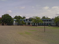
- Nashirabad
-
Nashirabad — town — Coordinates 21°00′00″N 75°40′00″E / 21°N 75.6666667°ECoordinates: 21°00′00″N 75°40′00″E / 21°N 75.6666667°E Country India State Maharashtra District(s) Jalgaon Time zone IST (UTC+05:30) Area
• 206 metres (676 ft)
Codes-
• Pincode • 425309
FootnotesNashirabad is a small town about 10 km from Jalgaon district in the north side of Maharashtra state of India. Nashirabad has a population of around 40,000. Most of the population is Leva Patidar (Khandeshi) and are farmers. Main business to earn bread and butter is farming of banana tree, sugar cane. Nashirabad is on National Highway No. 6 (Mumbai-Agra National Highway) and has many warehouses of local products. Nashirabad is in Jalgaon district.[2]
At the time of Moughal empires name of Nashirabad was SolNimbhore. The main reason behind this was, Nashirabad had 16 Hanuman temples and 16 main big doors. You can keep in touch with Nashirabad group at Orkut also. There was one Nashirabad group created by Lokesh Ramesh Chirmade on Orkut.
Contents
Transport facilities
Most people depend on Public transport (MSRTC), commonly known as "ST" & private hire vehicles like Auto-riksha for commuting to and from district and taluka places like Jalgaon & Bhusawal. All the MSRTC buses except express bus services stop at Nashirabad bus stand. Nearest Bus depots like Jalgaon and Bhusawal are located at either side of Nashirabad and are one of the biggest in the region. Although, private shared transports are available but ST is still a preferred option of traveling. Railway stations:
- Bhadli 2.5 km (Halt for passenger trains only)
- Jalgaon 10 km (express and passenger halt)
- Bhusawal 16 km (all trains halt)
Education
Schools
New English School, Nashirabad was established in 1945 and admit students for primary and secondary education. Also, there is a branch of New English School which has Junior College of Arts and MCVC (kiman kaushlya vibhag). The school is a center for 10th board exams and most of the students from neighbouring small villages like Bhadli, Asoda, Kadgaon get their center as New English School.
Girls school
There is separate girls school for primary education.There are four Z.P.primary school & urdu school.
Industrial Training Institute (ITI)
ITI is an institute which trains students in many speciality fields like fitter, mechanical, electrical. The ITI of Nashirabad and New English School is located very close to each other.
Medical Facilities
Nashirabad has a Primary Health Center (PHC) managed by government. Most of the people go to PHC for basic treatment of common diseases and vaccination of their children.
Godavari hospital was opened with the help of Shri. Ulhas Patil (Ex-MP) close to Nashirabd (2–3 km away). This hospital is popular in local communities as they provide good services at low cost. This Hospital is managed by Godavari medical college.
Nashirabad has around 15 qualified private practitioners and all of them have their own private clinics across different parts of village.
People of Nashirabad
People are mainly of Leva patidar samaj, other people of Bramhin samaj & Mali along with other communities e.g. Sali, Koshti, Wani, Muslims, Jain, etc.
Temples
1. Vitthal Mandir - Located at down lane, holi maidan 2. Anna Maharaj Math 3. Sawata Maharaj Manidr -Upper lane 4. Ram Mandir(residence of prashant and rajeshvar dharmadhikari) 5. Bavani Mandir 6. Mukteshwar Mandir 7. Mahalakshmi Mandir 8. Ganpati Mandir (Tarsod 2.5 km from village) etc. 9.neemjay mata bhavani's mandir 10.Dnyaneshwar maharaj mandir. 11.Shree.Krishna Mandir
Areas in Nashirabad
- Varchi Aali (Upper Lane)
- Khalchi Aali (Down Lane)
- Dr. Yashwant Nagar
- Unch Aad
- Bhavani Nagar
- Peth
- Ram Mandir
- Choube Petrol Pump
- Mukteshwar Colony
- Waghur Colony
- Sati Bajar
- Vishnu Mandir
- Holi Maidan
- Dwarka Nagar
References
Temples in Nashirabad:-
- Shri Vishnu Mandir Devasthan was establish in 1725 .this temple had been situated at nashirabad
since the time of "Pesheve". Shri Vishnu Mandir devasthan was built uo in the direction of Ownarary Majistrate Kai.AMRUTRAO DESHPANDE.
- ^ Pin codes of Jalgaon district, Jalgaon pincodes, Maharashtra zip code. WhereInCity. Retrieved on 2008-06-14.
- ^ "Census of India 2001: Data from the 2001 Census, including cities, villages and towns (Provisional)". Census Commission of India. Archived from the original on 2004-06-16. http://web.archive.org/web/20040616075334/http://www.censusindia.net/results/town.php?stad=A&state5=999. Retrieved 2008-11-01.
External links
Categories:- Cities and towns in Jalgaon district
- Jalgaon district
-
Wikimedia Foundation. 2010.


