- Islas Marías
-
This article is about the Mexican islands. For the Falkland island known as Isla María, see Bleaker Island. For the Czech card game known as Mariáš which is similar to a German game, see Sechsundsechzig.
María Madre 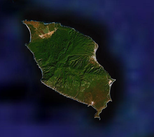
Maria Madre Island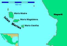
Geography Location Pacific Ocean Coordinates 21°36′57″N 106°34′42″W / 21.61583°N 106.57833°W Archipelago Islas Marías Total islands 9 Major islands María Madre, María Magdalena, María Cleofas & San Juanito Area 244.970 km2 (94.5834 sq mi) Highest elevation 616 m (2,021 ft) Highest point Punta Rocallosa Country MexicoState Nayarit Municipality San Blas, Nayarit Largest city Puerto Balleto (pop. 602) Demographics Population 1116 Density 7.68 /km2 (19.89 /sq mi) The Islas Marías ("Mary Islands") are an archipelago of four islands that belong to Mexico. They are located in the Pacific Ocean, some 100 km (62 mi) off the coast of the state of Nayarit. They are part of the municipality (municipio) of San Blas, Nayarit. As of 2006, the islands are still being used as a penal colony, containing the Islas Marias Federal Prison.
In 2010 the archipelago was designated Biosphere reserve by the UNESCO[1]
Contents
Geography
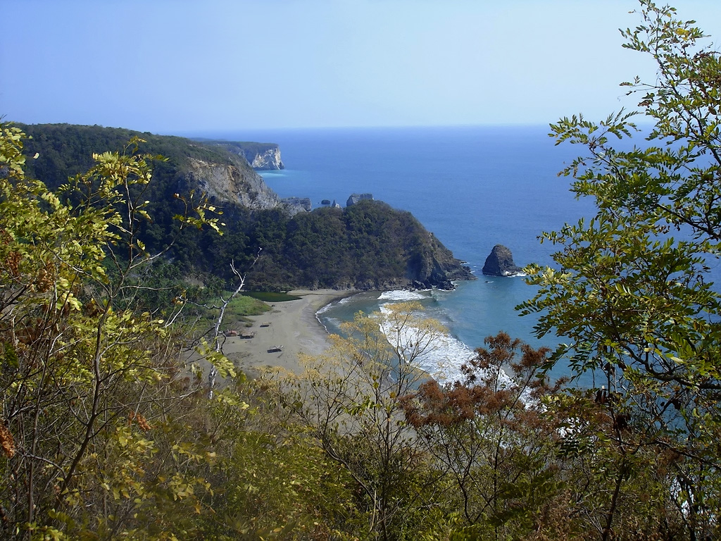
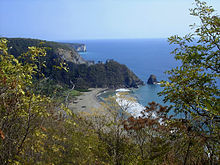 Mary Magdalene island.
The islands have an aggregate area of 244.970 km². 1116 people lived on Isla María Madre as of the census of 2005. The other islands are uninhabited. The main settlement is Puerto Balleto, with a population of 602.
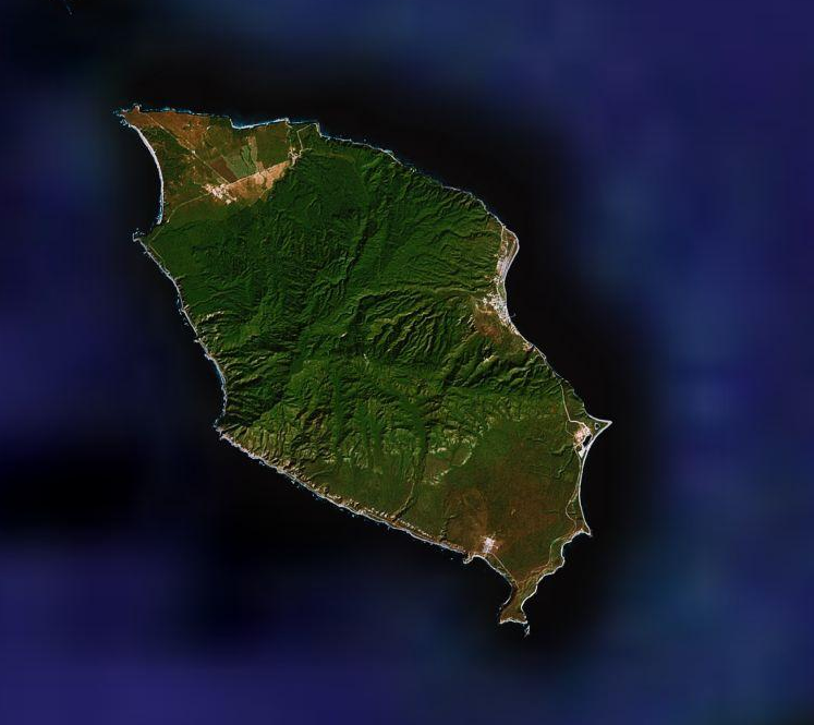
Isla María Madre, the northernmost island, is the largest, with a surface area of 145.282 km². It houses the Islas Marías Federal Prison which was established there in 1905. The other two islands are Isla María Magdalena (70.440 km²) and, further south, Isla María Cleofas (19.818 km²). They were named after three women called Mary in the Biblical New Testament: respectively, Mary, the mother of Jesus, Mary Magdalene, and Mary, the wife of Cleopas. The smaller island, Isla San Juanito, with an area of 9.105 km² lies off the north coast of Isla María Madre.
The islands are listed from north to south in the following table:
Island or Rock Area
km²Height
mLocation San Juanito 9.105 . 21°44′48″N 106°40′41″W / 21.74667°N 106.67806°W Piedra El Morro 0.060 . 21°44′17″N 106°42′11″W / 21.73806°N 106.70306°W María Madre 145.282 616 21°36′57″N 106°34′42″W / 21.61583°N 106.57833°W Isla Don Boni 0.025 . 21°32′30″N 106°32′00″W / 21.54167°N 106.5333333°W María Magdalena 70.440 457 21°27′44″N 106°25′48″W / 21.46222°N 106.43°W María Cleofas 19.818 402 21°18′44″N 106°14′51″W / 21.31222°N 106.2475°W Piedra Blanca 0.172 . 21°19′01″N 106°17′09″W / 21.31694°N 106.28583°W Roca Blanca 0.034 . 21°17′44″N 106°16′07″W / 21.29556°N 106.26861°W Unnamed Rock 0.034 . 21°17′52″N 106°16′35″W / 21.29778°N 106.27639°W Islas Marías 244.970 616 21°32′N 106°28′W / 21.533°N 106.467°W The first European to discover the islands was Diego Hurtado de Mendoza, a cousin of Hernan Cortez in 1532, who gave them the name Islas Magdalenas. He found no evidence of prior habitation by the native americans.
In addition to prisoners, on Maria Madre island there are employees of diverse institutions of the federal government, such as the Secretariat of Public Education, the Secretariat of the Environment, the Secretariat of Communications and Transport, post office, and the Secretariat of the Navy. Another group of settlers is made up of religious ministers and acolytes of the Catholic Church, nuns of the Order of Social Service, and invited teachers, technicians and their relatives.
The colony is governed by a state official who is both the governor of the islands and chief judge. The military command is independent and is exercised by an officer of the Mexican Navy.
Populated places
All populated places of the Islas Marías are on Isla María Madre. They are listed from north to south in the following table:
Each populated center features a different economic activity. The primary population center is Puerto Balleto, the location of the administrative offices and the primary centers of commerce and recreation. It is subdivided into four jefaturas[2]:
- Balleto, 21°38′02″N 106°32′21″W / 21.63389°N 106.53917°W
- Bellavista, 21°38′19″N 106°32′30″W / 21.63861°N 106.54167°W
- Unit Habitacional Miguel Hidalgo (UHMH), 21°38′13″N 106°32′26″W / 21.63694°N 106.54056°W
- Primero de Mayo, 21°38′20″N 106°32′23″W / 21.63889°N 106.53972°W
See also
References
- Link to tables of population data from Census of 2005, Nayarit INEGI: Instituto Nacional de Estadística, Geografía e Informática
- Mexican islands with areas and coordinates
- map
External links
Coordinates: 21°25′N 106°28′W / 21.417°N 106.467°W
World Heritage Sites in Mexico North West Archaeological Zone of Paquimé, Casas Grandes · Islands and Protected Areas of the Gulf of California1 · Rock Paintings of Sierra de San Francisco · Whale Sanctuary of El Vizcaino

North Central Franciscan Missions in the Sierra Gorda of Querétaro · Historic Centre of Zacatecas · Historic Monuments Zone of Querétaro · Historic Town of Guanajuato and Adjacent Mines · Protected town of San Miguel and the Sanctuary of Jesús Nazareno de Atotonilco
West Agave Landscape and Ancient Industrial Facilities of Tequila · Historic Centre of Morelia · Hospicio Cabañas, Guadalajara · Islands and Protected Areas of the Gulf of California1 · Monarch Butterfly Biosphere Reserve1 ·
East Earliest 16th-Century Monasteries on the slopes of Popocatépetl1 · Pre-Hispanic City of El Tajín · Historic Centre of Puebla · Historic Monuments Zone of Tlacotalpan
South West Historic Centre of Oaxaca and Archaeological Site of Monte Albán · Pre-Hispanic City and National Park of Palenque ·
South Central Archaeological Monuments Zone of Xochicalco · Central University City Campus of the UNAM · Earliest 16th-Century Monasteries on the slopes of Popocatépetl1 · Historic Centres of Mexico City and Xochimilco · Luis Barragán House and Studio · Monarch Butterfly Biosphere Reserve1 · Pre-Hispanic City of Teotihuacán
South East Ancient Maya City of Calakmul, Campeche · Historic Fortified Town of Campeche · Pre-Hispanic City of Chichén Itzá · Sian Ka'an · Pre-Hispanic Town of Uxmal
1 Shared with other region/s Categories:- Islands of Nayarit
- Natural history of Nayarit
- World Heritage Sites in Mexico
- Biosphere reserves of Mexico


Wikimedia Foundation. 2010.