- Cedarcroft, Baltimore
Infobox_nrhp | name =Cedarcroft Historic District
nrhp_type = hd
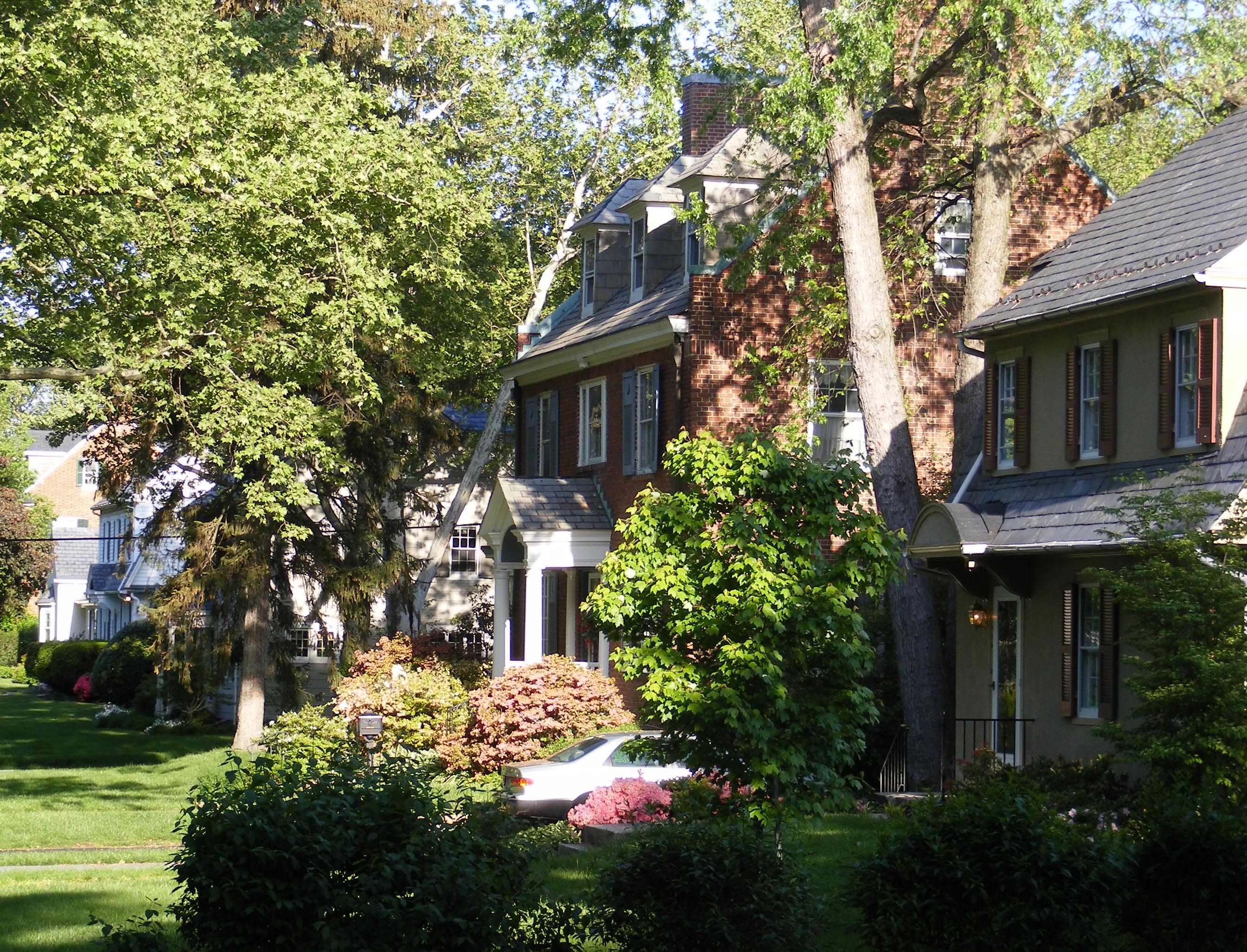
caption = Homes in Cedarcroft
location=Baltimore, Maryland
locmapin = Maryland
area =
architect= Palmer, Edward L. Jr., et.al.
architecture= Late 19th And 20th Century Revivals, Late Victorian
added =December 24 ,2003
governing_body = Local
refnum=03001332cite web|url=http://www.nr.nps.gov/|title=National Register Information System|date=2007-01-23|work=National Register of Historic Places|publisher=National Park Service]Cedarcroft is a distinctive residential neighborhood located in the northern part of
Baltimore, Maryland ,United States . Cedarcroft is bordered by Gittings, East Lake and Bellona Avenues and York Road. According to Baltimore City's Commission for Historical and Architectural Preservation (CHAP), the houses in Cedarcroft are in the Dutch Colonial Revival, Federal Revival, Tudor Revival, Georgian Revival, Cape Cod Revival, Bungalow, and Italianate styles of architecture. [cite web|url=http://www.cedarcroftbaltimore.com/|title=Historic Cedarcroft|publisher=Cedarcroft Community Website|accessdate=2008-05-08]History
Most of the homes in Cedarcroft were built in the 1920s by the Cedarcroft Land Company. In 1885, Philip E. Lamb purchased 25 acres fronting York Road north of the rural village of Govanstown. On the property was a house that had been built in 1846. A few years later, he bought an additional 20 acres. He called his estate Cedarcroft, and in 1886 built a frame house which still stands at 6204 Sycamore Road.
The Cedarcroft Land Company was formed about 1910 by Philip and George Lamb, along with George Van Holland, William McGeen and C.L. Applegarth. Later they were joined by Frank A. Warner, Jr., and Edward L. Palmer, the architect credited with the design of the development, which was between York and Bellona, Lake and Gittings. Episcopalians living nearby met in makeshift quarters and were anxious to build a church. In 1911, the diocese bought land on the southwest corner of Cedarcroft and York Roads for $5,000. The church was dedicated in 1913. Ten years later, it was moved a few hundred feet on soaped beams from the center of the lot so that a parish house could be added.
The Cedarcroft Land Company was liquidated in the early 1920s when all the lots had been sold. The Cedarcroft Maintenance Corporation was chartered and the Cedarcroft Improvement Association formed. All of the covenants, restrictions and regulations made by the Land Company were incorporated in the Maintenance Corporation, still the governing body of Cedarcroft.
The early records of the corporation and improvement association are kept in a tattered loose leaf binder with the inked legend "Beginning 1926." But the first records date from 1929. The treasurer's report that year shows payments of $13 for cutting grass on vacant lots and $112.50 for top soil, hauling leaves and operating the snow plow. [cite web|url=http://www.cedarcroftbaltimore.com/services-1.htm|title=History of Cedarcroft |publisher=Cedarcroft Community Website|accessdate=2008-05-08]
By 1921 only 30 houses stood within the neighborhood’s boundaries, however all lots sold quickly. At the time lots sold for $1800, corner lots for $2000. [Historic Cedarcroft, “History”, http://www.cedarcroftbaltimore.com/services-1.htm<] The rapid surge of immigrants and Baltimore residents moving north initiated the creation of Cedarcroft’s Maintenance Corporation and Improvement Association. All restrictions and requirements set by the Land Company were preserved. These traditional codes governed the construction of single family houses of certain value, all built to neighborhood plan and color scheme regulations. [Commission for Historical and Architectural Preservation, “Cedarcroft,” Cedarcroft vertical file, EPFL<]
In 1977 the Cedarcroft Maintenance Corporation’s covenants remained firm. Plans, color schemes and renovations were to be submitted to the group for approval. Price floors were also introduced. Each house was required to cost at least $6000, yet most selling prices ranged from $40,000 to $60,000. Due to the larger size and higher values of Cedarcroft houses, the neighborhood saw a sizable number of young family groups moving in. These family units most often included professionally employed husbands and wives, and children who attended area private schools such as Bryn Mawr. [Baltimore Messenger, “Cedarcroft Covenants, Safeguard,” Cedarcroft vertical file, EPFL.<]
In 2007, 11 units within Cedarcroft were sold. The average price of these sales was $528,591, the median being $505,000. [Live Baltimore Home Center, “Average Home Sales by Neighborhood, 2005-2007,” PDF from livebaltimore.com.<] Aside from renovations to the houses of the neighborhood, Cedarcroft looks much as it did in the mid-1900’s. The distinguishing features of the area are its traditional Beaux-Arts Revival style houses, as well as narrow streets lined with arched trees, “reminiscent of medieval arches.” [Mary Medland, “Green Cedarcroft features beauty rare in urban area,” The Sun, December 16,1990, pg. 1.D. http://proquest.com.<]
Located in City Council District Four, Cedarcroft has been registered as a historic district by the National Register of Historic Places. [Historic Cedarcroft, “Historical Distinction,” http://www.cedarcroftbaltimore.com/historical-distinction.htm.<]
According to the 2000 Demographic profile, 97.8% of the houses in Cedarcroft are occupied. 75.6% of the houses are family households. [Baltimore City Dept. of Planning, “Cedarcroft Neighborhood Statistics,” http://censusprofile.bnia.org/.<]
All in all, Cedarcroft remains a calm and beautiful neighborhood despite its increasingly urban surrounding. The tight-knit community comes together naturally, celebrating October block parties, Halloween parades, and Christmas decoration contests together. [Mary Medland, “Green Cedarcroft features beauty rare in urban area,” The Sun, December 16,1990, pg. 1.D. http://proquest.com.<] This historic district is quite simply a “diamond in the rough” of an evolving and progressing city.
Demographics
97.8% of the houses in Cedarcroft are occupied and 91.1% of that number are owner occupied. According to the last census, 91.5% of the residents are white, 5.1% are black, 1.7% Asian and 2.5% are hispanic. 21.9% of the white residents are reported as Irish, another 16.7% English, 34.2% German and 14.9% Italian. The median family income is $99,389 with 0% of those in the workforce unemployed. 100% of the residents are high school graduates and 34.1% report having a graduate or professional degree. [Cite web|url= http://censusprofile.bnia.org|title=2000 U.S. Census Demographic Profiles|publisher= Baltimore Dept. of Planning|accessdate=2008-04-23]
Buildings of Interest
Nativity Episcopalian Church
During the early years of the Cedarcroft development, the new community did not have a physical place of worship. In 1910, Reverend Charles Hensel began a new mission by holding services in the newly constructed houses in the community. The actual structure of what is now known as the Church of the Nativity was originally built in Garrett County, Maryland. In 1913, the Tudor Revival style edifice was dismantled and transported to what is now 419 Cedarcroft Road. The first official church service was held on Christmas of the same year. The construction of the Parish House in 1923 required the entire church structure to be moved convert|100|ft|m|abbr=on towards the York Road extremity of the property.
In 1947, the Cedarcroft School was established within the church as a preschool and kindergarten. As the population in the community of Cedarcroft grew in the 1950’s, structural additions were made to the church including a passageway to the Parish House, where Cedarcroft school now exists. [Church of the Nativity, Cedarcroft, “History of Nativity,” http://www.nativitycedarcroft.org/history.htm<]
Cedarcroft School
Edith Gentry, a graduate of the nearby College of Notre Dame, established the Cedarcroft School in 1947. Using the west wing of the Church of Nativity in Cedarcroft as their venue, teachers place exceptional emphasis on proper manners and the “philosophy that every child learns differently”. The establishment is coed, nonsectarian, and is the school to many young children of the Cedarcroft community and surrounding neighborhoods. The vertical Gothic Revival style emanates the powerful attitude of religious buildings such as this one as it was built in 1923. [Mike Bowler, “Edith Gentry insists she changes nothing for the sake of change.” The Sun, March 24, 1997, pg. 1.B. http://proquest.com<]
The Lamb Estate
6204 Sycamore Road is the site of the original house built by Philip Lamb in 1886. The mansion was the first constructed on Lamb’s 45 acre estate, which is now the Cedarcroft neighborhood.The house is symmetrical, featuring a cross-gable roof, sash windows with shutters, a porch elevated by Doric columns, and a simple bracketed cornice.This Eastlake style, closely associated with the Victorian Revival, was very prominent in the 1880’s.
Architectural Styles
"NOTE:" the following descriptions pertain, in order, to the houses in the above gallery.
Georgian Revival houses of the early 1900’s - The symmetrical sash windows, the tall chimneys, and triangular pediments, held above the front entrances by Doric columns, distinguish the Georgian style. Also, the simple cornices and dormer windows built into the gable roofs distinguish these houses as Georgian Revival.
Also prominent throughout the neighborhood is the Dutch Colonial Revival Style of the early 1900’s. The pictured house features a shingled gambrel roof with 6 by 6 paneled sash windows. On the first floor is a pediment entryway and 8 by 8 paneled sash windows, surrounded with shutters.
The American Four-Square style is also present in Cedarcroft. The house is essentially a cube with a pyramidal roof set on top. On each side of the pyramid is a centered dormer window for the attic of the house. Bay windows that extend through both stories of the house are another common feature of the American Four-Square style, which was most common between 1910 and 1920.
The Bungalow - The steep gable roof includes a large multi-sash window triangular dormer. The shallower gable covers an open porch that is held up by Doric columns. Also, the entire structure is supported by a large stone foundation that is exposed as part of the architecture. Bungalows like this one were a part of the development of new houses in Cedarcroft during the 1920’s.
Lastly, houses of the Spanish Colonial Revival style, such as the building above, are found across Cedarcroft. Popular throughout the 1920’s and 30’s, this style popularized the stucco exterior finish, and the subtle yet ornamental pinhole designs seen at the apex of this house’s gable upon the façade.
References
Wikimedia Foundation. 2010.