- Magat Dam
-
Magat Dam 
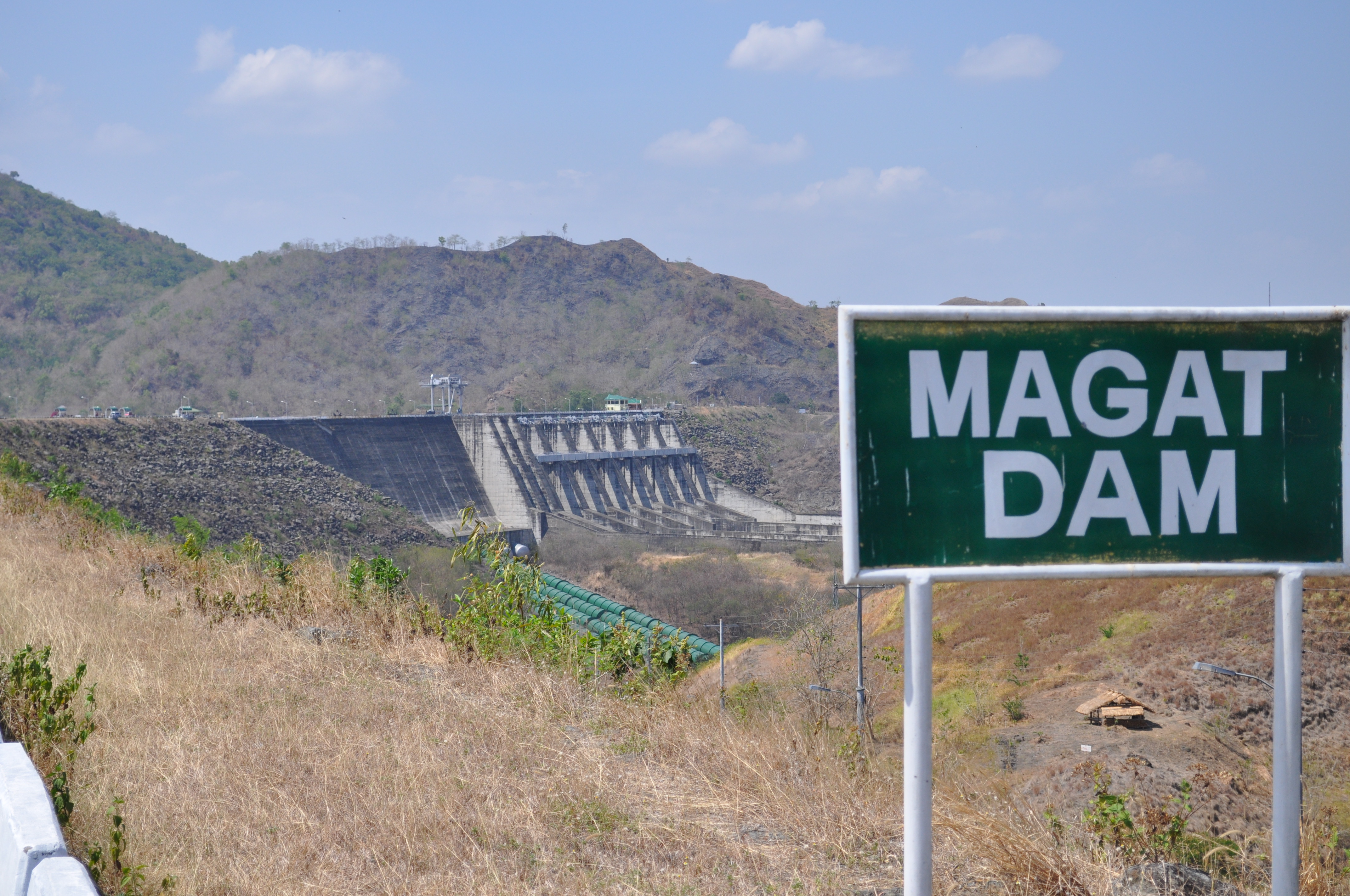
The dam, with its entrance sign in the foregroundLocation of Magat Dam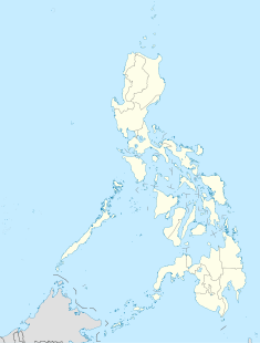

Location Alfonso Lista, Ifugao / Ramon, Isabela Coordinates 16°49′30″N 121°27′14″E / 16.825°N 121.45389°ECoordinates: 16°49′30″N 121°27′14″E / 16.825°N 121.45389°E Construction began 1978 Opening date 1982 Dam and spillways Type of dam Rock-fill dam Height 114 m (374 ft) Length 4,160 m (13,650 ft) Impounds Magat River Reservoir Surface area 117 km2 (45 sq mi) Max. water depth 193 m (633 ft) Power station Installed capacity 360 MW Magat Dam is a large rock-fill dam on the island of Luzon in the Philippines. The dam is located on Magat River, a major tributary of Cagayan River. Construction of the dam started in 1975 and completed in 1982. Magat Dam is one of the largest dams in the Philippines and has two primary purposes: as a source of irrigation water and as a provider of hydroelectric power.
Contents
History
The construction and appurtenant structures was authorized by P.D. 693 signed on May 7, 1975 by the late President Ferdinand E. Marcos. The Magat Dam was constructed in 1978 and inaugurated by the Late Pres. Ferdinand E. Marcos on October 27, 1982[1] and started operations in 1983.[2]
Implementation of this multipurpose project was based on the preliminary study conducted in 1973 by the National Irrigation Administration (NIA) with the assistance of the United States Bureau of Reclamation (USBR) and the United States Agency for International Development (USAID).
Subsequent detailed and extensive dam site investigation and engineering studies further confirmed the feasibility of what is now known as NIA's most daring infrastructure project and one of Asia's biggest dams today.
It was Southeast Asia's first large multipurpose dam.[3] The dam is part of the Magat River Multipurpose Project (MRMP) which was financed by the World Bank and whose purpose is to improve on the existing Magat River Irrigation System (MARIS) and to triple the production of rice in the Cagayan River basin.[1]
The project was jointly financed by the Philippine Government and the World Bank which extended a $150M U.S Dollars loan to finance the foreign exchange requirement. In addition, a $9M U.S. dollars loan from Bahrain was obtained for the purchase of other equipment for the diversion tunnels, soils laboratory and model testing. The total project cost is $3.4B pesos(yr. 1975).
Geography
The Magat Dam is located on the Magat River at the boundary between the municipalities of Alfonso Lista in the province of Ifugao and Ramon in Isabela both on the island of Luzon, approximately 350 kilometres (220 mi) north of Metro Manila. The Magat River is the largest tributary of the Cagayan River, the longest river in the country.
Magat River
The Magat Dam is located on the Magat River, which is the largest tributary of the Cagayan River on the island of Luzon.[4] Cagayan is the longest river in the Philippines.[4] The Magat River has an estimated yearly water discharge of 9,808 million cubic meters and has an approximate crest length of 4,160 metres (13,650 ft) with its headwaters in the province of Nueva Vizcaya and its confluence with the Cagayan River in the province of Isabela
The portion of the Magat River on which Magat Dam is located forms part of the boundary between the provinces of Ifugao and Isabela and this is the reason for the dispute between the local governments of the two provinces over the jurisdiction of Magat Dam. (See the History section of this article for details.)
Features
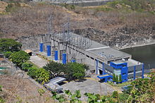 The Magat power plant, located at the base of the dam.
Magat High Dam
Height: 114 metres (374 ft)
Crest Length: 4,160 metres (13,650 ft)
Volume of Rocks & Earth Materials: 18 million cubic meters
Concrete = 1.00 million cubic metersSpillway
Length = 500 metres (1,600 ft)
Width = 164 metres (538 ft)
Discharge Cap.= 30,600 cubic meters
Radial Gates = 7 sets
Orifice Gates = 2 setsDiversion Tunnels
Number: 2
Diameters: 2 metres (6.6 ft)
Ave.Length: 630 metres (2,070 ft)Reservoir
Storage Cap.at Full Supply Level(FSL): 1.08 billion cubic meters
Area at FSL : 45 square kilometres (17 sq mi)
Area at min. Supply Level : 15 square kilometres (5.8 sq mi)
Elevation at FSL : El. 193 metres (633 ft)
Maximum Flood Level : El. 197.6 metres (648 ft)
Live Storage : 810 million cubic metersPower House
Installed Capacity : 360 MegaWatts
Additional Capacity: 180 MegaWatts
Total : 540 MegaWattsAccess
It is connected by an all weather road to San Mateo-Santiago Road at Oscariz, Ramon, Isabela some 350 kilometres (220 mi) north of Metro Manila.
Structure and facilities
The Magat Dam is a multi-purpose dam which serves as a source of hydroelectric power and as a source of irrigation water for about 85,000 hectares (210,000 acres) of agricultural lands.[1]
The hydroelectric power plant is a four-unit powerhouse with a rated capacity of 360 megawatts.[1] The hydroelectric plant is a peaking power plant,[1] which means that it only operates when there is a high demand for electricity in the Luzon power grid, to which the plant is connected.[2]
The water stored in the reservoir is enough to supply about two months of normal energy requirements.[1]
Present Status
The irrigation facilities, including the reservoir, the intake gates to the hydroelectric plant, and the dam itself, is owned and managed by the National Irrigation Authority (NIA) while the hydroelectric plant itself was owned by the National Power Corporation (NAPOCOR).[1] Under the Electric Power Industry Reforms Act of 2001 (Republic Act No. 9136), the Magat Dam hydroelectric plant underwent a privatization process. As a result, the plant's ownership and operation was turned over to SN Aboitiz Power Inc. (SNAP), a joint venture of a local company, Aboitiz Equity Venture (AEV), and the Norwegian SN Power Invest (SN Power) in April 2007.[1] SNAP won the privatization bidding in 2006.[5]
After the privatization of the hydroelectric plant, the provinces of Ifugao and Isabela had a dispute over the tax resulting from the transfer of the plant to SNAP. An agreement was made to divide the tax evenly, about 57 million pesos each, though some further disputes remain over the jurisdiction of various elements of the dam.[5]
The dam was constructed to last for 50 years but increased siltation and sedimentation in the reservoir, slash-and-burn farming, illegal logging ang fish-caging resulted to the deterioration of the dam's watershed. The massive 1990 Luzon earthquake also contributed to the increased siltation in the Magat River system. Because of this, President Gloria Macapagal-Arroyo instructed various government agencies to create a rehabilitation plan to improve the lifespan of the dam system.[3]
References
- ^ a b c d e f g h "Magat Hydro: Environmental & Social Review Summary" - International Finance Corporation (World Bank)
- ^ a b Visaya, Villamor Jr. (2007-07-29). "Gov't starts cloud-seeding over Magat dam". INQUIRER.net (Philippine Daily Inquirer). http://newsinfo.inquirer.net/breakingnews/regions/view_article.php?article_id=85416. Retrieved 2008-04-21.
- ^ a b "Arroyo orders officials to formulate plan for massive rehabilitation of Magat Dam". Manila Bulletin. 2006-01-06. http://www.mb.com.ph/node/57440. Retrieved 2008-04-21.
- ^ a b "The Cagayan River Basin" - PAGASA. Accessed on 2008-04-21.
- ^ a b "Ifugao, Isabela share natl wealth tax over Magat dam after legal battle". GMANews.TV (GMA Network). 2008-04-04. http://www.gmanews.tv/story/87609. Retrieved 2008-04-21.
 Dams in the PhilippinesCategories:
- Dams in the Philippines
- Buildings and structures completed in 1983
- Hydroelectric power plants in the Philippines


Wikimedia Foundation. 2010.