- Minocqua, Wisconsin
-
Minocqua, Wisconsin — Town — Location of Minocqua, Wisconsin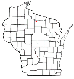
Coordinates: 45°50′48″N 89°49′50″W / 45.84667°N 89.83056°W Country United States State Wisconsin County Oneida Area – Total 168.1 sq mi (435.3 km2) – Land 150.8 sq mi (390.6 km2) – Water 17.3 sq mi (44.8 km2) Elevation[1] 1,598 ft (487 m) Population (2000) – Total 4,859 – Density 32.2/sq mi (12.4/km2) Time zone Central (CST) (UTC-6) – Summer (DST) CDT (UTC-5) FIPS code 55-53225[2] GNIS feature ID 1583727[1] Minocqua is a town in north-western Oneida County, Wisconsin, United States. The population was 4,385 at the 2010 census. The census-designated place of Minocqua is located in the town. The unincorporated community of Rantz is also located in the town. Minocqua is commonly referred to as "The Island City." [3]
Contents
History
Minocqua was officially organized in the year 1889. While there are varying explanations regarding the meaning of the word "Minocqua", most credit its origin to the Island's first inhabitants, the Ojibwe Indians.[4]
In the late 1800's, Minocqua was a logging town and also saw a lot of French fur traders. The first white child born in town was named Minocqua Clawson. Clawson Hill was a famous landmark in town and is the current location of the Pointe Resort & Hotel at the south end of the Highway 51 bridge.
The railroad was a critical component of Minocqua's early growth. The Milwaukee Road railroad company originally came to the area to access timber. Later, railroads catered primarily to sportsmen and tourists, transforming Minocqua into the vacation getaway haven it remains to this day. The two railroad trestles that brought trains to the Island are still intact today and serve as the trailhead for the Bearskin State Trail (hiking and biking in summer, snowmobiling in winter).
Much of the town's business district was wiped out by a major fire in 1912. Many of the buildings on our main street today are those built after the fire. Like many main streets, the main street of Minocqua had a store for every need. Even into the 1970's Minocqua's main street contained three grocery stores, a fruit market, two car dealerships, a gas station, a bank, a dental office, a newspaper, two hardware stores, two pharmacies, a cafe, a candy store, a shoe shop and a few clothing stores.
While the last several decades have brought a higher percentage of visitor-oriented retail stores, the downtown still retains a U.S. Post Office, multiple banks, numerous restaurants...even an old fashioned barber shop. The Island serves as Minocqua's civic center; you'll find the Campanile Center for the Arts (former St. Patrick's Church), the Minocqua Police Department, Minocqua Fire Department and the Minocqua Community Center, which houses the town offices and newly-expanded public library.
Some of the more famous landmarks on the Island are Bosacki's Boathouse at the north end of the Highway 51 bridge (Bosacki's is now known as Matt Morgan's) and the Thirsty Whale, which is just down the shore from Matt Morgan's and built entirely over the water. Bosacki's burned to the ground in 1972; ordinarily a structure could not be rebuilt so close to--or in this case, partly over--water, but a public outcry convinced the DNR to allow it to be rebuilt where it was.
Torpy Park and its beach are also Island landmarks, along with the Belle-Isle building and the three-story Minocqua Community Center, which was originally the Minocqua Grade School and the Minocqua High School in days of yore. The Minocqua Community Center is where the town offices (third floor) and the Minocqua Public Library (first floor) are located.
There have been 30 town chairmen in the history of Minocqua. The list of early town chairmen reads like a who's-who of the early Minocqua settlers...names like A.O. Dorwin, Jacob Huber, Thomas Bolger, William Schlecht, and Dr. Torpy.
Geography
According to the United States Census Bureau, the town has a total area of 168.1 square miles (435.4 km²), of which, 150.8 square miles (390.6 km²) of it is land and 17.3 square miles (44.8 km²) of it is water. The total area is 10.29% water.
Termed the "Island City," a portion of the town is situated on what was an actual island, which is accessible by bridge on Highway 51 and "the fill" to the north. Much of Minocqua has sandy soil, although areas of the far northwest and the northeast are clay. The majority of the soil is highly acidic and many areas are covered by forests. The marshes between Minocqua and Wisconsin Rapids are cultivated for cranberry production.
The highest point in Minocqua is Squirrel Hill, located near Winter Park (1735 ft per Wisconsin Blue Book). The second highest point on the island is located at Island Golf (1608 ft). The highest structure in Minocqua is the Lakeland Sanitary District water tower, a steel tank on Hwy 51 North put in place in the 1960s during the winter.
The community of Bo-di-Lac is located in the western portion of the town bordered by Squirrel Lake, Diamond Lake, Booth Lake, and the town of Lac Du Flambeau (Bo-di-Lac is short for "Booth-Diamond-Lac du Flambeau).
Demographics
As of the census[2] of 2000, there are 4,859 people, 2,189 households, and 1,488 families residing in the town. The population density is 32.2 people per square mile (12.4/km²). There are 4,284 housing units at an average density of 28.4 per square mile (11.0/km²). The racial makeup of the town is 97.65% White, 0.04% African American, 1.03% Native American, 0.25% Asian, 0.02% Pacific Islander, 0.23% from other races, and 0.78% from two or more races. 0.95% of the population are Hispanic or Latino of any race.
There are 2,189 households out of which 22.3% have children under the age of 18 living with them, 60.0% are married couples living together, 5.5% have a female householder with no husband present, and 32.0% are non-families. 27.6% of all households are made up of individuals and 13.2% have someone living alone who is 65 years of age or older. The average household size is 2.22 and the average family size is 2.68.
In the town the population is spread out with 19.6% under the age of 18, 4.2% from 18 to 24, 23.0% from 25 to 44, 28.7% from 45 to 64, and 24.5% who are 65 years of age or older. The median age is 47 years. For every 100 females there are 100.4 males. For every 100 females age 18 and over, there are 97.6 males.
The median income for a household in the town is $40,333, and the median income for a family is $50,466. Males have a median income of $41,272 versus $23,147 for females. The per capita income for the town is $24,461. 6.5% of the population and 4.7% of families are below the poverty line. Out of the total population, 8.5% of those under the age of 18 and 5.5% of those 65 and older are living below the poverty line.
Tourism
Tourism plays a substantial role in the economy of Minocqua. As a forested lake community, there are many outdoor summer activities such as fishing, camping, waterskiing, boating, hiking, bike riding, berry collecting, and swimming. There is also a business strip which runs through downtown Minocqua (A.K.A "The Island") and to the north side of "The Fill" which has several tourist attractions and shopping. Downtown Minocqua is also home to the world's oldest amateur waterski team, the Min-Aqua Bats.
During the fall, rifle and bow hunting draw many hunters, as does the annual downtown merchants' Beef-a-Rama held the last Saturday in September. In winter, available activities include: snowmobile festivals, Nordic (cross country) skiing, ice fishing, downhill skiing in nearby mountains, snow tubing, sleigh rides, snowmobiling and dining at area restaurants. Minocqua's nightlife includes bars featuring live music in the summer. During fall, driving through the northwoods admiring the fall colors is a popular activity. The arts play an important role in tourism and include the Northern Lights Playhouse, the Campanile Center for the Arts, and the annual HMMGG Festival of Arts and Culture.
Education
Minocqua has one public elementary school, Minocqua-Hazelhurst-Lake Tomahawk Elementary School, and one large high school, Lakeland Union High School. As well as a satellite campus of the Nicolet Area Technical College located next to the high school.
Footnotes
- ^ a b "US Board on Geographic Names". United States Geological Survey. 2007-10-25. http://geonames.usgs.gov. Retrieved 2008-01-31.
- ^ a b "American FactFinder". United States Census Bureau. http://factfinder.census.gov. Retrieved 2008-01-31.
- ^ http://www.townofminocqua.org/.
- ^ http://www.townofmincoqua.org/
External links
- Town of Minocqua
- Minocqua Public Library
- Minocqua Tourism, Events and Business Directory
- Minocqua Area Chamber of Commerce
- local newspaper site
Municipalities and communities of Oneida County, Wisconsin City 
Towns Cassian | Crescent | Enterprise | Hazelhurst | Lake Tomahawk | Little Rice | Lynne | Minocqua | Monico | Newbold | Nokomis | Pelican | Piehl | Pine Lake | Schoepke | Stella | Sugar Camp | Three Lakes | Woodboro | Woodruff
CDPs Lake Tomahawk | Minocqua | Three Lakes | Woodruff
Unincorporated
communitiesClearwater Lake | Clifford‡ | Crescent Corner | Enterprise | Gagen | Goodnow | Harshaw | Hazelhurst | Jennings | Lennox | Malvern | McCord‡ | McNaughton | Monico | Newbold | Pelican Lake | Pratt Junction | Rantz | Roosevelt | Starks | Sugar Camp | Sunflower | Tripoli‡ | Woodboro
Ghost town Footnotes ‡This populated place also has portions in an adjacent county or counties
Coordinates: 45°52′17″N 89°42′40″W / 45.87139°N 89.71111°W
Categories:- Towns in Oneida County, Wisconsin

Wikimedia Foundation. 2010.