- Duval Street
-
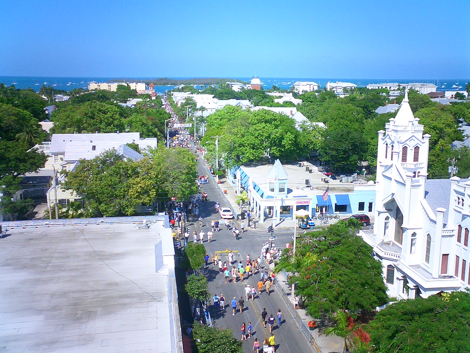
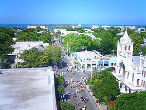 Aerial view of Duval St. with a view toward the Gulf of Mexico, taken from atop the La Concha Hotel during the day of Fantasy Fest parade 2004.
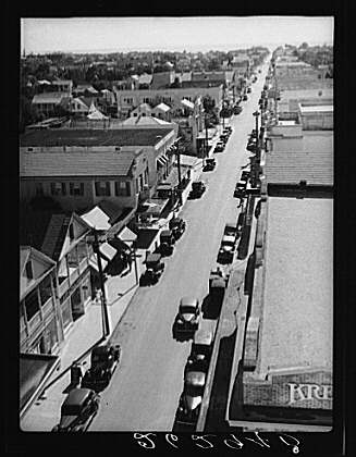
Photo: Marc Averette Duval St. seen from atop the La Concha Hotel in 1938, with a view toward the Atlantic. The Kress department store building seen at bottom right still houses a retail store.
Photo: Arthur RothsteinDuval Street (DOO-VAHL) is a famous downtown commercial zoned street in Key West, Florida, running north and south from the Gulf of Mexico to the Atlantic Ocean. Duval Street is the location of many famous restaurants and bars, including Sloppy Joe's, Fogarty's Restaurant, Bar and Bakery and it's "The Flying Monkeys Bar", The Bull and Whistle, Rick's Cafe and Irish Kevin's bar. It is named for William Pope Duval, the first territorial governor of Florida.
On certain nights, Duval Street is a carnival that lasts until dawn and beyond. The pub crawl in the area is sometimes called the "Duval crawl."
At the north end, tourists from the cruise ships that dock at the Hilton harbor complex, Mole pier or Mallory Square are often seen traversing Duval Street's many shops [1] in the afternoon looking for souvenir trinkets and T-shirts.
At the south end of Duval Street is the Southernmost House, a striking Victorian architecture mansion built in 1886 bordered by the Atlantic Ocean, South Street and Duval Street.
Near the northern end of the street is Mallory Square.
Neighborhood
Duval Street is also a neighborhood within the City of Key West.
It is the area on either side of Duval Street, and includes the area to the north of Front Street, containing Wall Street, Mallory Square and the Port of Key West.[1]
Pop culture
Duval Street is mentioned as the place where Jimmy Buffett is partying in the song "My Head Hurts, My Feet Stink and I Don't Love Jesus."
Duval Street is featured on an episode of Hogan Knows Best when Brooke goes missing for hours when the family is vacationing in Key West.
Duval Street is mentioned in the 1978 disco song "Key West" by the Village People: "take a walk down Duval Street, you never know who'll you meet."
The economy of Duval Street is an essential part of the fictional novel 'Callahan's Con' by Spider Robinson.
References
Bahama Village • Casa Marina • Duval Street • Fleming Key • Historic Distric • Historic Seaport • Golf Club • The Meadows • Midtown • New Town • Old Town • Poinciana Plaza • Sigsbee Park • Sunset Key • Truman Annex • Trumbo Point • Upper Duval • White Street Gallery DistrictCoordinates: 24°33′14″N 81°48′05″W / 24.55380°N 81.80132°W
Categories:- Neighborhoods in Key West, Florida
- Roads in Key West, Florida
- Visitor attractions in Key West, Florida
Wikimedia Foundation. 2010.