- Wheatland, Kenosha County, Wisconsin
Infobox Settlement
official_name = Wheatland, Wisconsin
settlement_type =Town
nickname =
motto =
imagesize =
image_caption =
image_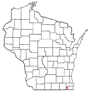
mapsize = 250px
map_caption = Location of Wheatland, Wisconsin
mapsize1 =
map_caption1 =subdivision_type = Country
subdivision_name =United States
subdivision_type1 = State
subdivision_name1 =Wisconsin
subdivision_type2 = County
subdivision_name2 = Kenoshagovernment_footnotes =
government_type =
leader_title =
leader_name =
leader_title1 =
leader_name1 =
established_title =
established_date =unit_pref = Imperial
area_footnotes =
area_magnitude =
area_total_km2 = 62.2
area_land_km2 = 61.0
area_water_km2 = 1.2
area_total_sq_mi = 24.0
area_land_sq_mi = 23.6
area_water_sq_mi = 0.5population_as_of = 2000
population_footnotes =
population_total = 3292
population_density_km2 = 54.0
population_density_sq_mi = 139.8timezone = Central (CST)
utc_offset = -6
timezone_DST = CDT
utc_offset_DST = -5
elevation_footnotes = GR|3
elevation_m = 246
elevation_ft = 807
latd = 42 |latm = 34 |lats = 37 |latNS = N
longd = 88 |longm = 13 |longs = 35 |longEW = Wpostal_code_type =
postal_code =
area_code =
blank_name = FIPS code
blank_info = 55-86500GR|2
blank1_name = GNIS feature ID
blank1_info = 1584421GR|3
website =
footnotes =Wheatland is a town in Kenosha County,
Wisconsin ,United States . The population was 3,292 at the 2000 census. The unincorporated community of Slades Corners is located within the town.Settlement in the town is centered located along 328th Avenue (Kenosha County Highway W) north of 60th Street (Kenosha County Highway K). The former
Soo Line Chicago-Twin Cities main line (now theWisconsin Central /Canadian National railroad) also runs through the town; a passenger and freight station used was located here well into the 20th century.Geography
According to the
United States Census Bureau , the town has a total area of 24.0 square miles (62.2 km²), of which, 23.5 square miles (61.0 km²) of it is land and 0.5 square miles (1.2 km²) of it (1.96%) is water.History
Wheatland was formed on
May 7 ,1842 . The name is derived from the agricultural nature of the town and specifically the wheat, which was said to grow well in the rich soil. The first constable was James B. Powers, for whom Powers Lake is named.When the Town of Wheatland was formed, it was originally located in Racine County. On
January 30 ,1850 the town was transferred toKenosha County , where it remains today. [ [http://www.wisconsinhistory.org/dictionary/index.asp?action=view&term_id=7425 Wheatland, Town of, Kenosha Co ] ]Demographics
As of the
census GR|2 of 2000, there were 3,292 people, 1,209 households, and 893 families residing in the town. Thepopulation density was 139.8 people per square mile (54.0/km²). There were 1,379 housing units at an average density of 58.6/sq mi (22.6/km²). The racial makeup of the town was 98.12% White, 0.49% African American, 0.21% Native American, 0.24% Asian, 0.27% from other races, and 0.67% from two or more races. Hispanic or Latino of any race were 0.97% of the population.There were 1,209 households out of which 36.0% had children under the age of 18 living with them, 60.0% were married couples living together, 9.5% had a female householder with no husband present, and 26.1% were non-families. 20.7% of all households were made up of individuals and 7.1% had someone living alone who was 65 years of age or older. The average household size was 2.72 and the average family size was 3.15.
In the town the population was spread out with 26.9% under the age of 18, 8.1% from 18 to 24, 30.3% from 25 to 44, 25.3% from 45 to 64, and 9.4% who were 65 years of age or older. The median age was 37 years. For every 100 females there were 104.6 males. For every 100 females age 18 and over, there were 99.3 males.
The median income for a household in the town was $52,386, and the median income for a family was $61,797. Males had a median income of $43,000 versus $27,917 for females. The
per capita income for the town was $21,299. About 3.5% of families and 5.3% of the population were below thepoverty line , including 3.2% of those under age 18 and 5.9% of those age 65 or over.January 2008 Tornado
A
tornado touched down in the town onJanuary 7 ,2008 at 4:03 PM CST. The tornado was rated EF3 on theEnhanced Fujita Scale with winds estimated at 140-150 mph.cite news | last=Held | first=Tom | coauthor=Jones, Meg | title=In a tornado's wake | publisher=Milwaukee Journal Sentinel | work=JSOnline.com | date=2008-01-08 | accessdate=2008-01-09 | url=http://www.jsonline.com/story/index.aspx?id=705092] It's path covered convert|10.8|mi|km and was convert|200|yd wide, demolishing 25house s and damaging about 100 more.cite news | last=Einhorn | first=Catrin | title=Storms Strike Midwest, Killing at Least 6 | publisher=The New York Times | work=NYTimes.com | date=2008-01-09 | accessdate=2008-01-09 | url=http://www.nytimes.com/2008/01/09/us/09tornado.html] This left 160 people homeless or unable to return to their homes. The damage is estimated at $18 million.cite news | last=DeLong | first=Katie | title=Tornado Damage Estimate Up To $18 Million | publisher=The Associated Press | work=TodaysTMJ4.com | date=2008-01-11 | accessdate=2008-01-11 | url=http://www.todaystmj4.com/news/local/13705482.html]Notes
External links
* [http://www.co.kenosha.wi.us/muni/wheatland.html Town of Wheatland information] from Kenosha County website
* [http://www.wisconsinhistory.org/dictionary/index.asp?action=view&term_id=7425 Town of Wheatland] in the "Dictionary of Wisconsin History "
Wikimedia Foundation. 2010.