- Powers Lake, Wisconsin
Infobox Settlement
official_name = Powers Lake, Wisconsin
settlement_type = CDP
nickname =
motto =
imagesize =
image_caption =
image_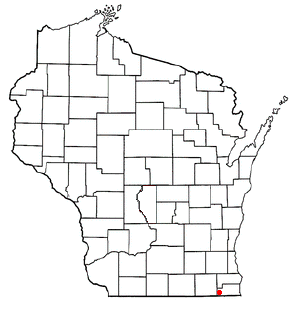
mapsize = 250px
map_caption = Location of Powers Lake, Wisconsin
mapsize1 =
map_caption1 =subdivision_type = Country
subdivision_name =United States
subdivision_type1 = State
subdivision_name1 =Wisconsin
subdivision_type2 = Counties
subdivision_name2 = Kenosha, Walworthgovernment_footnotes =
government_type =
leader_title =
leader_name =
leader_title1 =
leader_name1 =
established_title =
established_date =unit_pref = Imperial
area_footnotes =area_magnitude =
area_total_km2 = 7.2
area_land_km2 = 5.0
area_water_km2 = 2.2
area_total_sq_mi = 2.8
area_land_sq_mi = 1.9
area_water_sq_mi = 0.9population_as_of = 2000
population_footnotes =
population_total = 1500
population_density_km2 = 302.5
population_density_sq_mi = 783.6timezone = Central (CST)
utc_offset = -6
timezone_DST = CDT
utc_offset_DST = -5
elevation_footnotes = GR|3
elevation_m = 265
elevation_ft = 869
latd = 42 |latm = 32 |lats = 20 |latNS = N
longd = 88 |longm = 17 |longs = 53 |longEW = Wpostal_code_type =
postal_code =
area_code =
blank_name = FIPS code
blank_info = 55-64825GR|2
blank1_name = GNIS feature ID
blank1_info = 1571858GR|3
website =
footnotes =Powers Lake is a
census-designated place (CDP) in Kenosha and Walworth Counties in theU.S. state ofWisconsin . As of the 2000 census, the CDP had a total population of 1,500.History
The community was named after James B. Powers, one of its early settlers. [ [http://www.rootsweb.com/~wikenosh/placenames.htm Kenosha Co. WI Placenames ] ]
Geography
Powers Lake is located at 42°32'20" North, 88°17'53" West (42.538813, -88.298027)GR|1.
According to the
United States Census Bureau , the CDP has a total area of 2.8square mile s (7.2km² ), of which, 1.9 square miles (4.9 km²) of it is land and 0.9 square miles (2.2 km²) of it is water. The total area is 30.69% water.Demographics
As of the
census GR|2 of 2000, there were 1,500 people, 544 households, and 405 families residing in the CDP. Thepopulation density was 783.6 people per square mile (303.2/km²). There were 855 housing units at an average density of 446.6/sq mi (172.8/km²). The racial makeup of the CDP was 97.53% White, 0.33% African American, 0.13% Native American, 0.27% Asian, 0.00% Pacific Islander, 0.07% from other races, and 1.67% from two or more races. 2.13% of the population were Hispanic or Latino of any race.There were 544 households out of which 38.2% had children under the age of 18 living with them, 59.6% were married couples living together, 10.8% had a female householder with no husband present, and 25.4% were non-families. 20.0% of all households were made up of individuals and 7.7% had someone living alone who was 65 years of age or older. The average household size was 2.73 and the average family size was 3.15.
In the CDP the population was spread out with 28.5% under the age of 18, 6.6% from 18 to 24, 32.3% from 25 to 44, 21.2% from 45 to 64, and 11.5% who were 65 years of age or older. The median age was 36 years. For every 100 females there were 98.4 males. For every 100 females age 18 and over, there were 92.6 males.
The median income for a household in the CDP was $53,403, and the median income for a family was $53,264. Males had a median income of $42,000 versus $26,736 for females. The
per capita income for the CDP was $22,766. 7.4% of the population and 6.6% of families were below thepoverty line . 3.0% of those under the age of 18 and 9.7% of those 65 and older were living below the poverty line.Organizations
Powers Lake has been a friendly atmosphere for many different groups and organizations. The Powers Lake Yacht Club is a family friendly club who have been sailing on these waters for many years. One of the more recent organizations is the Powers Lake Boat Club. It is a dedicated group of boaters, skiers and partiers whom can be seen on the water all season long. They are a younger club. Mostly known for their outlandish costume skiing and rock bar parties.
References
External links
Wikimedia Foundation. 2010.