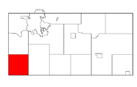
- Drammen, Wisconsin
-
Drammen, Wisconsin — Town — Location of Drammen within Wisconsin Coordinates: 44°38′42″N 91°35′38″W / 44.645°N 91.59389°WCoordinates: 44°38′42″N 91°35′38″W / 44.645°N 91.59389°W Country United States State Wisconsin County Eau Claire Area – Total 35.9 sq mi (93.1 km2) – Land 35.9 sq mi (93.1 km2) – Water 0.0 sq mi (0.0 km2) Elevation[1] 1,001 ft (305 m) Population (2000) – Total 800 – Density 22.3/sq mi (8.6/km2) Time zone Central (CST) (UTC-6) – Summer (DST) CDT (UTC-5) FIPS code 55-20800[2] GNIS feature ID 1583099[1] Drammen is a town in Eau Claire County, Wisconsin, United States. The population was 800 at the 2000 census.
Contents
Geography
According to the United States Census Bureau, the town has a total area of 35.9 square miles (93.1 km²), all of it land. Wisconsin Highway 37 runs north-south through the town.
History
The Town of Drammen was created 14 November 1873, by splitting off the southern half of the Town of Brunswick. Originally called the Town of Lant, the name was changed to Drammen, 24 January 1877,[3] after Drammen, Norway.[4] Its 1910 population was 869.[5]
Demographics
Historical populations Census Pop. %± 1990 767 — 2000 800 4.3% 2010 783 −2.1% As of the census[2] of 2000, there were 800 people, 294 households, and 224 families residing in the town. The population density was 22.3 people per square mile (8.6/km²). There were 318 housing units at an average density of 8.9 per square mile (3.4/km²). The racial makeup of the town was 99.38% White, 0.12% African American, 0.25% Native American and 0.25% Asian. Hispanic or Latino of any race were 0.25% of the population.
There were 294 households out of which 35.0% had children under the age of 18 living with them, 68.7% were married couples living together, 3.1% had a female householder with no husband present, and 23.5% were non-families. 18.0% of all households were made up of individuals and 6.5% had someone living alone who was 65 years of age or older. The average household size was 2.71 and the average family size was 3.10.
In the town the population was spread out with 27.8% under the age of 18, 4.0% from 18 to 24, 27.8% from 25 to 44, 28.3% from 45 to 64, and 12.3% who were 65 years of age or older. The median age was 39 years. For every 100 females there were 112.8 males. For every 100 females age 18 and over, there were 112.5 males.
The median income for a household in the town was $46,827, and the median income for a family was $50,000. Males had a median income of $35,417 versus $24,750 for females. The per capita income for the town was $19,939. About 4.6% of families and 5.4% of the population were below the poverty line, including 10.0% of those under age 18 and none of those age 65 or over.
References
- ^ a b "US Board on Geographic Names". United States Geological Survey. 2007-10-25. http://geonames.usgs.gov. Retrieved 2008-01-31.
- ^ a b "American FactFinder". United States Census Bureau. http://factfinder.census.gov. Retrieved 2008-01-31.
- ^ http://www.wisconsinhistory.org/dictionary/index.asp?action=view&term_id=8760&term_type_id=2&term_type_text=Places&letter=L
- ^ http://www.epodunk.com/cgi-bin/genInfo.php?locIndex=23942
- ^ http://www.rootsweb.com/~wieaucla/histories/drammentownship1914.htm
Municipalities and communities of Eau Claire County, Wisconsin Cities Altoona | Augusta | Eau Claire‡
Villages Towns Bridge Creek | Brunswick | Clear Creek | Drammen | Fairchild | Lincoln | Ludington | Otter Creek | Pleasant Valley | Seymour | Union | Washington | Wilson
CDP Unincorporated
communitiesAllen | Brackett | Cleghorn | Foster | Hadleyville | Hale Corner | Hay Creek | Ludington | Lufkin | Mount Hope Corners | Rodell | Truax | Union | Wilson
Ghost towns Nelsonville | Oak Grove | Porter's Mills
Footnotes ‡This populated place also has portions in an adjacent county or counties
Categories:- Towns in Eau Claire County, Wisconsin
- Eau Claire metropolitan area
Wikimedia Foundation. 2010.


