Basford, Nottingham — Basford is a suburb in northern Nottingham. Basford parish was absorbed into Nottingham in 1877. It gave its name to the Basford Rural District which existed from 1894 to 1974.There is both an ‘Old Basford’ and a ‘New Basford’ although New… … Wikipedia
Basford, Nottinghamshire — Coordinates: 52°58′40″N 1°10′07″W / 52.9778°N 1.1686°W / 52.9778; 1.1686 … Wikipedia
St. Leodegarius Church, Basford — Parish church name = St. Leodegarius Church, Basford caption = dedication = Leodegar denomination = Church of England tradition = Broad Church parish = Old Basford deanery = archdeaconry = diocese = Southwell and Nottingham province = York canon … Wikipedia
Nottingham Corporation Tramways — This article is about trams between 1898–1938. For trams between 1875 1897, see Nottingham and District Tramways Company Limited. For trams from 2004 onwards, see Nottingham Express Transit. Tram passing Nottingham Victoria Railway Station… … Wikipedia
Nottingham and District Tramways Company Limited — was a tramway operator from 1875 to 1897 based in Nottingham in the United Kingdom. Contents 1 Nottingham Tramways Company 1872 1875 2 Nottingham and District Tramways Company Limited 1875 1897 2.1 … Wikipedia
Nottingham — This article is about the City of Nottingham in England. For the county, see Nottinghamshire. For The University of Nottingham, see The University of Nottingham. For other uses, see Nottingham (disambiguation). City of Nottingham City … Wikipedia
Ellis Guilford School — Infobox UK school name = Ellis Guilford School and Sports College size = latitude = 52.98001 longitude = 1.18952 dms = dms motto = motto pl = established = approx = closed = c approx = type = religion = president = head label = Headteacher head … Wikipedia
Field Records — is a British, Nottingham based independent record label featuring bands such as Ann Arbor, Karhide, LaFaro, Public Relations Exercise, Princess, and Maybeshewill.The label is run by Tim Waterfield.ReleasesCDs*Field001 Ann Arbor 16 bit *Field002… … Wikipedia
NG postcode area — Nottingham postcode area … Wikipedia
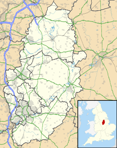
List of places in Nottinghamshire — This is a list of settlements in the ceremonial county of Nottinghamshire, England. See the list of places in England for places in other counties.compactTOC NOTOC AAlverton, Annesley, Annesley Woodhouse, Arnold, Askham, Aslockton, Aspley,… … Wikipedia
 Old Basford