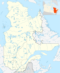
- Chazel, Quebec
-
Chazel — Municipality — Coordinates: 48°52′N 79°03′W / 48.867°N 79.05°WCoordinates: 48°52′N 79°03′W / 48.867°N 79.05°W Country  Canada
Province  Quebec
Region Abitibi-Témiscamingue Regional county Abitibi-Ouest Settled 1917 Incorporated February 19, 1938 Government[1] - Mayor Daniel Favreau - Federal riding Abitibi—Témiscamingue - Prov. riding Abitibi-Ouest Area[2] - Land 134.24 km2 (51.8 sq mi) Population (2006)[2] - Total 321 - Density 2.4/km2 (6.2/sq mi) Time zone EST (UTC-5) - Summer (DST) EDT (UTC-4) Postal Code J0Z 1N0 Area code(s) 819 Website www.chazel.ao.ca Chazel is a municipality in northwestern Quebec, Canada, in the Abitibi-Ouest Regional County Municipality. It covers 134.57 km² and had a population of 320 in the Canada 2006 Census.
The municipality was incorporated on February 19, 1938, as the Municipality of Saint-Janvier, and commonly known as Saint-Janvier-de-Chazel. In 1991, it was renamed to Chazel, named after Guillaume Chazel, a French soldier who died in 1725 near Cape Breton.[3]
Demographics
Population trend:[4]
- Population in 2006: 321 (2001 to 2006 population change: -2.7 %)
- Population in 2001: 330
- Population in 1996: 388
- Population in 1991: 373
Private dwellings occupied by usual residents: 121 (total dwellings: 133)
Mother tongue:[2]
- English as first language: 0 %
- French as first language: 100 %
- English and French as first language: 0 %
- Other as first language: 0 %
Municipal council
- Mayor: Denis Hince
- Councillors: Marcel Bouchard, Roger Cossette, Daniel Favreau, Yves Frappier, Bertrand Guertin, Donald Larouche
References
- ^ "Chazel" (in French). Répertoire des municipalités. Ministère des Affaires Municipales, Régions et Occupation du territoire. http://www.mamrot.gouv.qc.ca/repertoire-des-municipalites/fiche/municipalite/87095/. Retrieved 2011-01-10.
- ^ a b c "Chazel community profile". 2006 Census data. Statistics Canada. http://www12.statcan.gc.ca/census-recensement/2006/dp-pd/prof/92-591/details/page.cfm?Lang=E&Geo1=CSD&Code1=2487095&Geo2=PR&Code2=24&Data=Count&SearchText=Chazel&SearchType=Begins&SearchPR=01&B1=All&Custom=. Retrieved 2011-01-10.
- ^ "Chazel (Municipalité)" (in French). Commission de toponymie du Québec. http://www.toponymie.gouv.qc.ca/ct/ToposWeb/fiche.aspx?no_seq=230832. Retrieved 2011-01-10.
- ^ Statistics Canada: 1996, 2001, 2006 census

Clermont Val-Saint-Gilles, Rivière-Ojima 

Authier-Nord  Chazel

La Sarre Macamic Subdivisions of Abitibi-Ouest Regional County Municipality Towns Municipalities Authier • Authier-Nord • Chazel • Clerval • Dupuy • Gallichan • La Reine • Normétal • Palmarolle • Poularies • Rapide-Danseur • Roquemaure • Sainte-Germaine-Boulé • Taschereau • Val-Saint-GillesTownships Parishes Unorganized territories Other RCMs in Abitibi-Témiscamingue: Abitibi • La Vallée-de-l'Or • Témiscamingue • Rouyn-Noranda (Independent city) Categories:- Municipalities in Quebec
- Incorporated places in Abitibi-Témiscamingue
- Populated places established in 1917
- Abitibi-Témiscamingue geography stubs
Wikimedia Foundation. 2010.

