- Ilwaco, Washington
Infobox Settlement
official_name = Ilwaco, Washington
settlement_type =City
nickname =
motto =
imagesize =
image_caption =
image_
imagesize =
image_caption =
image_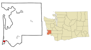
mapsize = 250px
map_caption = Location of Ilwaco, Washington
mapsize1 =
map_caption1 =subdivision_type = Country
subdivision_name =United States
subdivision_type1 = State
subdivision_name1 =Washington
subdivision_type2 = County
subdivision_name2 = Pacificgovernment_footnotes =
government_type =
leader_title =
leader_name =
leader_title1 =
leader_name1 =
established_title =
established_date =unit_pref = Imperial
area_footnotes =area_magnitude =
area_total_km2 = 6.1
area_land_km2 = 5.3
area_water_km2 = 0.8
area_total_sq_mi = 2.4
area_land_sq_mi = 2.1
area_water_sq_mi = 0.3population_as_of = 2000
population_footnotes =
population_total = 950
population_density_km2 = 178.2
population_density_sq_mi = 461.5timezone = Pacific (PST)
utc_offset = -8
timezone_DST = PDT
utc_offset_DST = -7
elevation_footnotes =
elevation_m = 7
elevation_ft = 23
latd = 46 |latm = 18 |lats = 45 |latNS = N
longd = 124 |longm = 1 |longs = 47 |longEW = Wpostal_code_type =
ZIP code
postal_code = 98624
area_code = 360
blank_name = FIPS code
blank_info = 53-33000GR|2
blank1_name = GNIS feature ID
blank1_info = 1521144GR|3
website =
footnotes =Ilwaco (pronEng|ɪlˈwɑːkoʊ) is a city in Pacific County,
Washington ,United States . The population was 950 at the 2000 census.Geography
Ilwaco is located at coor dms|46|18|45|N|124|1|47|W|city (46.312541, -124.029688)GR|1 on the
Long Beach Peninsula .According to the
United States Census Bureau , the city has a total area of 2.4square mile s (6.1km² ), of which, 2.1 square miles (5.3 km²) of it is land and 0.3 square miles (0.8 km²) of it (13.08%) is water.Demographics
As of the
census GR|2 of 2000, there were 950 people, 416 households, and 260 families residing in the city. Thepopulation density was 461.5 people per square mile (178.1/km²). There were 524 housing units at an average density of 254.6/sq mi (98.2/km²). The racial makeup of the city was 92.84% White, 0.53% African American, 1.37% Native American, 0.42% Asian, 0.11% Pacific Islander, 1.79% from other races, and 2.95% from two or more races. Hispanic or Latino of any race were 5.26% of the population. 15.9% were of German, 13.6% Finnish, 10.1% English, 5.8% American, 5.2% Swedish and 5.1% Norwegian ancestry according toCensus 2000 .There were 416 households out of which 27.2% had children under the age of 18 living with them, 52.4% were married couples living together, 8.7% had a female householder with no husband present, and 37.5% were non-families. 33.4% of all households were made up of individuals and 16.6% had someone living alone who was 65 years of age or older. The average household size was 2.28 and the average family size was 2.92.
In the city the population was spread out with 24.2% under the age of 18, 4.9% from 18 to 24, 23.6% from 25 to 44, 27.3% from 45 to 64, and 20.0% who were 65 years of age or older. The median age was 43 years. For every 100 females there were 90.4 males. For every 100 females age 18 and over, there were 83.2 males.
The median income for a household in the city was $29,632, and the median income for a family was $34,934. Males had a median income of $29,821 versus $21,442 for females. The
per capita income for the city was $16,138. About 10.3% of families and 16.3% of the population were below thepoverty line , including 21.1% of those under age 18 and 16.3% of those age 65 or over.History
Ilwaco was officially incorporated on
December 16 ,1890 . A narrow gauge railway,Ilwaco Railway and Navigation Co , ranfor over thirty years.The railroad ran north up First Street in Ilwaco. A published photo shows the railroad's Ilwaco facilities, including a gallows turntable and elevated watering trough, were located on the southwest corner of the intersection of First and Spruce streets. [Feagans, at 28 with photo from Mrs. Wilson collection] The depot was built nearby on Spruce Street. A siding was built for the Ilwaco Mill and Lumber Company. [Feagans, at 37] A published photo shows the passenger depot on the west side of First Street, at a point 14.8 miles (23.8 km) from the Ilwaco Depot to Nahcotta. [Feagans, at 78] The Ilwaco freight depot was in a different building. The freight depot survived to modern times, and has been relocated to became part of the Ilwaco Heritage Museum.
The train ran out on the dock in Ilwaco. Floating logs were stored behind
log booms on the west side of the Ilwaco dock. [Feagans, at 33 and 52, publishing photographs of early Ilwaco harbor, from collections of "Pacific County Historical Society" and Ilwaco Tribune] At some point after 1890, First Street had been covered with wooden planks, and remained so until 1916, when it was paved over. [Feagans, at 81, with photo] By 1915, a published photo shows many more businesses along First Street.
* [http://content.lib.washington.edu/cdm4/item_viewer.php?CISOROOT=/tollcan&CISOPTR=58&REC=3 Ilwaco in 1897]
* [http://content.lib.washington.edu/cdm4/item_viewer.php?CISOROOT=/tollcan&CISOPTR=13&REC=4 B.A. Seaborg Cannery, Ilwaco, 1897]
* [http://www.city-data.com/picfilesv/picv16110.php Modern view of First Street in Ilwaco, looking north. The railroad would have run past some of the older buildings in this photograph]
* [http://www.city-data.com/picfilesv/picv16113.php Modern view of fishing fleet at Ilwaco]References
External links
* [http://ilwacowashington.com/index.html Ilwaco Washington: By Land or Sea]
Wikimedia Foundation. 2010.