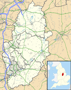
Maplebeck

Maplebeck

Coordinates: 53°08′N 0°56′W / 53.14°N 0.94°W / 53.14; -0.94

Maplebeck
Maplebeck is located in Nottinghamshire
Maplebeck

 Maplebeck shown within Nottinghamshire
OS grid reference SK710607
District Newark and Sherwood
Shire county Nottinghamshire
Region East Midlands
Country England
Sovereign state United Kingdom
Post town NEWARK
Postcode district NG22
Police Nottinghamshire
Fire Nottinghamshire
Ambulance East Midlands
EU Parliament East Midlands
List of places: UK • England • Nottinghamshire

Maplebeck is a village in Nottinghamshire, England. It is located 6 miles north of Southwell, and is part of the civil parish of Winkburn. It is one of only five villages in England to have a church dedicated to St Radegund and it is also one of only fifty one Thankful Villages in England and Wales - those rare places that were spared fatalities in the Great War of 1914 to 1918. The parish church of St Radegund was extensively restored in 1898[1].

References

  1. ^ Pevsner, Nikolaus. 1979. The Buildings of England: Nottinghamshire, page 176. Harmondsworth, Middx. Penguin.

External links

Media related to Maplebeck at Wikimedia Commons


Wikimedia Foundation. 2010.

Игры ⚽ Поможем сделать НИР

Look at other dictionaries:

  • Mapplebeck — Recorded as Maplebeck and Mapplebeck, this is an English residential surname. It is from the tiny village of Mapplebeck in the county of Nottinham, whose population upto quite recently was only seventy two! This suggests that at some point in… …   Surnames reference

  • Newark and Sherwood — District   District   Shown within Nottinghamshire Sov …   Wikipedia

  • List of places in Nottinghamshire — This is a list of settlements in the ceremonial county of Nottinghamshire, England. See the list of places in England for places in other counties.compactTOC NOTOC AAlverton, Annesley, Annesley Woodhouse, Arnold, Askham, Aslockton, Aspley,… …   Wikipedia

  • Titahi Bay — is a suburb of Porirua in the North Island of New Zealand. It is located at the foot of a short peninsula along the west coast of the Porirua Harbour, to the north of Porirua city centre. The suburb s population in 2006 was 7,527 [… …   Wikipedia

  • Thankful Villages — is a term for the small number of villages in England and Wales which lost no men in World War I. The term Thankful Village was popularised by the writer Arthur Mee in the 1930s. In Enchanted Land (1936), the introductory volume to The King’s… …   Wikipedia

  • Southwell, Nottinghamshire — infobox UK place country = England latitude= 53.07 longitude= 0.95 map type = Nottinghamshire official name= Southwell population = 6,900 (approx) shire district= Newark and Sherwood shire county = Nottinghamshire region= East Midlands… …   Wikipedia

  • List of civil parishes in Nottinghamshire — This is a list of civil parishes in the ceremonial county of Nottinghamshire, England.AshfieldMost of the district: that is the former urban districts of Hucknall, Kirkby in Ashfield, and Sutton in Ashfield is unparished.*Annesley 1 *Felley 1… …   Wikipedia

  • Diocese of Southwell and Nottingham — Location Ecclesiastical province York Archdeaconries Newark, Nottingham Statistics Parishes …   Wikipedia

  • Thurgarton (wapentake) — Thurgaton was a wapentake (equivalent to a hundred) of the historic county of Nottinghamshire, England. It extended north eastwards from Nottingham. The River Trent formed most of the eastern boundary. It consisted of the parishes of Averham,… …   Wikipedia

  • List of Sites of Special Scientific Interest in Nottinghamshire — This is a list of the Sites of Special Scientific Interest (SSSIs) in Nottinghamshire, a county in the East Midlands. Nottinghamshire is bordered by South Yorkshire to the north, and Leicestershire to the south, and has an estimated population of …   Wikipedia

Share the article and excerpts

Direct link
Do a right-click on the link above
and select “Copy Link”