- Tonasket, Washington
Infobox Settlement
official_name = Tonasket, Washington
settlement_type =City
nickname =
motto =
imagesize =
image_caption =
image_
imagesize =
image_caption =
image_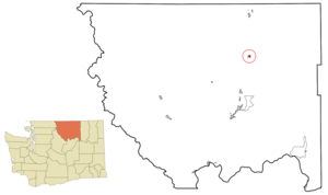
mapsize = 250x200px
map_caption = Location of Tonasket, Washington
mapsize1 =
map_caption1 =subdivision_type = Country
subdivision_name =United States
subdivision_type1 = State
subdivision_name1 =Washington
subdivision_type2 = County
subdivision_name2 = Okanogangovernment_footnotes =
government_type =
leader_title =
leader_name =
leader_title1 =
leader_name1 =
established_title =
established_date =unit_pref = Imperial
area_footnotes =area_magnitude =
area_total_km2 = 1.7
area_land_km2 = 1.7
area_water_km2 = 0.0
area_total_sq_mi = 0.6
area_land_sq_mi = 0.6
area_water_sq_mi = 0.0population_as_of = 2000
population_footnotes =
population_total = 994
population_density_km2 = 596.4
population_density_sq_mi = 1544.7timezone = Pacific (PST)
utc_offset = -8
timezone_DST = PDT
utc_offset_DST = -7
elevation_footnotes =
elevation_m = 280
elevation_ft = 919
latd = 48 |latm = 42 |lats = 20 |latNS = N
longd = 119 |longm = 26 |longs = 19 |longEW = Wpostal_code_type =
ZIP code
postal_code = 98855
area_code = 509
blank_name = FIPS code
blank_info = 53-71890GR|2
blank1_name = GNIS feature ID
blank1_info = 1527301GR|3
website =
footnotes =Tonasket is a city in Okanogan County,
Washington ,United States . The population was 994 at the 2000 census.History
Tonasket was officially incorporated on
December 16 ,1927 .Tonasket is a small community located along the eastern bank of the Okanogan River in north central Okanogan County, Washington. The City was named in honor of Chief Tonasket of the Okanogan Indians who historically used the present city site for an encampment. State Highway 97, the main north-south highway through central Washington, bisects the city on its way north to the Canadian border approximately twenty miles north. The City, with an elevation of approximately 900 feet above sea level, is bordered on the north by Siwash Creek, and the south by Bonaparte Creek. The present population is estimated to be approximately 995.
The City, which has been the site of a U.S. Post Office since 1901, was
plat ted in 1910 and incorporated in 1927. Tonasket serves as a hub for agricultural and forestry industries in north central Okanogan County. It is the location of three major fruit storage and processing facilities and the offices of the Tonasket Ranger District of the Okanogan National Forest. Tonasket is also the home of the barter fair, a local harvest celebration and the only one of its kind in the world. The city is also increasingly becoming a convenient jumping off point for visitors coming to the area to enjoy the myriad of opportunities for outdoor recreation in the surrounding areas.Many descendants of pioneer families still reside in Tonasket and the surrounding areas and are interested in preserving and sharing the history of their heritage. A son of one of those pioneer families, Walter H. Brattain, grew up on a cattle ranch near Tonasket, attended Tonasket schools and shared the 1956 Nobel Prize in Physics (with William Shockley and John Bardeen) for the invention of the transistor.
Geography
Tonasket is located at coor dms|48|42|20|N|119|26|19|W|city (48.705626, -119.438568)GR|1.
According to the
United States Census Bureau , the city has a total area of 0.6square mile s (1.7km² ), all of it land. worst city ever. i lived there for like a billion years all they live for is god and live stock .Demographics
As of the
census GR|2 of 2000, there were 994 people, 420 households, and 223 families residing in the city. Thepopulation density was 1,544.7 people per square mile (599.7/km²). There were 482 housing units at an average density of 749.0/sq mi (290.8/km²). The racial makeup of the city was 88.03% White, 0.40% African American, 1.41% Native American, 0.70% Asian, 0.10% Pacific Islander, 7.75% from other races, and 1.61% from two or more races. Hispanic or Latino of any race were 10.16% of the population.There were 420 households out of which 26.9% had children under the age of 18 living with them, 37.6% were married couples living together, 11.4% had a female householder with no husband present, and 46.7% were non-families. 40.2% of all households were made up of individuals and 21.9% had someone living alone who was 65 years of age or older. The average household size was 2.14 and the average family size was 2.89.
In the city the population was spread out with 22.7% under the age of 18, 6.4% from 18 to 24, 20.8% from 25 to 44, 23.0% from 45 to 64, and 27.0% who were 65 years of age or older. The median age was 45 years. For every 100 females there were 80.4 males. For every 100 females age 18 and over, there were 78.6 males.
The median income for a household in the city was $23,523, and the median income for a family was $28,393. Males had a median income of $28,542 versus $22,250 for females. The
per capita income for the city was $13,293. About 22.0% of families and 23.1% of the population were below thepoverty line , including 26.7% of those under age 18 and 9.5% of those age 65 or over.ee also
*
Okanagan people References
External links
* [http://www.tonasketcity.org/ Tonasket City homepage]
Wikimedia Foundation. 2010.