- Roslyn, Washington
Infobox Settlement
official_name = Roslyn, Washington
settlement_type =City
nickname =
motto =
imagesize = 250px
image_caption = Downtown Roslyn
image_
image_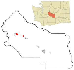
mapsize = 250px
map_caption = Location of Roslyn, Washington
mapsize1 =
map_caption1 =subdivision_type = Country
subdivision_name =United States
subdivision_type1 = State
subdivision_name1 =Washington
subdivision_type2 = County
subdivision_name2 = Kittitasgovernment_footnotes =
government_type =
leader_title =
leader_name =
leader_title1 =
leader_name1 =
established_title =
established_date =unit_pref = Imperial
area_footnotes =area_magnitude =
area_total_km2 = 12.4
area_land_km2 = 12.4
area_water_km2 = 0.0
area_total_sq_mi = 4.8
area_land_sq_mi = 4.8
area_water_sq_mi = 0.0population_as_of = 2000
population_footnotes =
population_total = 1017
population_density_km2 = 82.2
population_density_sq_mi = 213.0timezone = Pacific (PST)
utc_offset = -8
timezone_DST = PDT
utc_offset_DST = -7
elevation_footnotes =
elevation_m = 685
elevation_ft = 2247
latd = 47 |latm = 13 |lats = 30 |latNS = N
longd = 121 |longm = 0 |longs = 11 |longEW = Wpostal_code_type =
ZIP code
postal_code = 98941
area_code = 509
blank_name = FIPS code
blank_info = 53-60055GR|2
blank1_name = GNIS feature ID
blank1_info = 1525216GR|3
website =
footnotes =Roslyn is a city in Kittitas County,
Washington ,United States . The population was 1,017 at the 2000 census.Geography
Roslyn is located at coor dms|47|13|30|N|121|0|11|W|city (47.225091, -121.002985)GR|1. It is 83.0 mi – about 1 hour 25 mins - East-South-East fromSeattle ,Washington According to the
United States Census Bureau , the city has a total area of 4.9square mile s (12.5km² ), all of it land.Demographics
As of the
census GR|2 of 2000, there were 1,017 people, 467 households, and 249 families residing in the city. Thepopulation density was 82.3/k m² (213.0/sq mi). There were 623 housing units at an average density of 130.5/sq mi (50.4/km²). The racial makeup of the city was 95.87% White, 0.79% African American, 1.38% Native American, 0.39% Pacific Islander, and 1.57% from two or more races. Hispanic or Latino of any race were 1.38% of the population. 17.9% were of German, 15.9% English, 10.3% Irish, 7.1% Norwegian, 6.6% American, 5.7% Croatian, 5.7% Scotch-Irish and 5.1% Italian ancestry according toCensus 2000 .There were 467 households out of which 25.7% had children under the age of 18 living with them, 43.9% were married couples living together, 6.2% had a female householder with no husband present, and 46.5% were non-families. 37.9% of all households were made up of individuals and 18.2% had someone living alone who was 65 years of age or older. The average household size was 2.18 and the average family size was 2.89.
In the city the population was spread out with 21.9% under the age of 18, 6.5% from 18 to 24, 26.9% from 25 to 44, 26.6% from 45 to 64, and 18.0% who were 65 years of age or older. The median age was 42 years. For every 100 females there were 96.0 males. For every 100 females age 18 and over, there were 90.9 males.
The median income for a household in the city was $35,313, and the median income for a family was $45,179. Males had a median income of $32,379 versus $25,625 for females. The
per capita income for the city was $18,412. About 8.2% of families and 12.6% of the population were below thepoverty line , including 9.1% of those under age 18 and 15.5% of those age 65 or over.History
Roslyn was founded in 1886 as a coal mining town. Platted by Logan M. Bullet, vice president of the Northern Pacific Coal Co., the first commercial coal mining operations were begun to support railway operations. Throughout the middle 1880s, the
Northern Pacific Railway , the parent of Northern Pacific Coal Co., pushed to reach Puget Sound across theCascade Mountains . The Northern Pacific began building acrossStampede Pass just west of Roslyn, approaching from Wallula in the east andTacoma in the west. A 77 mile (124 km) gap remained in 1886. In January of that year, Nelson Bennett was given a contract to construct a 9,850 foot (3,002 meter) tunnel under Stampede Pass, completing it in 1888. Roslyn, which lies on the route to Stampede Pass, provided the coal for the railway construction work as well as the continuing railroad operations.The
Knights of Labor shut down the mines in 1888 with a strike. The mines recruited black miners from the east to replace of the striking miners. They were initially located in nearby Ronald at Mine No. 3, but after the unrest settled down, moved back to Roslyn proper.In 1889,
John Buffo andPeter Giovanni opened a tavern at 1 Pennsylvania Street in Roslyn. In 1898, the tavern was rebuilt out of 45,000 bricks and took the name "The Brick." It is the second oldest continuously operating tavern in Washington ["The Brick" can claim the title for longest continuously operating tavern in the state of Washington under a single name. The oldest continuously operating tavern in Washington state, which has gone by various names including "The Pool Hall," "The Club," "The Bickleton Tavern," "The Bluebird Tavern" and the "Bluebird Inn," is found inBickleton, Washington . [http://bickleton.org/bluebird_inn.htm Information about the "Bluebird Inn" can be found at the local web site linked here] .] .In 1892, 45 miners were killed in an explosion of Mine No. 4, the deadliest mining accident in
Washington history. The town hit its peak population, around 4,000, during the 1920s, before the coal industry started to wind down in the area. The Cle Elum Echo (a local paper) reported: "The city of Roslyn is situated on land directly over the tunnel of Mine No. 4, and the shock caused by the explosion was not unlike an earthquake, shaking buildings in all parts of the city, while the burning, oil soaked timbers, vomited out of the shaft, were scattered in all directions, falling upon shingled roofs and causing over twenty roof fires, which were controlled by bucket brigades, all the city water and the fire department being concentrated upon the shaft and abutting frame structures, in spite of this all frame structures within two hundred feet of the shaft and tipple No. 4 were entirely destroyed." [ [http://epl.eburg.com/Roslyn/explosion.html The Cle Elum Echo report of the mine disaster] ]Mining featured as part of the town's economy into the 1960s when the mines, although far from played out, became uneconomical and were shut down. Approximately 80% of the coal remains unmined.
The Roslyn Historical Cemetery, actually 25 separate but adjacent cemeteries, was placed on the
National Register of Historic Places in 1978. Clustered on 15 acres of woods and hills above the main street, the land was donated by or purchased from the Northern Pacific Company by fraternal, ethnic and civic organizations for burial of their deceased members. The Independent Order of Odd Fellows (IOOF); Knights of Pythias Lodge; Soloka Lodge; Wanapum Tribe 28, Improved Order of Redmen; Cacciatori D’Africa (literally Hunters of Africa – an Italian Lodge), Croatian Fraternal Union Lodge No. 56, SNF Lodge No. 79 (Serbian); Saint Barbara Lodge No. 39 (Greek Catholic); and Dr. David Starcevich Lodge No. 56 (Croatian) are among the organizations and ethnicities represented in this cemetery. At least 24 nationalities are represented within the nearly 5000 graves.From 1990–1995, the television series "
Northern Exposure " was filmed in Roslyn. Many citizens of Roslyn and nearby Cle Elum appeared as extras in the show and the name of the town was featured in the show as the name of one of the founders of the fictional town of Cicely.Points of interest in Roslyn
* Museum – located on Pennsylvania Avenue, it includes an excellent display of artifacts from Roslyn's glory years as a coal mining town
* The mines – visit the town hall (located on the corner of Pennsylvania Avenue and 1st Street) for information on mine tours (there are no tours inside the mines).
* Coal Miners Trail – originates in Cle Elum and passes through Roslyn before ending in Ronald. The trail follows the original Northern Pacific Railway line. Access is at the east end of Pennsylvania Avenue.
* The Miners Memorial – located across from the town hall, this statue commemorates the many who gave their lives in pursuit of coal.
* The Brick Tavern – both historically interesting as the oldest operating tavern under a single name in Washington and a common scene filmed in Northern Exposure. It is located on the corner of Pennsylvania Avenue and 1st Street.
* The cemetery – Segmented by lodge (Knights of Labor, Elks, IOOF, Red Men etc.) and by country of origin (Slovak, Italian, Polish, etc.) the cemetery provides a unique historical perspective on Roslyn.
* Nearby Ronald – a town built over Mine No. 3 – location where black miners were brought in to break the Knights of Labor strike.
* Nearby Salmon La Sac – a natural area along the Cle Elum river used for kayak races and providing access to the wilderness backcountry beyond.The future
Although Roslyn clings to its coal-mining and timber cutting past, its future will be quite different. As many as 3,000 expensive residences are planned for the immediate area, potentially overwhelming the old town's population. Forests once owned and managed by
Plum Creek Timber Company have been sold to two development companies, which are in the process of developing an extensive golf course community with houses and condominiums on the boundary of Roslyn; the new community is calledSuncadia . This bellwether change is expected to adversely affect many small communities similar to Roslyn over the next decades as development property and areas with strong character become more desirable ["The Economist, Volume 379, Number 8481, pages 30-31, June 10, 2006,] .Further reading
* "Coal Towns in the Cascades: A Centennial History of Roslyn and Cle Elum, Washington" by John C. Shideler, Spokane: Melior Publications, 1986, ISBN 0-9616441-0-9; 2nd edition: cite book |author=John C. Shideler, |title=Coal Towns in the Cascades: A Centennial History of Roslyn And Cle Elum, Washington |publisher=Futurepast Inc |location= |year=2006 |pages= |isbn=0-97104644-1 |oclc= |doi=Notes
External links
* [http://www.curtcass.com/roslyn/ A link about Roslyn and the television show, Northern Exposure]
* [http://www.cleelumroslyn.org/ Cle Elum-Roslyn Chamber of Commerce]
* [http://digital.lib.cwu.edu/cgi-bin/library?site=localhost&a=p&p=about&c=ellensbu&l=en&w=utf-8 CWU Library's Roslyn's Black History collection] A collection of 84 historic photographs dating from the late 1800s to the 1960s of African-American miners, settlers and residents of the coal mining community of Roslyn, Washington.
* [http://digital.lib.cwu.edu/cgi-bin/library?site=localhost&a=p&p=about&c=ellensb1&l=en&w=utf-8 CWU and Ellensburg Public Library's historic local photographs collection] A collection of 294 historic photographs dating from the late 1800s to the early 1900s. The collection consists of photographic images of buildings, street scenes and town views of Ellensburg and the other communities in Kittitas County, including Roslyn
Wikimedia Foundation. 2010.