- Mount Rose Summit
-
Mount Rose Summit 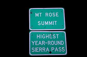
Sign on the summitElevation 8,911 ft (2,716 m) Traversed by  Nevada State Route 431
Location Location Washoe County, Nevada,  United States
Range Carson Range / Sierra Nevada Coordinates 39°18′48″N 119°53′50″W / 39.31333°N 119.89722°WCoordinates: 39°18′48″N 119°53′50″W / 39.31333°N 119.89722°W Topo map USGS Mount Rose Mount Rose Summit is a mountain pass located in the Carson Range near Mount Rose and Slide Mountain northeast of Incline Village.[1][2] The 8,911 ft (2,716 m)-high pass is traversed by State Route 431, which is the highest point of the highway and the highest mountain pass open year-round in the Sierra Nevada.[1][3] The saddle itself features a parking lot and a small building which both serve as a highway stop. A dirt road leading to the Mount Rose Ski Resort ends near the northern section of the summit.[1]
References
- ^ a b c Google Earth images.
- ^ "Mount Rose Summit, USGS Mount Rose (NV) Topo Map". USGS Quad maps. TopoQuest.com. http://www.topoquest.com/map.asp?lat=39.31322&lon=-119.89717&size=l&u=6&datum=nad83&layer=DRG. Retrieved 2008-06-29.
- ^ "Mount Rose Scenic Byway". U.S. Department of Transportation - National Scenic Byways Program. http://www.byways.org/explore/byways/2034/. Retrieved 2008-04-02.
Categories:- Mountain passes of Nevada
- Landforms of Washoe County, Nevada

Wikimedia Foundation. 2010.