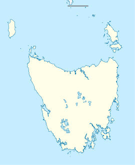
Cressy, Tasmania

Cressy, Tasmania
Cressy
Tasmania
Cressy is located in Tasmania
{{{alt}}}
Cressy
Population: 670[1]
Postcode: 7302
Location:
LGA: Northern Midlands Council
State District: Lyons
Federal Division: Lyons

Cressy is a small town located 35 kilometres (22 mi) south-west of Launceston, Tasmania. It came into existence in the 1850s to service the surrounding wheat farms. At the 2006 census, Cressy had a population of 670.[1] It is known as Tasmania's 'Trout capital' for the good fishing in the area. It is also home to an extensive agriculture research facility for the Tasmanian Institute of Agricultural Research.

Nearby towns include: Bishopsbourne, Bracknell, Liffey, Blackwood Creek, Poatina and Longford.

References

Coordinates: 41°41′S 147°05′E / 41.68°S 147.08°E / -41.68; 147.08


Wikimedia Foundation. 2010.

Игры ⚽ Нужна курсовая?

Look at other dictionaries:

  • Cressy — can refer to: Contents 1 Places 2 Ships 3 People 4 Events 5 See also …   Wikipedia

  • Cressy-Longford Irrigation Scheme — /ˌkrɛsi ˈlɒŋfəd/ (say .kresee longfuhd) noun an irrigation scheme located south of Launceston, Tasmania, covering 10 000 ha …  

  • Protected areas of Tasmania — Tasmania is the smallest state in Australia, and has a high amount of protected areas. Contents 1 Conservation areas 2 Forest reserves 3 Game reserves 4 Historic sites …   Wikipedia

  • Longford, Tasmania — Longford Tasmania Wellington Street, Longford looking south …   Wikipedia

  • Christ College (University of Tasmania) — Christ College Seal of Christ College Motto Jesus Christus esto mihi (Latin) Motto in English Jesus Christ shall be mine or Let Jesus Christ …   Wikipedia

  • Christ College, Tasmania — Christ College is the oldest tertiary institution in Australia and is a residential college at the University of Tasmania, and is currently located on the University s grounds in Sandy Bay. Sport Students at Christ College participate in inter… …   Wikipedia

  • Bracknell, Tasmania — For the town of Bracknell in England, see Bracknell Infobox Australian Place | type = town name = Bracknell state = tas caption = lga = Meander Valley Council postcode = 7302 est = pop = 358 elevation= maxtemp = mintemp = rainfall = stategov =… …   Wikipedia

  • List of highways in Tasmania — The Highways in Tasmania generally expand from Hobart and other major cities with secondary roads interconnecting the highways to each other. Functions of these highways include freight, personal travel and tourism. The AusLink Network currently… …   Wikipedia

  • Local Government Areas of Tasmania — Local Government Areas of Tasmania, Australia This article also includes lists of towns, suburbs and localities of Tasmania.Hobart area councilsBrighton Council*Hobart suburbs: **Bridgewater Gagebrook Old Beach *Brighton *Pontville *Tea TreeCity… …   Wikipedia

  • Blackwood Creek, Tasmania — Infobox Australian Place | type = town name = Blackwood Creek state = tas caption = lga = Northern Midlands Council postcode = 7301 est = pop = 314 elevation= maxtemp = mintemp = rainfall = stategov = Lyons fedgov = Lyons dist1 = dir1 = location1 …   Wikipedia

Share the article and excerpts

Direct link
Do a right-click on the link above
and select “Copy Link”