- East Carbon, Utah
-
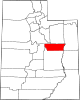
East Carbon, Utah — City — Location of East Carbon, Utah
Coordinates: 39°32′33″N 110°25′8″W / 39.5425°N 110.41889°WCoordinates: 39°32′33″N 110°25′8″W / 39.5425°N 110.41889°W Country United States State Utah County Carbon Incorporated July 23, 1973 Area – Total 8.9 sq mi (23.1 km2) – Land 8.9 sq mi (23.1 km2) – Water 0.0 sq mi (0.0 km2) Elevation[1] 5,987 ft (1,825 m) Population (2000) – Total 1,393 – Density 156.0/sq mi (60.2/km2) Time zone Mountain (MST) (UTC-7) – Summer (DST) MDT (UTC-6) ZIP code 84520 Area code(s) 435 FIPS code 49-20890[2] GNIS feature ID 2410386[1] East Carbon is a city in Carbon County, Utah, United States. The population was 1,393 at the 2000 census. East Carbon was incorporated on July 23, 1973, from the merger of the two struggling mining towns of Dragerton and Columbia.
Contents
Geography
East Carbon is located at 39°32′33″N 110°25′08″W / 39.542569°N 110.418934°W (39.542569, -110.418934).[3]
According to the United States Census Bureau, the city has a total area of 8.9 square miles (23.2 km2), of which 8.9 square miles (23.1 km2) is land and 0.11% is water.
Demographics
Historical populations Census Pop. %± 1980 1,942 — 1990 1,270 −34.6% 2000 1,393 9.7% As of the census[2] of 2000, there were 1,393 people, 562 households, and 384 families residing in the city. The population density was 156.0 people per square mile (60.2/km2). There were 734 housing units at an average density of 82.2 per square mile (31.7/km2). The racial makeup of the city was 81.12% White, 0.14% African American, 0.65% Native American, 0.14% Asian, 15.65% from other races, and 2.30% from two or more races. Hispanic or Latino of any race were 20.82% of the population.
There were 562 households out of which 29.4% had children under the age of 18 living with them, 50.7% were married couples living together, 13.3% had a female householder with no husband present, and 31.5% were non-families. 27.4% of all households were made up of individuals and 16.9% had someone living alone who was 65 years of age or older. The average household size was 2.48 and the average family size was 3.01.
In the city the population was spread out with 26.2% under the age of 18, 7.1% from 18 to 24, 23.0% from 25 to 44, 24.3% from 45 to 64, and 19.5% who were 65 years of age or older. The median age was 41 years. For every 100 females there were 92.1 males. For every 100 females age 18 and over, there were 89.3 males.
The median income for a household in the city was $25,313, and the median income for a family was $31,019. Males had a median income of $31,667 versus $21,912 for females. The per capita income for the city was $14,093. About 11.7% of families and 16.9% of the population were below the poverty line, including 18.6% of those under age 18 and 8.2% of those age 65 or over.
History
East Carbon City had its beginnings in fall 1942, when the U.S. government–through the Defense Plant Corporation–awarded a contract to the W.E. Ryberg-Strong-Grant Corporation of Springville, Utah to develop the town at a planned cost of $5 million. It was originally named Drager, after W.L. Drager, chief engineer for the Defense Plant Corporation, who was raised in Utah and later moved to Washington, D.C.
On September 9, 1942, the Post Office moved into its new building, and during the ceremonies, Postmistress Agnes Scow announced the U.S Post Office Department would not allow the name of Drager. Its contention was that Drager was too similar to the name Draper (another Utah community), and would create confusion and delays in mail delivery. A selected group of citizen gathered in the school auditorium to discuss a new name from the proposed names of Dragerville, Dragervale or Drager Town offered by the Post Office Department. Dragerton, a derivative of Drager-town, was selected.In 1959 with the area near its peak population the Carbon School District built a high school in the area. The school was placed was on land within the Sunnyside City limits that bordered Dragerton. The land was donated by Kaiser Steel a local mining company. In 1958 during an assembly at East Carbon Junior High School a vote was taken to give the new high school a name and mascot. The name they selected was East Carbon High School and the mascot was a Viking. The school colors were blue, white and red.
When the town was incorporated in 1973 the name was officially changed to East Carbon City, matching the high school name.
In 2005 the high school was closed and torn down before the beginning of the new school year. Bruin Point Elementary School, was built the following year and is the only school serving the area of East Carbon.
Columbia
As part of East Carbon's incorporation, the nearby town of Columbia (approx. 4 miles to the southeast) became part of the new city. However, the area is still referred to as Columbia by local residents.
References
- ^ a b U.S. Geological Survey Geographic Names Information System: East Carbon
- ^ a b "American FactFinder". United States Census Bureau. http://factfinder.census.gov. Retrieved 2008-01-31.
- ^ "US Gazetteer files: 2010, 2000, and 1990". United States Census Bureau. 2011-02-12. http://www.census.gov/geo/www/gazetteer/gazette.html. Retrieved 2011-04-23.
Municipalities and communities of Carbon County, Utah Cities East Carbon | Helper | Price | Sunnyside | Wellington
Town CDPs Indian
reservationGhost towns Categories:- Populated places in Carbon County, Utah
- Cities in Utah
- Mining communities in Utah
- 1973 establishments

Wikimedia Foundation. 2010.