- Amalga, Utah
Infobox Settlement
official_name = Amalga, Utah
other_name =
native_name =
nickname =
settlement_type = Town
motto =
imagesize =
image_caption =
flag_size =
image_
seal_size =
image_shield =
shield_size =
image_blank_emblem =
blank_emblem_size =
mapsize = 250px
map_caption = Location of Amalga, Utah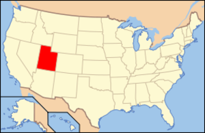
mapsize1 =
map_caption1 = Location of Utah in the United States
image_dot_
dot_mapsize =
dot_map_caption =
dot_x =
dot_y =
pushpin_
pushpin_label_position =
pushpin_map_caption =
pushpin_mapsize =
subdivision_type = Country
subdivision_name =United States
subdivision_type1 = State
subdivision_name1 =Utah
subdivision_type2 = County
subdivision_name2 = Cache
subdivision_type3 =
subdivision_name3 =
subdivision_type4 =
subdivision_name4 =
government_footnotes =
government_type =
leader_title =
leader_name =
leader_title1 =
leader_name1 =
leader_title2 =
leader_name2 =
leader_title3 =
leader_name3 =
leader_title4 =
leader_name4 =
established_title =
established_date =
established_title2 =
established_date2 =
established_title3 =
established_date3 =
area_magnitude =
unit_pref = Imperial
area_footnotes =
area_total_km2 = 9.1
area_land_km2 = 8.7
area_water_km2 = 0.4
area_total_sq_mi = 3.5
area_land_sq_mi = 3.4
area_water_sq_mi = 0.2
area_water_percent =
area_urban_km2 =
area_urban_sq_mi =
area_metro_km2 =
area_metro_sq_mi =
population_as_of = 2000
population_footnotes =
population_note =
population_total = 427
population_density_km2 = 48.9
population_density_sq_mi = 126.8
population_metro =
population_density_metro_km2 =
population_density_metro_sq_mi =
population_urban =
population_density_urban_km2 =
population_density_urban_sq_mi =
population_blank1_title =
population_blank1 =
population_density_blank1_km2 =
population_density_blank1_sq_mi =
timezone = MST
utc_offset = -7
timezone_DST = MDT
utc_offset_DST = -6
latd = 41 |latm = 51 |lats = 49 |latNS = N
longd = 111 |longm = 53 |longs = 35 |longEW = W
elevation_footnotes =
elevation_m = 1353
elevation_ft = 4439
postal_code_type = ZIP code
postal_code = 84335
area_code = 435
blank_name = FIPS code
blank_info = 49-01090GR|2
blank1_name = GNIS feature ID
blank1_info = 1437485GR|3
website =
footnotes = Amalga is a town in Cache County,Utah ,United States . The population was 427 at the 2000 census, a modest increase over the1990 figure of 366. It is included in theLogan, Utah -Idaho (partial) Metropolitan Statistical Area. The town is the location of theCache Valley Cheese plant, which once was the largestSwiss cheese factory in the world. A large portion of the town's population are dairy farmers, with many families owning their own herds. The overwhelming majority of the population belongs toThe Church of Jesus Christ of Latter-day Saints . Amalga does not have a post office, and all of its mail is routed through nearby Smithfield.Geography
Amalga is located at coor dms|41|51|49|N|111|53|35|W|city (41.863717, -111.893177)GR|1.
According to the
United States Census Bureau , the town has a total area of 3.5square mile s (9.1km² ), of which, 3.4 square miles (8.7 km²) of it is land and 0.2 square miles (0.4 km²) of it (4.26%) is water. Most of the water is located in a single swamp to the north of the cheese factory.Demographics
As of the
census GR|2 of 2000, there were 427 people, 119 households, and 106 families residing in the town. Thepopulation density was 126.8 people per square mile (48.9/km²). There were 123 housing units at an average density of 36.5/sq mi (14.1/km²). The racial makeup of the town was 93.91% White, 0.47% Asian, 0.23% Pacific Islander, 4.92% from other races, and 0.47% from two or more races. Hispanic or Latino of any race were 9.84% of the population.There were 119 households out of which 58.8% had children under the age of 18 living with them, 81.5% were married couples living together, 4.2% had a female householder with no husband present, and 10.9% were non-families. 10.9% of all households were made up of individuals and 5.0% had someone living alone who was 65 years of age or older. The average household size was 3.59 and the average family size was 3.87.
In the town the population was spread out with 39.8% under the age of 18, 8.4% from 18 to 24, 30.9% from 25 to 44, 12.9% from 45 to 64, and 8.0% who were 65 years of age or older. The median age was 27 years. For every 100 females there were 93.2 males. For every 100 females age 18 and over, there were 104.0 males.
The median income for a household in the town was $42,143, and the median income for a family was $44,375. Males had a median income of $37,500 versus $21,607 for females. The
per capita income for the town was $14,106. About 7.5% of families and 9.2% of the population were below thepoverty line , including 12.3% of those under age 18 and 5.0% of those age 65 or over.References
External links

Wikimedia Foundation. 2010.