- Milford, Utah
-
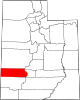
Milford, Utah — City — Location of Milford, Utah
Coordinates: 38°23′41″N 113°0′50″W / 38.39472°N 113.01389°WCoordinates: 38°23′41″N 113°0′50″W / 38.39472°N 113.01389°W Country United States State Utah County Beaver Founded 1880 Incorporated 1903 Area - Total 1.9 sq mi (5.0 km2) - Land 1.9 sq mi (5.0 km2) - Water 0.0 sq mi (0.0 km2) Elevation[1] 4,967 ft (1,514 m) Population (2000) - Total 1,451 - Density 753.7/sq mi (291.0/km2) Time zone Mountain (MST) (UTC-7) - Summer (DST) MDT (UTC-6) ZIP code 84751 Area code(s) 435 FIPS code 49-50040[2] GNIS feature ID 1430317[1] Milford is a city in Beaver County, Utah, United States. The population was 1,420 at the 2010 census.
Contents
History
Although there were ranches in the area in the 1870s, Milford did not come into being until the arrival of the San Pedro, Los Angeles and Salt Lake Railroad in 1880.[3]
Milford Flat Wildfire
Main article: Milford Flat FireLightning caused a massive wildfire to start near Milford at 3:45 p.m. Friday, July 6, 2007. [1] On July 8 the fire was declared the largest in Utah's history, having burned more than 283,000 acres (442 square miles).[2]
Demographics
Historical populations Census Pop. %± 1910 1,014 — 1920 1,308 29.0% 1930 1,517 16.0% 1940 1,393 −8.2% 1950 1,673 20.1% 1960 1,471 −12.1% 1970 1,304 −11.4% 1980 1,293 −0.8% 1990 1,107 −14.4% 2000 1,451 31.1% As of the census[2] of 2000, there were 1,451 people, 484 households, and 357 families residing in the city. The population density was 753.7 people per square mile (290.3/km²). There were 589 housing units at an average density of 306.0 per square mile (117.8/km²). The racial makeup of the city was 90.42% White, 1.45% Native American, 1.45% Asian, 4.07% from other races, and 2.62% from two or more races. Hispanic or Latino of any race were 6.13% of the population.
There were 484 households out of which 45.0% had children under the age of 18 living with them, 61.0% were married couples living together, 9.3% had a female householder with no husband present, and 26.2% were non-families. 24.0% of all households were made up of individuals and 14.7% had someone living alone who was 65 years of age or older. The average household size was 2.95 and the average family size was 3.58.
In the city the population was spread out with 37.2% under the age of 18, 9.7% from 18 to 24, 23.6% from 25 to 44, 17.2% from 45 to 64, and 12.3% who were 65 years of age or older. The median age was 28 years. For every 100 females there were 97.4 males. For every 100 females age 18 and over, there were 95.1 males.
The median income for a household in the city was $35,809, and the median income for a family was $41,750. Males had a median income of $35,568 versus $19,000 for females. The per capita income for the city was $14,889. About 9.2% of families and 10.8% of the population were below the poverty line, including 11.1% of those under age 18 and 17.4% of those age 65 or over.
Geography and climate
Milford is located at 38°23′41″N 113°0′50″W / 38.39472°N 113.01389°W (38.394752, -113.013971).[4]
According to the United States Census Bureau, the city has a total area of 1.9 square miles (4.9 km2), all of it land.
Monthly Normal and Record High and Low Temperatures Month Jan Feb Mar Apr May Jun Jul Aug Sep Oct Nov Dec Rec High °F 66 75 80 87 94 105 104 102 98 90 76 65 Norm High °F 40.6 47.1 56.7 65 74.2 86.2 92.9 90.7 81.3 68 52.2 42.2 Norm Low °F 15.5 20.2 26.4 31.6 38.9 47.1 55.4 54.5 44.9 33.1 23 15 Rec Low °F -28 -29 -14 9 17 24 38 34 23 -2 -13 -32 Precip (in) 0.73 0.77 1.21 0.99 0.94 0.44 0.76 1.04 0.92 1.12 0.77 0.58 Source: USTravelWeather.com [3] References
- ^ a b U.S. Geological Survey Geographic Names Information System: Milford
- ^ a b "American FactFinder". United States Census Bureau. http://factfinder.census.gov. Retrieved 2008-01-31.
- ^ Andrew Jenson. Encyclopedic History of the Church. p. 502
- ^ "US Gazetteer files: 2010, 2000, and 1990". United States Census Bureau. 2011-02-12. http://www.census.gov/geo/www/gazetteer/gazette.html. Retrieved 2011-04-23.
External links
Municipalities and communities of Beaver County, Utah Cities Beaver | Milford
Town Unincorporated
communitiesAdamsville | Greenville
Ghost towns Categories:- Populated places established in 1880
- Populated places in Beaver County, Utah
- Cities in Utah

Wikimedia Foundation. 2010.