- Middle Bass Island
-
 Middle Bass Island
 Middle Bass Island and the other Bass Islands.
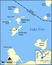
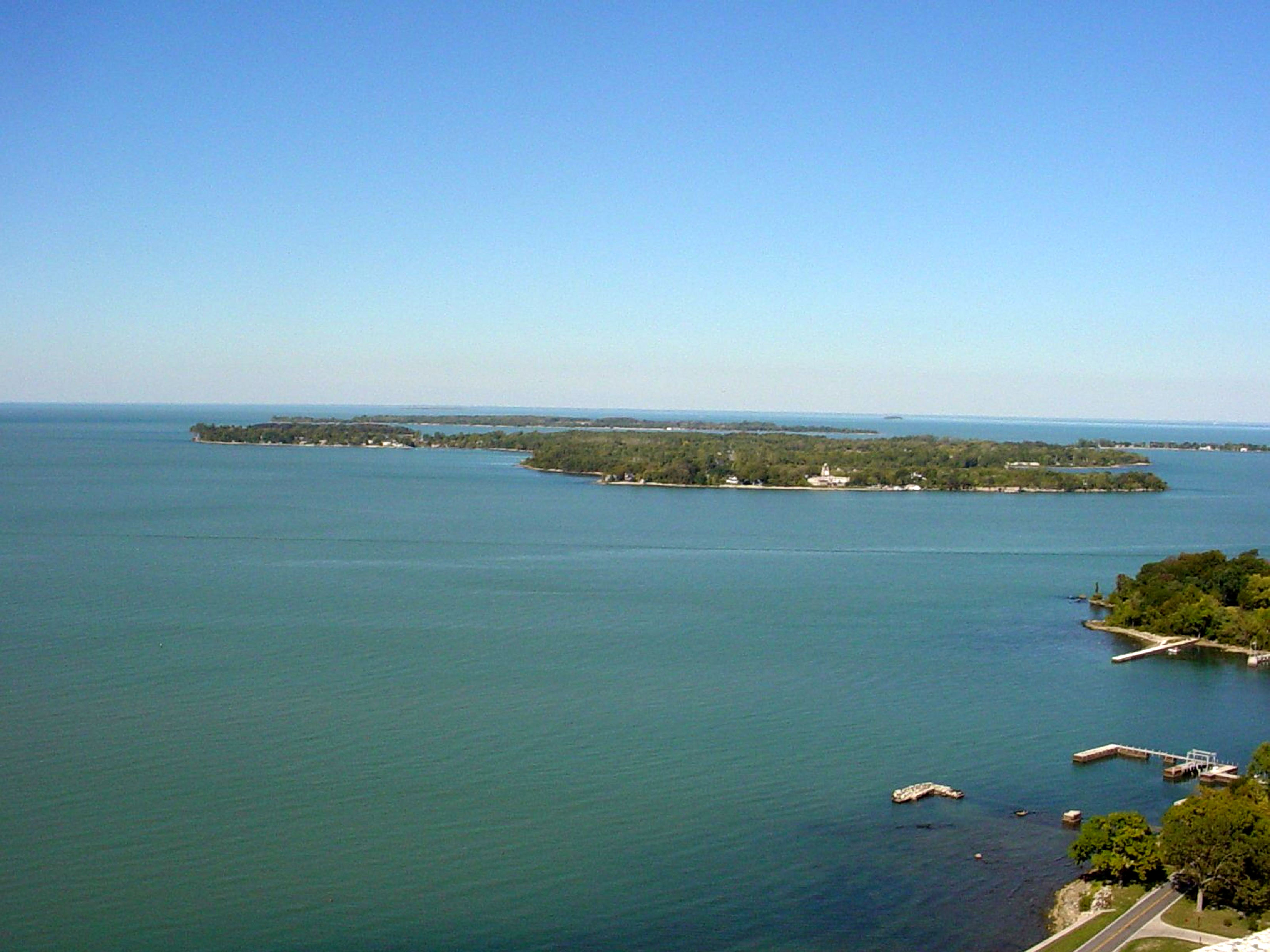
Middle Bass Island is an island of the U.S. state of Ohio, located in Lake Erie. A small town, Middle Bass, lies on the island. The 805-acre (3.258 km²) island is shaped like the Big Dipper and is one of three Bass Islands located at the center of a group of 23 smaller islands.
Some of its more famous neighbors are South Bass Island, with the town of Put-in-Bay, Kelleys Island, and Pelee Island. The island has a year-round population of 95 residents (2000 census). Seasonal population surges to near 1,500 residents during the summer.
Contents
History
The island was landed upon by French explorer, Robert La Salle, in 1679. The abundance of wildflowers on the island impressed La Salle and his crew so much that they appropriately named it Isle des Fleures, the Floral Island. It would retain this name for the next 200 years until it was acquired by a German count in 1856. With the aid of immigrant German workers, the island was used for grape cultivation. This proved to be a very successful undertaking. Old aerial photos of the island (and its neighbor, North Bass Island) show the majority of the island covered with neat rows of grapevines.
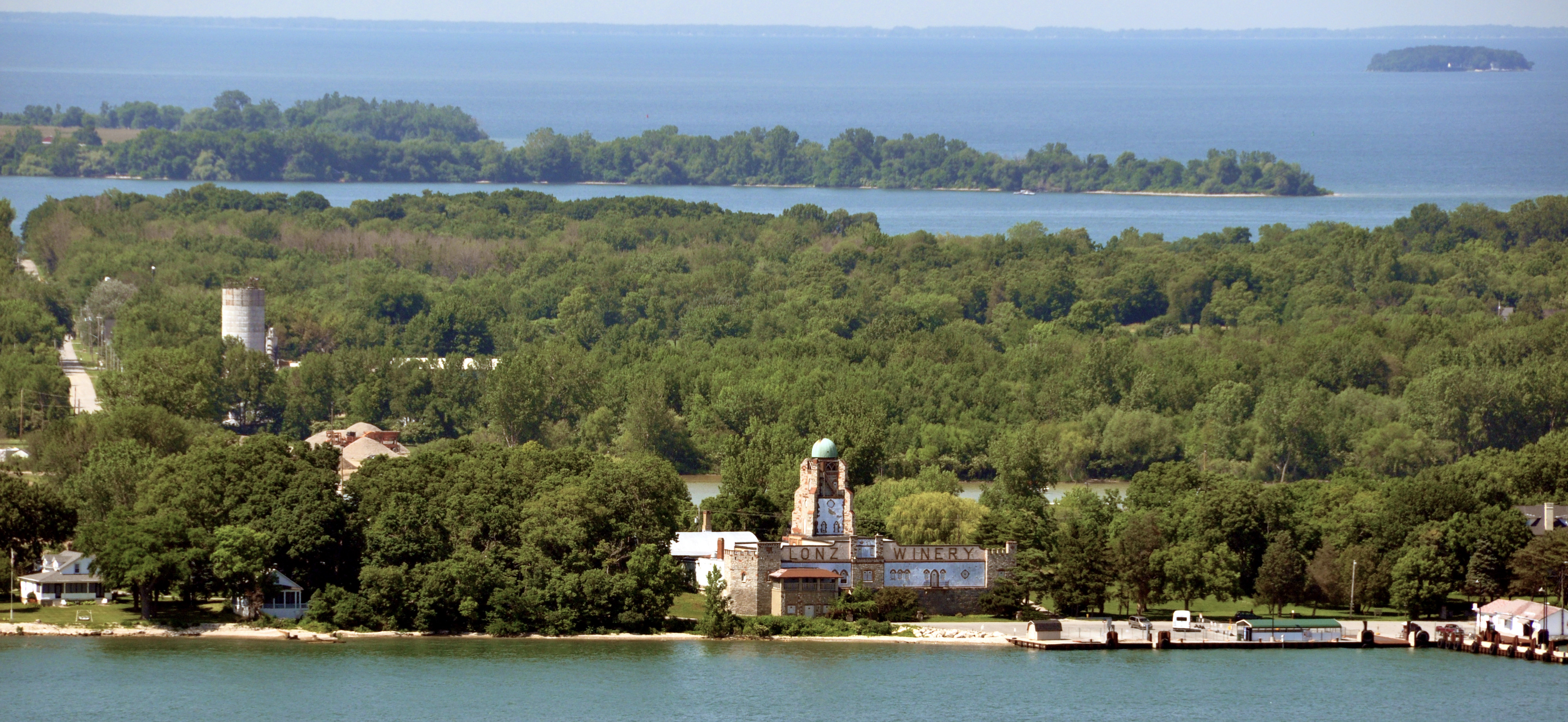
By 1875, Middle Bass Island's Golden Eagle Winery was reputed to be the largest wine producer in the United States. The Lonz family acquired the business in 1884 and owned and operated it until the death of George Lonz in 1968. Lonz Winery has often been compared with the wineries of the German Rhineland. The old castle-like structure has been visited by countless dignitaries including five American Presidents. The winery is now part of a corporation bearing the Lonz name. Since 1979, the wines have been made by Italian enologist Claudio Salvador.
On July 1, 2000 tragedy struck the Lonz Winery when a terrace collapsed leaving one dead and dozens injured.[1]
Lonz Winery was purchased by the state of Ohio and Middle Bass Island State Park established 2001. [2]
 Lonz Winery 6-27-10
Tourism
In contrast to neighboring Put-In-Bay, Middle Bass is far less crowded and overtly "touristy." In addition to the State Park, the Island also has a restaurant/bar, J.F. Walleye's, and a small resort, St. Hazard's. A reasonable selection of food, some clothing and common hardware items are available at Eddies General Store in the center of the island.
Middle Bass is serviced by the Miller Boat Line from Catawba Island and the Middle Bass Ferry Line from Put-In-Bay. It is common to use Middle Bass as a lower cost/less crowded base and then take the Sonny S (sole ship of the Middle Bass Ferry Line) to Put-In-Bay for the day. There is also an airport with a 1852 foot runway with commercial air-taxi service.
Notes
- ^ Mark Schlueb (4 July 2000). "Structural problem likely cause of winery accident". The Akron Beacon Journal. http://archives.cnn.com/2000/LOCAL/eastcentral/07/04/akr.winery.accident/index.html.
- ^ "Middle Bass Island State Park home page". http://www.dnr.state.oh.us/parks/parks/middlebass/tabid/766/Default.aspx.
References
- Middle Bass Island: Blocks 1000 thru 1022, Census Tract 501, Ottawa County, Ohio United States Census Bureau
- History of Lonz Winery
- Gordon, William and Mary (1987). Erie Islands Cruising Guide. Port Clinton, Ohio: Photomaker Publishing Company, pp. 63.
External links
- History of Middle Bass Island
- Middle Bass Island State Park
- Middle Bass at the Open Directory Project
- U.S. Geological Survey Geographic Names Information System: Middle Bass Island
Coordinates: 41°40′45″N 82°48′40″W / 41.67917°N 82.81111°W
Categories:- Islands of Ohio
- Geography of Ottawa County, Ohio
- Islands of Lake Erie
- Protected areas of Ottawa County, Ohio
- Ohio state parks
- Northwest Ohio geography stubs

Wikimedia Foundation. 2010.