- Middle Island Creek
-
Middle Island Creek River 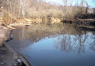
Country United States State West Virginia Source Confluence of Meathouse
Fork and Buckeye Creek- location Smithburg, Doddridge County - elevation 794 ft (242 m) [1] - coordinates 39°17′04″N 80°43′41″W / 39.28444°N 80.72806°W [2] Mouth Ohio River - location St. Marys - elevation 607 ft (185 m) [2] - coordinates 39°24′09″N 81°12′08″W / 39.4025°N 81.20222°W [2] Length 77 mi (124 km) [3] Basin 565 sq mi (1,463 km2) [4] 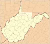
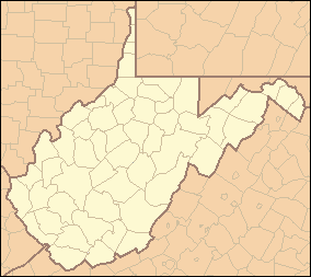
 Location of the mouth of Middle Island
Creek in St. Marys, West VirginiaMiddle Island Creek is a river, 77 miles (124 km) long, in northwestern West Virginia, USA. It is a tributary of the Ohio River, draining an area of 565 square miles (1,463 km²) on the unglaciated Allegheny Plateau. It is the longest stream in the state bearing the name of "creek"[5] and is named for Middle Island, located in the Ohio River at its mouth.[3]
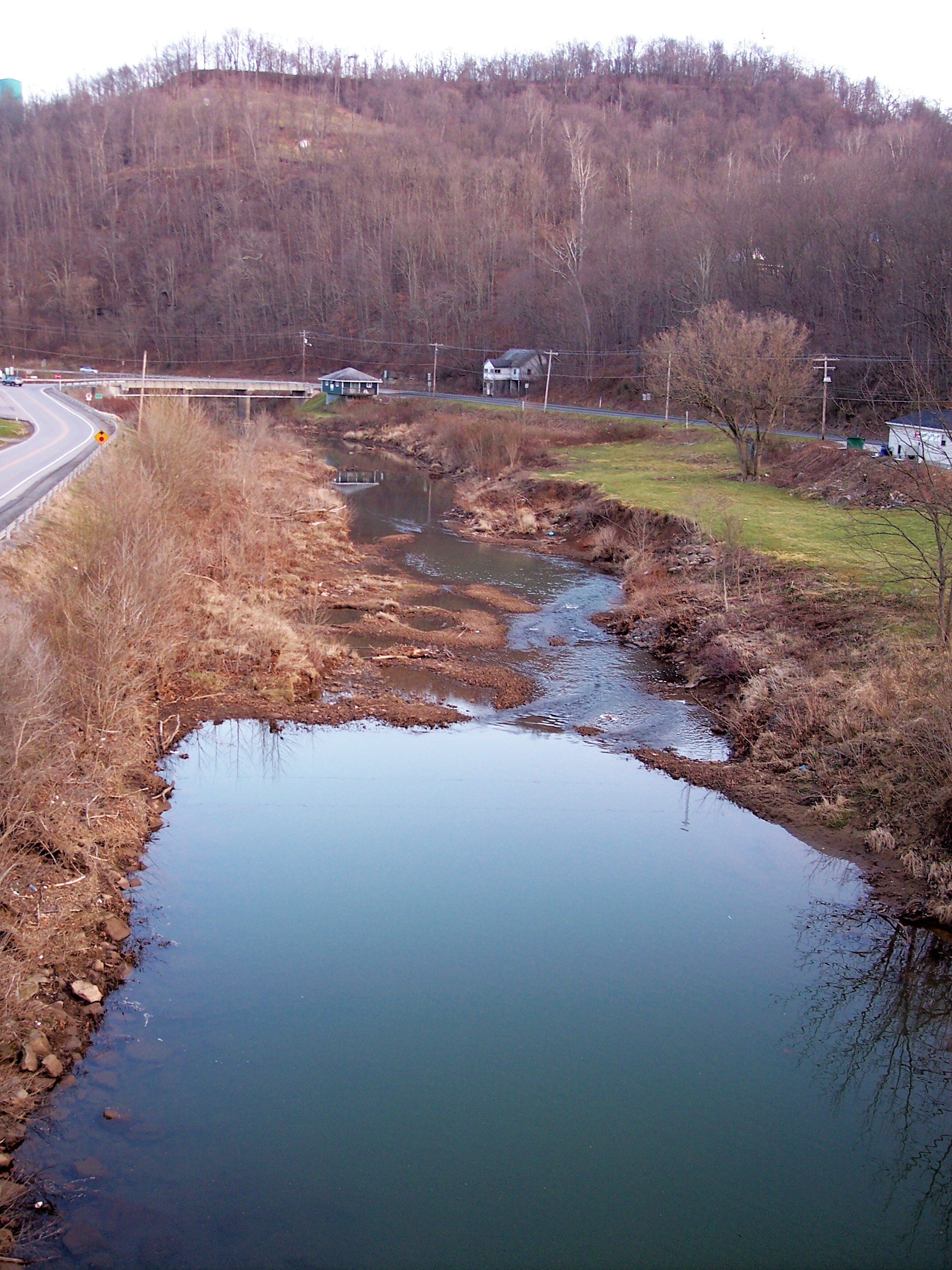
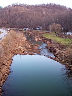 Middle Island Creek as viewed downstream from the North Bend Rail Trail in West Union
Contents
Geography
Course
Middle Island Creek is formed at the community of Smithburg in Doddridge County by the confluence of Meathouse Fork[1] and Buckeye Creek.[6] It flows generally northwestwardly in a highly meandering course through Doddridge and Tyler Counties, past the towns of West Union and Middlebourne. From Middlebourne the creek turns to the southwest and flows roughly parallel to the Ohio River (excepting its numerous bends) as it enters Pleasants County, where it joins the Ohio in St. Marys.[7] The lowermost 12 miles (19 km) of the creek are inundated by backup from the Willow Island Locks and Dam downstream on the Ohio River.[3]
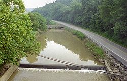
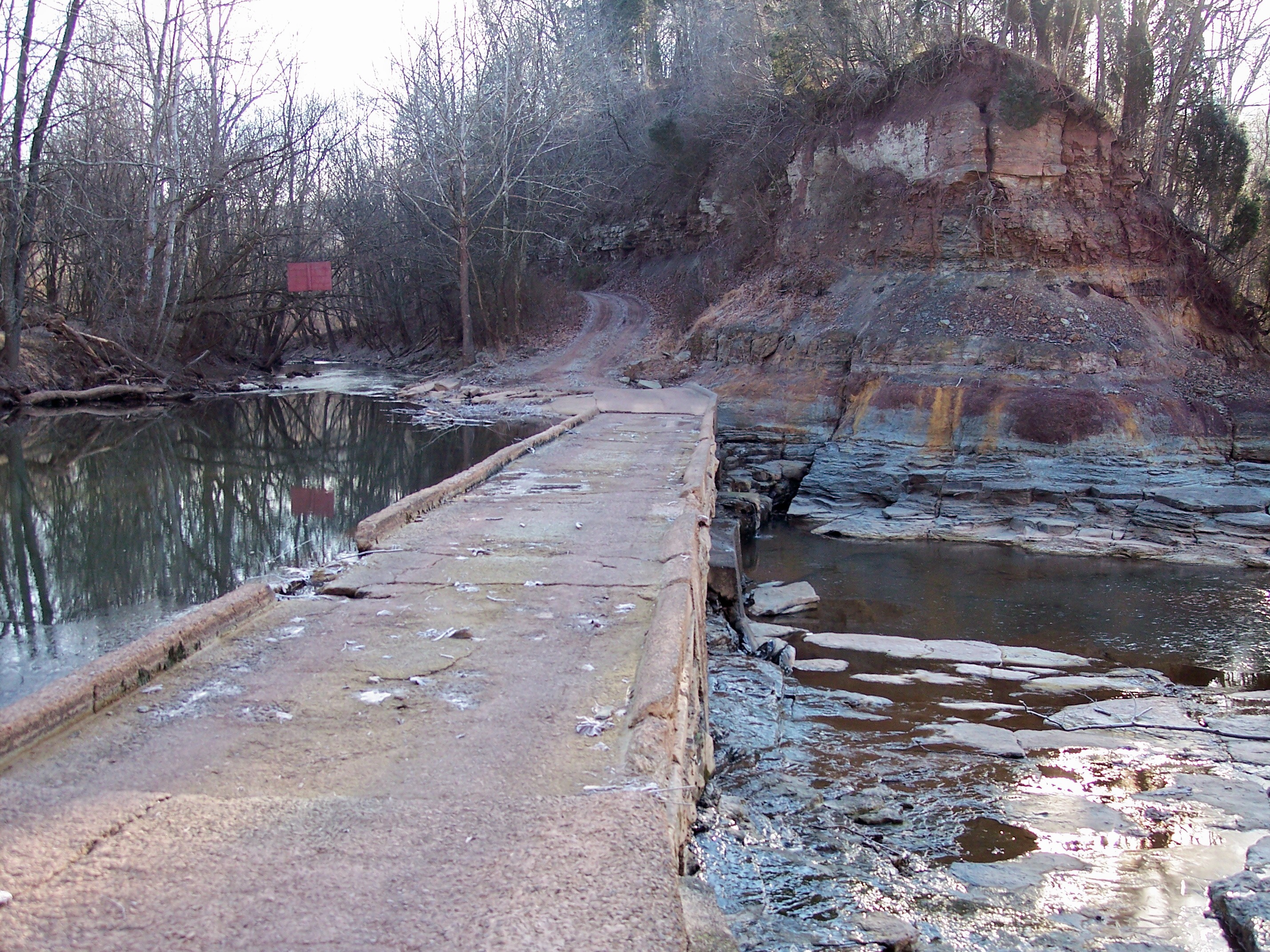
The Jug
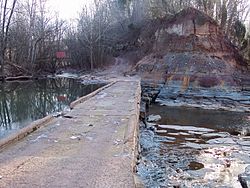 A low water bridge (1947) maintains the partial flow of Middle Island Creek (left) around "the Jug" (the creek emerges from the bend at right, just outside image).
Middle Island Creek's most extreme meander forms a peninsula known as "the Jug," located upstream of Middlebourne. The creek rounds a 7 mile (11 km) bend[3] only to return to within 100 feet (30 m) of itself. Sometime prior to 1800, a settler named George Gregg had a mill race carved across the narrow point of the peninsula and harnessed the resulting hydropower for a gristmill and sawmill. These were destroyed by a flood in 1852, while later mills were subsequently built and also washed away by floods. In 1947 the West Virginia Conservation Commission constructed a low water bridge which substantially dammed the cut-through and restored a steady flow to the bend of the creek.[5] The land encircled by the creek's loop is operated as a Wildlife Management Area by the state of West Virginia.[8]
Variant names
According to sources gathered by the Geographic Names Information System, Middle Island Creek has also been known historically as:[2]
- Be-Van-Soss Creek of the Indians
- Be-van-Soss Creek of the Indians
- Be-van-soss
- Be-yan-soss
- Bulls Creek
- By-En-Soss Creek
- By-en-Soss Creek
- By-en-soss
- Louisa River
Economy
The creek's environs were the site of substantial oil and gas extraction activities in the late 19th century and 20th century. An oil boom began in the region in the 1860s.[9] It peaked in Middlebourne in the 1890s,[10] and an oil refinery operated in St. Marys between 1914 and 1987.[9] Glass- and carbon-manufacturing facilities were built in West Union and Smithburg in the early 20th century, owing to the availability of natural gas.[11]
Fish life
Throughout its course Middle Island Creek is a slow-moving, low-gradient stream. It is considered one of the best streams in the state for muskellunge fishing; for many years in the 20th Century the West Virginia Division of Natural Resources harvested muskie eggs from the creek for use in its fish-stocking programs in streams elsewhere in the state. Other fish commonly found in the creek include spotted bass, smallmouth bass, rock bass, various species of sunfish, freshwater drum, channel catfish, and flathead catfish.[3]
See also
- List of West Virginia rivers
References
- ^ a b "Geographic Names Information System entry for Meathouse Fork". http://geonames.usgs.gov/pls/gnispublic/f?p=gnispq:3:::NO::P3_FID:1543103. Retrieved 2007-01-26.
- ^ a b c d "Geographic Names Information System entry for Middle Island Creek". http://geonames.usgs.gov/pls/gnispublic/f?p=gnispq:3:::NO::P3_FID:1552067. Retrieved 2007-01-26.
- ^ a b c d e Morrison, Scott (March 1997). "Middle Island Creek". Wonderful West Virginia (West Virginia Division of Natural Resources) 61 (1): 14–15.
- ^ West Virginia Department of Environmental Protection. "Watershed Atlas Project.". pp. Middle Ohio River watersheds (cited figures are for the sum of the Upper and Lower Middle Island Creek, Arnold Creek, McElroy Creek, and Point Pleasant Creek watersheds). Archived from the original on 2006-05-07. http://web.archive.org/web/20050404165853/www.dep.state.wv.us/watershed/. Retrieved 2007-02-26.
- ^ a b Ratliff, Gerald S. "Jug of Middle Island Creek." The West Virginia Encyclopedia. Ken Sullivan, editor. Charleston, WV: West Virginia Humanities Council. 2006. ISBN 0-9778498-0-5.
- ^ "Geographic Names Information System entry for Buckeye Creek". http://geonames.usgs.gov/pls/gnispublic/f?p=gnispq:3:::NO::P3_FID:1536586. Retrieved 2007-01-26.
- ^ DeLorme (1997). West Virginia Atlas & Gazetteer. Yarmouth, Maine: DeLorme. ISBN 0-89933-246-3.
- ^ West Virginia Division of Natural Resources. "West Virginia Wildlife Management Areas". Archived from the original on 2006-12-13. http://web.archive.org/web/20061213234742/http://www.wvdnr.gov/Hunting/WMAAreas.shtm. Retrieved 2007-01-26.
- ^ a b Bailey, Matthew Scott. "St. Marys." The West Virginia Encyclopedia. Ken Sullivan, editor. Charleston, WV: West Virginia Humanities Council. 2006. ISBN 0-9778498-0-5.
- ^ Kraina, Jane. "Middlebourne." The West Virginia Encyclopedia. Ken Sullivan, editor. Charleston, WV: West Virginia Humanities Council. 2006. ISBN 0-9778498-0-5.
- ^ Kreiser, Christine M. "Doddridge County." The West Virginia Encyclopedia. Ken Sullivan, editor. Charleston, WV: West Virginia Humanities Council. 2006. ISBN 0-9778498-0-5.
Categories:- Rivers of West Virginia
- Tributaries of the Ohio River
- Geography of Doddridge County, West Virginia
- Geography of Pleasants County, West Virginia
- Geography of Tyler County, West Virginia


Wikimedia Foundation. 2010.