- Jerome Township, Gove County, Kansas
-
Jerome Township — Township — Location in Gove County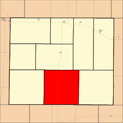
Coordinates: 38°47′09″N 100°29′04″W / 38.78583°N 100.48444°WCoordinates: 38°47′09″N 100°29′04″W / 38.78583°N 100.48444°W Country United States State Kansas County Gove Area – Total 142.96 sq mi (370.28 km2) – Land 142.96 sq mi (370.25 km2) – Water 0.01 sq mi (0.02 km2) 0.01% Elevation 2,585 ft (788 m) Population (2000) – Total 132 – Density 0.9/sq mi (0.4/km2) GNIS feature ID 0471397 Jerome Township is a township in Gove County, Kansas, USA. As of the 2000 census, its population was 132.
Contents
Geography
Jerome Township covers an area of 142.96 square miles (370.3 km2) and contains no incorporated settlements.
The streams of Cheyenne Creek and Plum Creek run through this township.
Transportation
Jerome Township contains three airports or landing strips: Beesley Farms Airport, Lundgren Hereford Ranch Airport and Tustin Airport.
References
External links
Municipalities and communities of Gove County, Kansas Cities 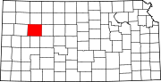
Townships Footnotes ‡This populated place also has portions in an adjacent county or counties
Categories:- Townships in Gove County, Kansas
- Kansas geography stubs


Wikimedia Foundation. 2010.