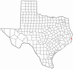
- Deweyville, Texas
-
Deweyville, Texas — CDP — Location of Deweyville, Texas Coordinates: 30°17′47″N 93°44′58″W / 30.29639°N 93.74944°WCoordinates: 30°17′47″N 93°44′58″W / 30.29639°N 93.74944°W Country United States State Texas County Newton Area – Total 11.3 sq mi (29.3 km2) – Land 11.2 sq mi (29.1 km2) – Water 0.1 sq mi (0.2 km2) Elevation 20 ft (6 m) Population (2000) – Total 1,190 – Density 105.9/sq mi (40.9/km2) Time zone Central (CST) (UTC-6) – Summer (DST) CDT (UTC-5) ZIP code 77614 Area code(s) 409 FIPS code 48-20212[1] GNIS feature ID 1334321[2] Deweyville is a census-designated place (CDP) in Newton County, Texas, United States. The population was 1,190 at the 2000 census.
Contents
Geography
Deweyville is located at 30°17′47″N 93°44′58″W / 30.29639°N 93.74944°W (30.296478, -93.749441)[3].
According to the United States Census Bureau, the CDP has a total area of 11.3 square miles (29 km2), of which, 11.2 square miles (29 km2) of it is land and 0.1 square miles (0.26 km2) of it (0.71%) is water.
Historical development
This settlement was established as a sawmill site by the Sabine Tram Company in 1898. It was named after George Dewey, an admiral in the United States Navy who was victorious in the Battle of Manila Bay that same year.[4] Within two years a post office would be established, and for a short time this town would be the largest town in Newton County. Electricity would be established for the residents of Deweyville in the 1920’s. [4]
The original settlement was called "Possum Bluff," and was purchased by Pierre Lavine from Bill Morrison, with a team of oxen in 1886. There is a Texas Historical Marker erected in 1967 on Highway 12 near the Texas / Louisiana border stating this information. The marker was later moved to in front of the Deweyville Public Library.
Demographics
As of the census[1] of 2000, there were 1,190 people, 459 households, and 325 families residing in the CDP. The population density was 105.9 people per square mile (40.9/km²). There were 528 housing units at an average density of 47.0/sq mi (18.1/km²). The racial makeup of the CDP was 98.40% White, 0.42% Native American, 0.17% Asian, 0.17% from other races, and 0.84% from two or more races. Hispanic or Latino of any race were 0.84% of the population.
There were 459 households out of which 32.0% had children under the age of 18 living with them, 59.3% were married couples living together, 7.4% had a female householder with no husband present, and 29.0% were non-families. 24.4% of all households were made up of individuals and 10.2% had someone living alone who was 65 years of age or older. The average household size was 2.59 and the average family size was 3.11.
In the CDP the population was spread out with 26.2% under the age of 18, 8.8% from 18 to 24, 28.7% from 25 to 44, 25.1% from 45 to 64, and 11.1% who were 65 years of age or older. The median age was 35 years. For every 100 females there were 101.0 males. For every 100 females age 18 and over, there were 95.5 males.
The median income for a household in the CDP was $30,714, and the median income for a family was $35,150. Males had a median income of $35,250 versus $15,852 for females. The per capita income for the CDP was $13,136. About 13.5% of families and 17.8% of the population were below the poverty line, including 25.2% of those under age 18 and 7.4% of those age 65 or over.
References
- ^ a b "American FactFinder". United States Census Bureau. http://factfinder.census.gov. Retrieved 2008-01-31.
- ^ "US Board on Geographic Names". United States Geological Survey. 2007-10-25. http://geonames.usgs.gov. Retrieved 2008-01-31.
- ^ "US Gazetteer files: 2010, 2000, and 1990". United States Census Bureau. 2011-02-12. http://www.census.gov/geo/www/gazetteer/gazette.html. Retrieved 2011-04-23.
- ^ a b TSHA Online - Texas State Historical Association
External links
Municipalities and communities of Newton County, Texas City CDPs Deweyville | South Toledo Bend
Unincorporated
communitiesGhost towns Belgrade | Princeton | Shankleville
Categories:- Populated places in Newton County, Texas
- Census-designated places in Texas
- Logging communities
Wikimedia Foundation. 2010.


