- Tehuacana, Texas
Infobox Settlement
official_name = Tehuacana, Texas
settlement_type =Town
nickname =
motto =
imagesize =
image_caption =
image_
mapsize = 250px
map_caption = Location of Tehuacana, Texas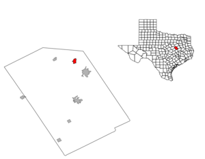
mapsize1 = 250px
map_caption1 =subdivision_type = Country
subdivision_name =United States
subdivision_type1 = State
subdivision_name1 =Texas
subdivision_type2 = County
subdivision_name2 = Limestonegovernment_footnotes =
government_type =
leader_title =
leader_name =
leader_title1 =
leader_name1 =
established_title =
established_date =unit_pref = Imperial
area_footnotes =area_magnitude =
area_total_km2 = 4.2
area_land_km2 = 4.2
area_water_km2 = 0.0
area_total_sq_mi = 1.6
area_land_sq_mi = 1.6
area_water_sq_mi = 0.0population_as_of = 2000
population_footnotes =
population_total = 307
population_density_km2 = 73.5
population_density_sq_mi = 190.3timezone = Central (CST)
utc_offset = -6
timezone_DST = CDT
utc_offset_DST = -5
elevation_footnotes =
elevation_m = 195
elevation_ft = 640
latd = 31 |latm = 44 |lats = 32 |latNS = N
longd = 96 |longm = 32 |longs = 44 |longEW = Wpostal_code_type =
ZIP code
postal_code = 76686
area_code = 254
blank_name = FIPS code
blank_info = 48-72080GR|2
blank1_name = GNIS feature ID
blank1_info = 1376406GR|3
website =
footnotes =Tehuacana is a town in Limestone County,
Texas ,United States . The population was 307 at the 2000 census. From 1869 until 1902, the town was home to Trinity University.Geography
Tehuacana is located at coor dms|31|44|32|N|96|32|44|W|city (31.742338, -96.545560)GR|1.
According to the
United States Census Bureau , the town has a total area of 1.6square mile s (4.2km² ), all of it land.Demographics
As of the
census GR|2 of 2000, there were 307 people, 132 households, and 86 families residing in the town. Thepopulation density was 190.3 people per square mile (73.6/km²). There were 147 housing units at an average density of 91.1/sq mi (35.3/km²). The racial makeup of the town was 89.25% White, 7.49% African American, 2.93% from other races, and 0.33% from two or more races. Hispanic or Latino of any race were 2.93% of the population.There were 132 households out of which 30.3% had children under the age of 18 living with them, 54.5% were married couples living together, 8.3% had a female householder with no husband present, and 34.1% were non-families. 33.3% of all households were made up of individuals and 18.2% had someone living alone who was 65 years of age or older. The average household size was 2.33 and the average family size was 2.89.
In the town the population was spread out with 23.5% under the age of 18, 10.7% from 18 to 24, 23.5% from 25 to 44, 27.0% from 45 to 64, and 15.3% who were 65 years of age or older. The median age was 42 years. For every 100 females there were 100.7 males. For every 100 females age 18 and over, there were 92.6 males.
The median income for a household in the town was $35,469, and the median income for a family was $51,250. Males had a median income of $31,250 versus $21,786 for females. The
per capita income for the town was $18,965. About 8.5% of families and 10.6% of the population were below thepoverty line , including 9.1% of those under the age of eighteen and none of those sixty five or over.Education
The Town of Tehuacana is served by the
Mexia Independent School District .References
External links

Wikimedia Foundation. 2010.