Shire of Stawell

Shire of Stawell

Infobox Australian Place | type = lga
name = Shire of Stawell
state = vic
region =
area = 2606
est = 1861
seat = Stawell
pop = 2620 (1992) [cite book|title=Victorian Year Book|author=Australian Bureau of Statistics, Victoria Office|year=1994|page=49-52|id=ISSN 0067-1223]

logosize =


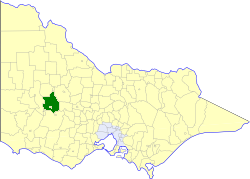
caption = Location in Victoria
county = Borung, Kara Kara
near-nw = Dunmunkle
near-n = Dunmunkle
near-ne = Kara Kara
near-w = Wimmera
near-e = Kara Kara
near-sw = Dundas
near-s = Ararat
near-se = Avoca
_noautocat = yes

The Shire of Stawell was a Local Government Area located about convert|230|km|mi|0 west-northwest of Melbourne, the state capital of Victoria, Australia. The shire covered an area of convert|2606|km2|sqmi|1, and existed from 1861 until 1994.

History

Stawell was first incorporated as a district on 29 January 1861, and became a shire on 30 December 1864. On 26 October 1926, it annexed part of the North Riding of the Shire of Ararat.cite book|title=Victorian Municipal Directory|year=1992|publisher=Arnall & Jackson|location=Brunswick|pages=840-841 Accessed at State Library of Victoria, La Trobe Reading Room.]

On 20 January 1995, the Shire was abolished, and merged with Town of St Arnaud, City of Stawell, most of the Shire of Kara Kara, the Grampians National Park within the Shire of Wimmera and parts of the Shires of Ararat, Avoca, Donald and Dunmunkle into the Shire of Northern Grampians. The Armstrong district passed into the Rural City of Ararat. [cite book|url=http://www.ausstats.abs.gov.au/ausstats/free.nsf/0/76E601D6DB55E88ACA25722500049195/$File/12570_1994-95.pdf|title=Victorian local government amalgamations 1994-1995: Changes to the Australian Standard Geographical Classification|author=Australian Bureau of Statistics|date=1 August 1995|publisher=Commonwealth of Australia|page=4,10|isbn=0-642-23117-6|accessdate=2008-01-05]

Wards

Stawell was divided into four ridings, each of which elected three councillors:
* Glenorchy Riding
* Great Western Riding
* Grampians Riding
* Marnoo Riding

Towns and Localities

* Armstrong
* Bellfield
* Callawadda
* Campbells Bridge
* Deep Lead
* Concongella
* Glenorchy
* Great Western
* Greens Creek
* Halls Gap
* Illawarra
* Kanya
* Lake Fyans
* Landsborough
* Ledcourt
* Marnoo
* Wallaloo

Population

* Estimate in the 1958 Victorian Year Book. # 1981 census says 2,306 for 1976.

References


Wikimedia Foundation. 2010.

Игры ⚽ Поможем сделать НИР

Look at other dictionaries:

  • Shire of Northern Grampians — Victoria Location in Victoria …   Wikipedia

  • Shire of Ararat — Infobox Australian Place | type = lga name = Shire of Ararat state = vic region = area = 3657.06 est = 1861 seat = Ararat pop = 4490 (1992) [cite book|title=Victorian Year Book|author=Australian Bureau of Statistics, Victoria… …   Wikipedia

  • Shire of Kara Kara — Infobox Australian Place | type = lga name = Shire of Kara Kara state = vic region = area = 2292.79 est = 1861 seat = St Arnaud pop = 1160 (1992) [cite book|title=Victorian Year Book|author=Australian Bureau of Statistics, Victoria… …   Wikipedia

  • Shire of Northern Grampians — Northern Grampians Shire Lage des Northern Grampians Shire in Victoria Basisdaten Bundesstaat: Victoria Hauptort: Stawell Fläch …   Deutsch Wikipedia

  • Stawell, Victoria — Infobox Australian Place | type = town name = Stawell state = vic caption = Location of Stawell in Victoria (red) lga = Shire of Northern Grampians postcode = 3380 est = 1853 pop = 6,035 (2006) Census 2006 AUS | id = SSC26669 | name = Stawell… …   Wikipedia

  • Shire of Dunmunkle — Infobox Australian Place | type = lga name = Shire of Dunmunkle state = vic region = area = 1550 est = 1877 seat = Rupanyup pop = 2850 (1992) [cite book|title=Victorian Year Book|author=Australian Bureau of Statistics, Victoria… …   Wikipedia

  • Stawell Airport — Infobox Airport name = Stawell Airport nativename = nativename a = nativename r = image width = caption = IATA = SWC ICAO = YSWL type = Public owner = operator = Northern Grampians Shire Council city served = location = Stawell, Victoria… …   Wikipedia

  • Stawell — /stɔl/ (say stawl) noun a town and shire in the Wimmera region of Victoria, north west of Ararat. {named after Sir William Foster Stawell} Stawell lies in territory traditionally inhabited by the Djabwurung people. Surveyor and explorer Thomas… …  

  • Shire of Avoca — Infobox Australian Place | type = lga name = Shire of Avoca state = vic region = area = 1124 est = 1861 seat = Avoca pop = 2320 (1992) [cite book|title=Victorian Year Book|author=Australian Bureau of Statistics, Victoria Office|year=1994|page=49… …   Wikipedia

  • Shire of Wimmera — Infobox Australian Place | type = lga name = Shire of Wimmera state = vic region = Wimmera area = 2611 est = 1862 seat = Horsham pop = 2,920 (1992) [cite book|title=Victorian Year Book|author=Australian Bureau of Statistics, Victoria… …   Wikipedia

Share the article and excerpts

Direct link
Do a right-click on the link above
and select “Copy Link”