- Shire of Ararat
Infobox Australian Place | type = lga
name = Shire of Ararat
state = vic
region =
area = 3657.06
est = 1861
seat = Ararat
pop = 4490 (1992) [cite book|title=Victorian Year Book|author=Australian Bureau of Statistics, Victoria Office|year=1994|page=49-52|id=ISSN 0067-1223]
logosize =
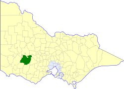
caption = Location in Victoria
county = Ripon, Borung
near-nw = Stawell
near-n = Stawell
near-ne = Avoca Lexton
near-w = Dundas
near-e = Ripon
near-sw = Mount Rouse
near-s = Mortlake
near-se = Hampden
_noautocat = yesThe Shire of Ararat was a Local Government Area located about convert|200|km|mi|0 west-northwest of
Melbourne , the state capital of Victoria,Australia . The shire covered an area of convert|3657.06|km2|sqmi|1, and existed from 1861 until 1994. It did not cover the town of Ararat, which was managed by a separate local government authority.History
Ararat was first incorporated as a district on 27 August 1861, and became a shire on 8 March 1864. Part of its north riding was annexed to the
Shire of Stawell on 26 October 1926, while other portions were annexed to theCity of Ararat on 1 October 1941 and 27 May 1960.cite book|title=Victorian Municipal Directory|year=1992|publisher=Arnall & Jackson|location=Brunswick|pages=567-568 Accessed atState Library of Victoria , La Trobe Reading Room.]On 23 September 1994, the Shire was abolished, and merged with
City of Ararat and part of theShire of Stawell into theRural City of Ararat . [cite book|url=http://www.ausstats.abs.gov.au/ausstats/free.nsf/0/76E601D6DB55E88ACA25722500049195/$File/12570_1994-95.pdf|title=Victorian local government amalgamations 1994-1995: Changes to the Australian Standard Geographical Classification|author=Australian Bureau of Statistics |date=1 August 1995|publisher=Commonwealth of Australia|page=4|isbn=0-642-23117-6|accessdate=2008-01-05]Wards
Ararat was divided into four ridings, each of which elected three councillors:
* North Riding
* South Riding
* East Riding
* West RidingTowns and Localities
* Buangor
* Elmhurst
* Lake Bolac
* Mafeking
* Maroona
* Mininera
* Moyston
* Norval
* Pomonal
* Rossbridge
* Streatham
* Tatyoon
* Warrak
* Westmere
* Wickliffe
* Willaura
* Yalla-y-PooraPopulation
* Estimate in the 1958 Victorian Year Book.
References
Wikimedia Foundation. 2010.