- Dimock, South Dakota
-
Dimock, South Dakota — Town — Location in Hutchinson County and the state of South Dakota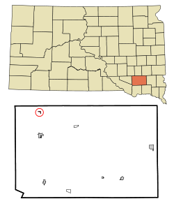
Coordinates: 43°28′34″N 97°59′13″W / 43.47611°N 97.98694°WCoordinates: 43°28′34″N 97°59′13″W / 43.47611°N 97.98694°W Country United States State South Dakota County Hutchinson Area – Total 0.1 sq mi (0.4 km2) – Land 0.1 sq mi (0.4 km2) – Water 0 sq mi (0 km2) Elevation 1,375 ft (419 m) Population (2010) – Total 125 – Density 1,250/sq mi (312.5/km2) Time zone Central (CST) (UTC-6) – Summer (DST) CDT (UTC-5) ZIP code 57331 Area code(s) 605 FIPS code 46-16620[1] GNIS feature ID 1254690[2] Dimock is a town in Hutchinson County, South Dakota, United States. The population was 125 at the 2010 census.
Geography
Dimock is located at 43°28′34″N 97°59′13″W / 43.47611°N 97.98694°W (43.475992, -97.987055).[3]
According to the United States Census Bureau, the town has a total area of 0.2 square miles (0.52 km2), all land.
Dimock has been assigned the ZIP code 57331 and the FIPS place code 16620.
Demographics
As of the census[1] of 2000, there were 151 people, 62 households, and 46 families residing in the town. The population density was 1,014.0 people per square mile (388.7/km²). There were 63 housing units at an average density of 423.1 per square mile (162.2/km²). The racial makeup of the town was 100.00% White.
There were 62 households out of which 25.8% had children under the age of 18 living with them, 71.0% were married couples living together, 1.6% had a female householder with no husband present, and 24.2% were non-families. 24.2% of all households were made up of individuals and 19.4% had someone living alone who was 65 years of age or older. The average household size was 2.44 and the average family size was 2.87.
In the town the population was spread out with 23.8% under the age of 18, 6.6% from 18 to 24, 21.9% from 25 to 44, 21.9% from 45 to 64, and 25.8% who were 65 years of age or older. The median age was 44 years. For every 100 females there were 91.1 males. For every 100 females age 18 and over, there were 98.3 males.
The median income for a household in the town was $42,188, and the median income for a family was $43,125. Males had a median income of $26,875 versus $16,667 for females. The per capita income for the town was $18,458. About 4.0% of families and 2.7% of the population were below the poverty line, including none of those under the age of 18 and 9.5% of those 65 and older.
References
- ^ a b "American FactFinder". United States Census Bureau. http://factfinder.census.gov. Retrieved 2008-01-31.
- ^ "US Board on Geographic Names". United States Geological Survey. 2007-10-25. http://geonames.usgs.gov. Retrieved 2008-01-31.
- ^ "US Gazetteer files: 2010, 2000, and 1990". United States Census Bureau. 2011-02-12. http://www.census.gov/geo/www/gazetteer/gazette.html. Retrieved 2011-04-23.
Municipalities and communities of Hutchinson County, South Dakota Cities 
Towns CDPs Categories:- Populated places in Hutchinson County, South Dakota
- Towns in South Dakota


Wikimedia Foundation. 2010.