- South Wingfield
-
Coordinates: 53°05′44″N 1°26′24″W / 53.0956°N 1.440°W
South Wingfield 
South Wingfield church during the 2007 floods
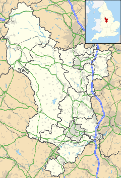
 South Wingfield shown within Derbyshire
OS grid reference SK375555 District Amber Valley Shire county Derbyshire Region East Midlands Country England Sovereign state United Kingdom Post town ALFRETON Postcode district DE55 Police Derbyshire Fire Derbyshire Ambulance East Midlands EU Parliament East Midlands List of places: UK • England • Derbyshire South Wingfield is a village in the Scarsdale Hundred of Derbyshire, England, and is now part of the district council area of Amber Valley.
The Domesday Book: South Wingfield is listed amongst the small proportion of manors that are owned by Roger de Poitou. In 1086, the book notes that "In South? Wingfield Alnoth had two carucates of land to the geld. There is land for three ploughs. Robert holds it of Count Alan under William Peverel and has 1 plough. There is a priest and 8 villans and 2 bordars and 3 ploughs. There is 4 acres (16,000 m2) of meadow. It was and is worth 20 shillings.[1]
— Note: Above the reference for Wingfield there is a note which says "Roger de Poitou had these lands now they are in the King's hand. An ex-mining village, it has a mixed community. Its most famous landmark is Wingfield Manor, a ruined manor house built around 1450. It is situated about 2 miles (3.2 km) from Crich, and 6 miles (9.7 km) from Matlock. It sits astride one 'B' class road, the B5035, and the River Amber runs through the lower parts of the parish. The centre of the village is at the Market Place, where Manor Road, Church Lane, Inns Lane and the High Road meet. The village shop sits on the Market Place, as does the Horse and Jockey Public House (now closed). The Market Place has been recently renovated by the local authority with a flower bed and paved area, this is known locally by some residents as Jackson's folly after the parish council member who instigated its building.
Other notable places in the village are the parish church of All Saints dating from the 13th Century, the Methodist Chapel, a Baptish Chapel and a Gospel Hall. The three currently active pubs are the Blue Bell on Church Lane the Old Yew Tree on Manor Road and South Wingfield Social Club on High Road. The village school was built in 1875 and is still thriving. The post office was on Inns Lane, but has recently closed. The Parish of South Wingfield extends to cover the wider area covering the village of Oakerthorpe and the hamlets of Moorwood Moor, Wingfield Park and Uftonfields.
Some feel that the origin of the name of the village is derived from Sweinfeld (or similar spelling) from the ancient English for Swine Field. Alternatively, the name may derive from 'Wynn' field, a field of heather, ie a moor.
Entertainment
South Wingfield Social Club on High Road hosts regular Friday night live music events. Local live bands including Armarda perform at the venue.
References
- ^ Domesday Book: A Complete Translation. London: Penguin, 2003. ISBN 0-14-143994-7 p.744
See also
Categories:- Villages in Derbyshire
- Towns and villages of the Peak District
- Derbyshire geography stubs
Wikimedia Foundation. 2010.

