- Cokesbury, South Carolina
-
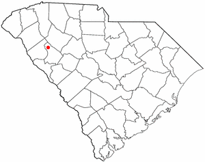
Cokesbury, South Carolina — CDP — Location of Cokesbury, South Carolina
Coordinates: 34°17′17″N 82°12′28″W / 34.28806°N 82.20778°WCoordinates: 34°17′17″N 82°12′28″W / 34.28806°N 82.20778°W Country United States State South Carolina County Greenwood Area - Total 0.6 sq mi (1.6 km2) - Land 0.6 sq mi (1.6 km2) - Water 0.0 sq mi (0.0 km2) Elevation 633 ft (193 m) Population (2000) - Total 279 - Density 444.1/sq mi (171.5/km2) Time zone Eastern (EST) (UTC-5) - Summer (DST) EDT (UTC-4) FIPS code 45-15625[1] GNIS feature ID 1247334[2] Cokesbury is a census-designated place (CDP) in Greenwood County, South Carolina, United States. The population was 279 at the 2000 census.
Contents
Geography
Cokesbury is located at 34°17′17″N 82°12′28″W / 34.28806°N 82.20778°W (34.287984, -82.207892)[3].
According to the United States Census Bureau, the CDP has a total area of 0.6 square miles (1.6 km2), all of it land.
Demographics
As of the census[1] of 2000, there were 279 people, 105 households, and 78 families residing in the CDP. The population density was 444.1 people per square mile (171.0/km²). There were 111 housing units at an average density of 176.7/sq mi (68.0/km²). The racial makeup of the CDP was 25.09% White, 72.76% African American, 1.08% Native American, and 1.08% from two or more races.
There were 105 households out of which 33.3% had children under the age of 18 living with them, 52.4% were married couples living together, 17.1% had a female householder with no husband present, and 25.7% were non-families. 25.7% of all households were made up of individuals and 7.6% had someone living alone who was 65 years of age or older. The average household size was 2.66 and the average family size was 3.14.
In the CDP the population was spread out with 26.2% under the age of 18, 6.5% from 18 to 24, 27.2% from 25 to 44, 29.0% from 45 to 64, and 11.1% who were 65 years of age or older. The median age was 40 years. For every 100 females there were 80.0 males. For every 100 females age 18 and over, there were 89.0 males.
The median income for a household in the CDP was $31,908, and the median income for a family was $31,447. Males had a median income of $16,927 versus $30,625 for females. The per capita income for the CDP was $13,592. About 7.4% of families and 13.5% of the population were below the poverty line, including none of those under the age of eighteen and 51.7% of those sixty five or over.
Historic district
The historic village of Cokesbury and the building that housed the Masonic Female College and Cokesbury Conference School are listed together on the National Register of Historic Places as an historic district.[4][5]
References
- ^ a b "American FactFinder". United States Census Bureau. http://factfinder.census.gov. Retrieved 2008-01-31.
- ^ "US Board on Geographic Names". United States Geological Survey. 2007-10-25. http://geonames.usgs.gov. Retrieved 2008-01-31.
- ^ "US Gazetteer files: 2010, 2000, and 1990". United States Census Bureau. 2011-02-12. http://www.census.gov/geo/www/gazetteer/gazette.html. Retrieved 2011-04-23.
- ^ Old Cokesbury and Masonic Female College and Conference School, Greenwood County, South Carolina Department of Archives and History, accessed September 9, 2010
- ^ Old Cokesbury, and Masonic Female College and Conference School
Municipalities and communities of Greenwood County, South Carolina County seat: Greenwood City 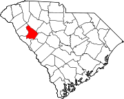
Towns Hodges | Ninety Six | Troy | Ware Shoals‡
CDPs Bradley | Cokesbury | Coronaca | Promised Land
Unincorporated
communityFootnotes ‡This populated place also has portions in an adjacent county or counties
Categories:- Greenwood County, South Carolina
- Census-designated places in South Carolina
- Populated places in South Carolina with African American majority populations

Wikimedia Foundation. 2010.