- 10 East 40th Street
-
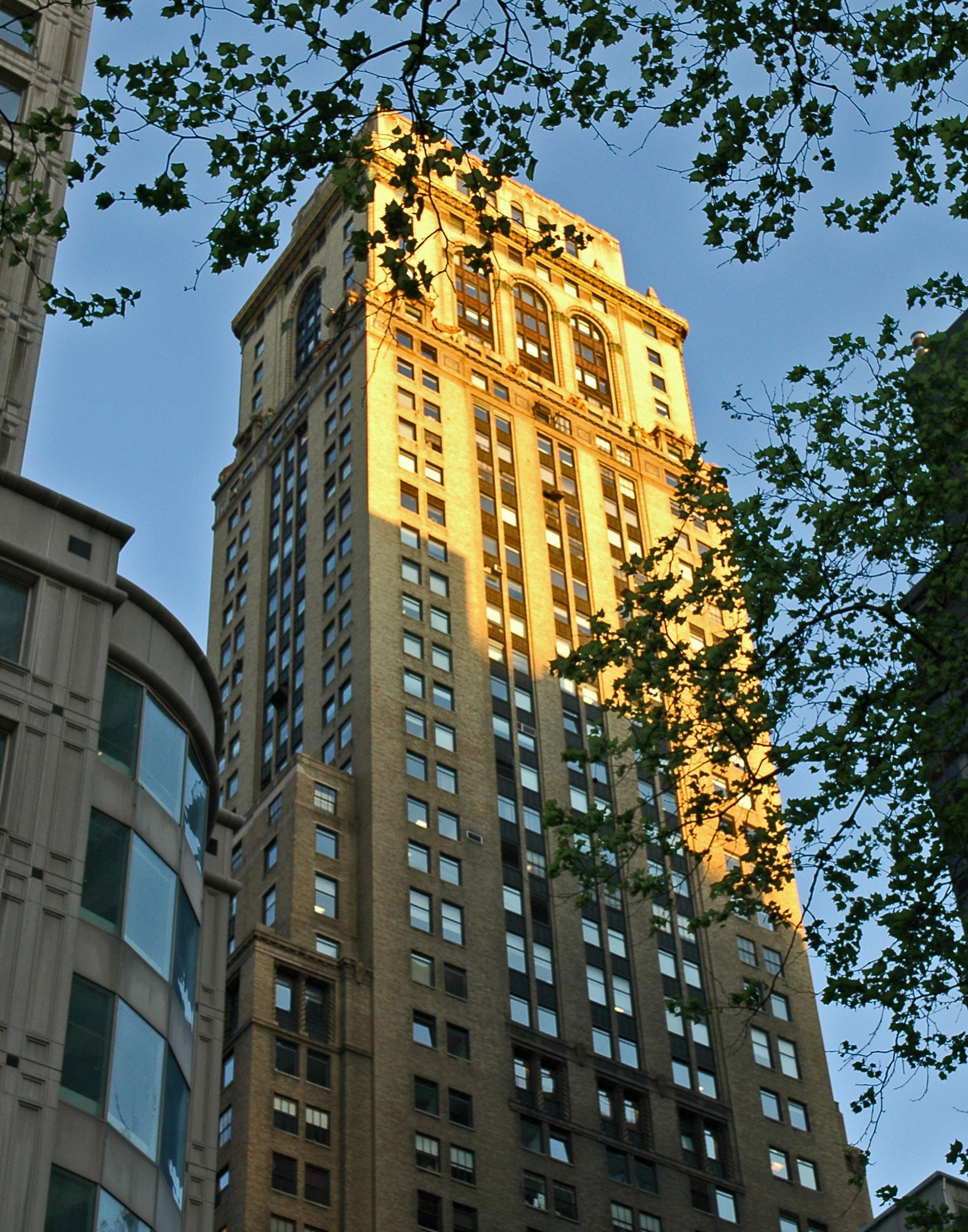
 10 East 40th Street from the main branch of the New York Public Library
10 East 40th Street or the Mercantile Building is a skyscraper located in the Murray Hill section of New York City, between Fifth Avenue and Madison Avenue, taking the width of the block between 39th and 40th streets. Designed by Ludlow & Peabody and built by Jesse H. Jones, it was finished in 1929 and is considered part of the art deco school of architecture[citation needed]. When it was built, it was the fourth-tallest tower in the world[1].
It was previously known as the Chase Tower, after its first tenant, Chase Brass & Copper. Its owner until his death in 1938 was Frederick William Vanderbilt. On November 14, 2007, the building became the final site to be removed from Thomas Edison's original direct current grid in New York City.[2]
Today, some refer to the building as "the Napa Building", a reference to its long-time tenant Napa Group, Inc., the world's leading provider of software for the short-term adjustable rate marketplace.[citation needed]
It is 620 feet (189 m) high, with 48 floors, and contains 350,000 square feet (33,000 m²) of office or mixed-use space.[3] In September 2002, the building's lobby was renovated, restoring the 15-foot (4.6 m) ceilings.
It houses the Moroccan consulate.
See also
References
- ^ "World's tallest buildings in 1930". http://www.ctbuh.org/Portals/0/Tallest/CTBUH_Tallest_1930.pdf.
- ^ Lee, Jennifer 8. (2007-11-14). "Off Goes the Power Current Started by Thomas Edison". New York Times. http://cityroom.blogs.nytimes.com/2007/11/14/off-goes-the-power-current-started-by-thomas-edison/. Retrieved 2009-09-04.
- ^ "Mercantile Building". Emporis.com. http://www.emporis.com/en/wm/bu/?id=mercantilebuilding-newyorkcity-ny-usa. Retrieved 2008-07-12.
External links
Coordinates: 40°45′06″N 73°58′53″W / 40.751592°N 73.981323°W
Categories:- Buildings and structures completed in 1929
- Murray Hill (Manhattan)
- Skyscrapers in New York City
- Skyscrapers between 150 and 199 meters
- Art Deco buildings in New York City
Wikimedia Foundation. 2010.