- Mountville, Pennsylvania
-
Borough of Mountville Settlement Country United States State Pennsylvania County Lancaster Elevation 443 ft (135 m) Coordinates 40°02′23″N 76°25′57″W / 40.03972°N 76.4325°W Area 0.9 sq mi (2.3 km2) - land 0.9 sq mi (2 km2) - water 0.0 sq mi (0 km2), 0% Population 2,444 (2000) Density 2,856.8 / sq mi (1,103 / km2) Timezone EST (UTC-5) - summer (DST) EDT (UTC-4) ZIP Code 17554 Area code 717 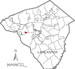 Location of Mountville in Lancaster County
 Location of Mountville in Pennsylvania
 Location of Pennsylvania in the United States
Mountville is a borough in Lancaster County, Pennsylvania, United States. The population was 2,444 at the 2000 census.
Contents
Geography
Mountville is located at 40°2′23″N 76°25′57″W / 40.03972°N 76.4325°W (40.039797, -76.432433)[1].
According to the United States Census Bureau, the borough has a total area of 0.9 square miles (2.2 km²), all of it land.
Demographics
As of the census[2] of 2000, there were 2,444 people, 1,018 households, and 692 families residing in the borough. The population density was 2,856.8 people per square mile (1,097.2/km²). There were 1,041 housing units at an average density of 1,216.8 per square mile (467.4/km²). The racial makeup of the borough was 95.21% White, 1.31% African American, 0.04% Native American, 0.98% Asian, 1.31% from other races, and 1.15% from two or more races. Hispanic or Latino of any race were 2.74% of the population.
There were 1,018 households out of which 28.9% had children under the age of 18 living with them, 52.1% were married couples living together, 12.4% had a female householder with no husband present, and 32.0% were non-families. 26.6% of all households were made up of individuals and 7.5% had someone living alone who was 65 years of age or older. The average household size was 2.31 and the average family size was 2.76.
In the borough the population was spread out with 20.9% under the age of 18, 8.4% from 18 to 24, 29.5% from 25 to 44, 25.5% from 45 to 64, and 15.7% who were 65 years of age or older. The median age was 40 years. For every 100 females there were 91.1 males. For every 100 females age 18 and over, there were 87.5 males.
The median income for a household in the borough was $45,366, and the median income for a family was $51,031. Males had a median income of $36,791 versus $23,910 for females. The per capita income for the borough was $22,010. About 4.6% of families and 7.2% of the population were below the poverty line, including 12.8% of those under age 18 and 2.0% of those age 65 or over.
The original Charles Chips potato chip factory was located here.
Services
Mountville is served by the West Hempfield Township Police, has one volunteer fire department, and is in the Hempfield School District
References
- ^ "US Gazetteer files: 2010, 2000, and 1990". United States Census Bureau. 2011-02-12. http://www.census.gov/geo/www/gazetteer/gazette.html. Retrieved 2011-04-23.
- ^ "American FactFinder". United States Census Bureau. http://factfinder.census.gov. Retrieved 2008-01-31.
Categories:- Populated places established in 1814
- Boroughs in Lancaster County, Pennsylvania


Wikimedia Foundation. 2010.