- Reamstown, Pennsylvania
Infobox Settlement
official_name = Reamstown, Pennsylvania
nickname =
motto = |thumb|North Reamstown Road at Church Street]
imagesize =
image_caption =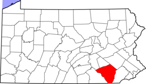
mapsize =
map_caption = Lancaster County's location inPennsylvania  |right|250px
mapsize1 =
map_caption1 = Reamstown's location in Lancaster County|subdivision_type = Country
subdivision_type1 = State
subdivision_type2 = County
subdivision_name = USA
subdivision_name1 =Pennsylvania
subdivision_name2 = Lancaster
leader_title =
leader_name =
established_title =
established_date =
area_magnitude =
area_total_sq_mi = 2.3
area_total_km2 = 5.888
area_land_sq_mi = 2.3
area_land_km2 = 5.888
area_water_sq_mi = 0
area_water_km2 = 0
area_urban_sq_mi =
area_urban_km2 =
area_metro_sq_mi =
area_metro_km2 =
population_as_of = 2000
population_note =
population_total = 3,498
population_metro =
population_urban =
population_density_km2 = 594.09
population_density_sq_mi = 1520.87
timezone = EST
utc_offset = -5
timezone_DST = EDT
utc_offset_DST = -4
latd=40 |latm=12 |lats=43 |latNS=N
longd=76 |longm=7 |longs=3 |longEW=W
elevation_m =
elevation_ft = 392
postal_code_type =ZIP Code
postal_code = 17567
area_code = 610
website = http://www.reamstown-pa.com
footnotes =Reamstown is a
census-designated place (CDP) in Lancaster County,Pennsylvania ,United States . The population was 3,498 at the 2000 census.Geography
Reamstown is located at coor dms|40|12|43|N|76|7|3|W|city (40.212046, -76.117587)GR|1. The town was named after Eberhard Ream (Johann Eberhardt Riehm 1687–1779), whose son, Tobias Ream, founded it in the 1740s. It was originally known as "Zoar" according to a local highway marker.
According to the
United States Census Bureau , the CDP has a total area of 50square mile s (5.9km² ), all of it land.History
Following the Battle of Brandywine on September 11 1777 Reamstown served as one of a number of field hospitals for the wounded. A dozen or more of these troops died here and are buried in unmarked graves in the Salem Evangelical Cemetery. The cemetery is also home to a large boulder that once served as a mortar and pestle for the Indians who lived on nearby Ephrata Mountain. It was transported to Reamstown by Pierce Lesher and today a plaque on the stone details both the Native American and military history.
Demographics
As of the
census GR|2 of 2000, there were 3,498 people, 1,161 households, and 897 families residing in the CDP. Thepopulation density was 1,542.0 people per square mile (595.0/km²). There were 1,194 housing units at an average density of 526.3/sq mi (203.1/km²). The racial makeup of the CDP was 95.23% White, 0.31% African American, 0.26% Native American, 2.23% Asian, 0.03% Pacific Islander, 0.80% from other races, and 1.14% from two or more races. Hispanic or Latino of any race were 1.92% of the population.There were 1,161 households out of which 41.6% had children under the age of 18 living with them, 67.9% were married couples living together, 6.1% had a female householder with no husband present, and 22.7% were non-families. 18.1% of all households were made up of individuals and 6.5% had someone living alone who was 65 years of age or older. The average household size was 2.85 and the average family size was 3.25.
In the CDP the population was spread out with 28.6% under the age of 18, 6.0% from 18 to 24, 33.3% from 25 to 44, 19.8% from 45 to 64, and 12.3% who were 65 years of age or older. The median age was 36 years. For every 100 females there were 99.7 males. For every 100 females age 18 and over, there were 97.6 males.
The median income for a household in the CDP was $53,423, and the median income for a family was $58,625. Males had a median income of $40,516 versus $25,625 for females. The
per capita income for the CDP was $21,143. About 3.3% of families and 5.5% of the population were below thepoverty line , including 9.1% of those under age 18 and 4.8% of those age 65 or over.Notable native
*
George S. Howard - Commander and conductor of theUnited States Air Force band.References
External links

Wikimedia Foundation. 2010.