- Warwick Township, Lancaster County, Pennsylvania
Infobox Settlement
official_name = Warwick Township,
Lancaster County, Pennsylvania
other_name =
native_name =
nickname =
settlement_type = Township
motto =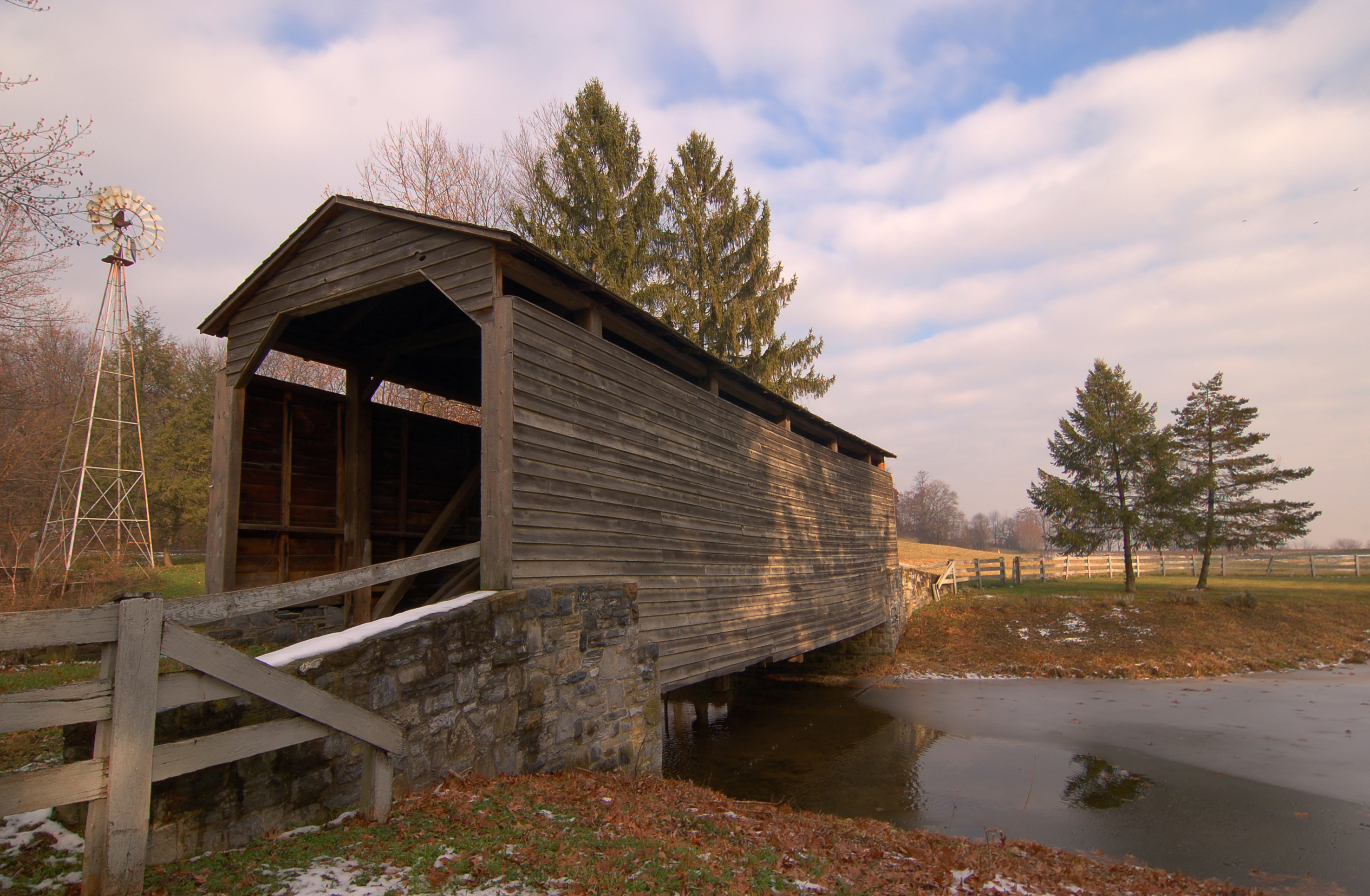
imagesize =
image_caption =Buck Hill Farm Covered Bridge in Warwick Township
flag_size =
image_
seal_size =
image_shield =
shield_size =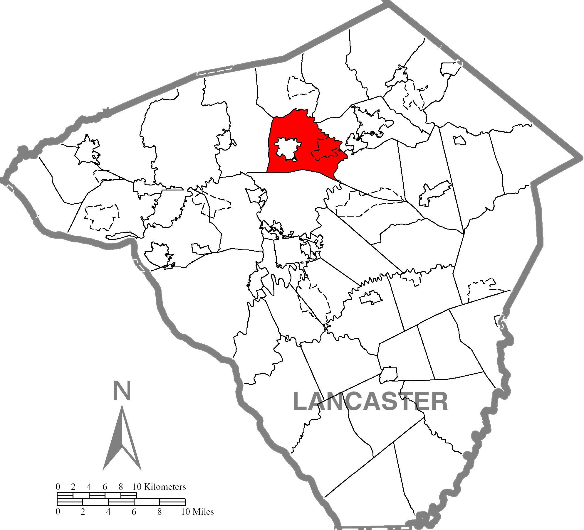
mapsize =
map_caption = Map of Lancaster County highlighting Warwick Township
mapsize1 =
map_caption1 =
subdivision_type = Country
subdivision_name =United States
subdivision_type1 = State
subdivision_name1 =Pennsylvania
subdivision_type2 = County
subdivision_name2 = Lancaster
subdivision_type3 =
subdivision_name3 =
subdivision_type4 =
subdivision_name4 =
government_footnotes =
government_type = Board of Supervisors
leader_title =
leader_name =
leader_title1 =
leader_name1 =
leader_title2 =
leader_name2 =
leader_title3 =
leader_name3 =
leader_title4 =
leader_name4 =
established_title = Settled
established_date = 1716
established_title2 = Incorporated
established_date2 = 1729
area_total_km2 =
area_land_km2 =
area_water_km2 =
area_total_sq_mi = 19.9
area_land_sq_mi = 19.8
area_water_sq_mi = 0.1
population_as_of = 2000
population_footnotes =
population_note =
population_total = 15,475
population_density_km2 =
population_density_sq_mi =
timezone = Eastern (EST)
utc_offset = -5
timezone_DST = EDT
utc_offset_DST = -4
area_code = 717
website = [http://www.warwicktownship.org/warwick/site/default.asp Warwick Township]
footnotes =Warwick Township is a township in north central Lancaster County,
Pennsylvania ,United States . The population was 15,475 at the 2000 census.Geography
According to the
United States Census Bureau , the township has a total area of 19.9square mile s (51.5km² ), of which, 19.8 square miles (51.3 km²) of it is land and 0.1 square miles (0.2 km²) of it (0.40%) is water.Demographics
As of the
census GR|2 of 2000, there were 15,475 people, 5,568 households, and 4,448 families residing in the township. Thepopulation density was 782.0 people per square mile (301.9/km²). There were 5,707 housing units at an average density of 288.4/sq mi (111.3/km²). The racial makeup of the township was 97.25% White, 0.48% African American, 0.09% Native American, 0.85% Asian, 0.05% Pacific Islander, 0.43% from other races, and 0.85% from two or more races. Hispanic or Latino of any race were 1.56% of the population.There were 5,568 households out of which 39.0% had children under the age of 18 living with them, 71.3% were married couples living together, 6.3% had a female householder with no husband present, and 20.1% were non-families. 16.3% of all households were made up of individuals and 4.5% had someone living alone who was 65 years of age or older. The average household size was 2.75 and the average family size was 3.10.
In the township the population was spread out with 28.0% under the age of 18, 6.5% from 18 to 24, 31.3% from 25 to 44, 23.8% from 45 to 64, and 10.4% who were 65 years of age or older. The median age was 36 years. For every 100 females there were 97.7 males. For every 100 females age 18 and over, there were 93.5 males.
The median income for a household in the township was $55,007, and the median income for a family was $59,701. Males had a median income of $42,153 versus $27,266 for females. The
per capita income for the township was $22,831. About 2.8% of families and 3.6% of the population were below thepoverty line , including 4.9% of those under age 18 and 3.9% of those age 65 or over.References
Wikimedia Foundation. 2010.