- Upper Leacock Township, Pennsylvania
Infobox Settlement
official_name = Pagename
settlement_type = Township
nickname =
motto =
imagesize =
image_caption =
image_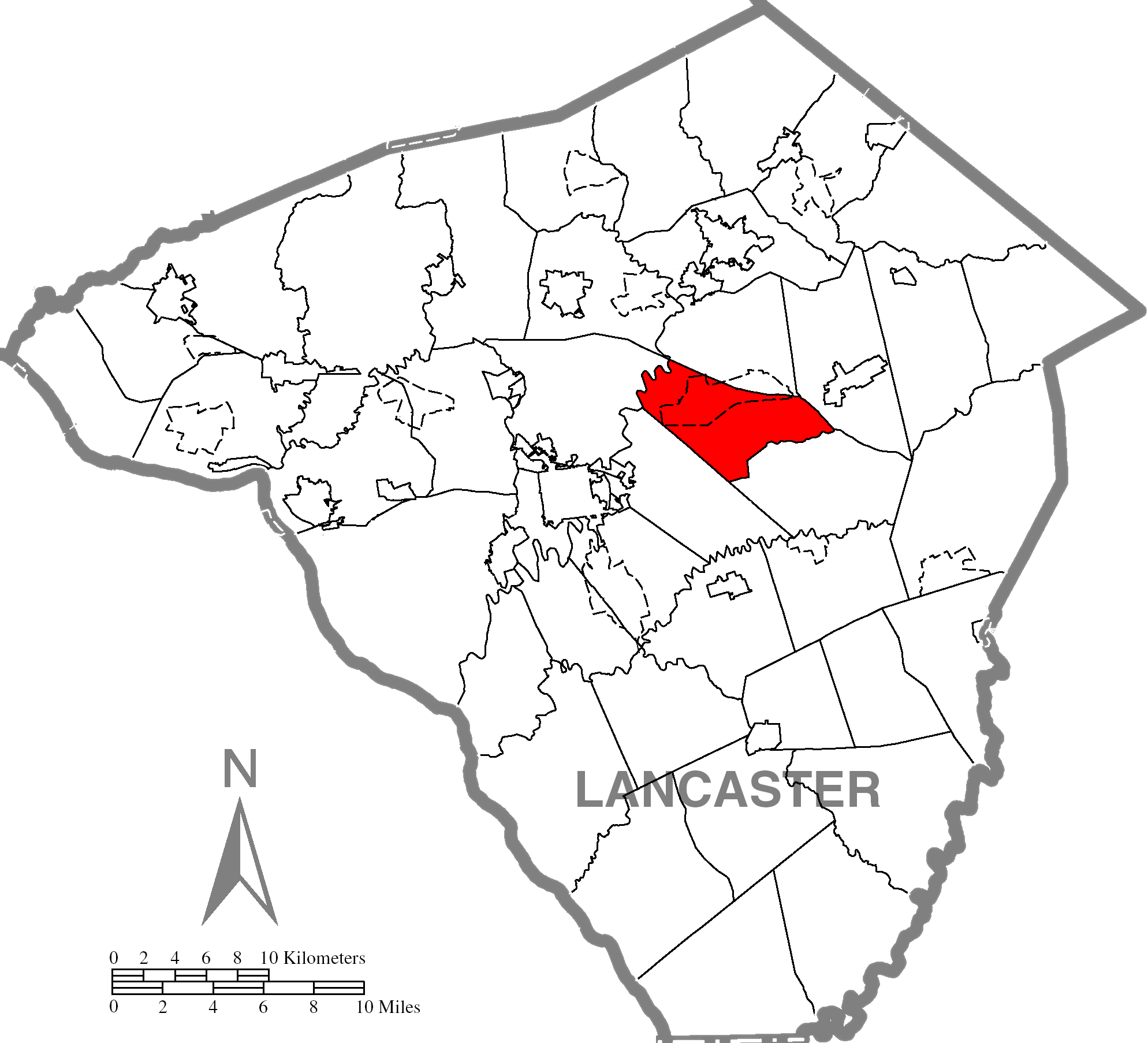
mapsize = 250x200px
map_caption = Map of Lancaster County, Pennsylvania highlighting Upper Leacock Township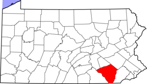
mapsize1 = 250x200px
map_caption1 = Map of Lancaster County, Pennsylvania
subdivision_type = Country
subdivision_name =United States
subdivision_type1 = State
subdivision_name1 =Pennsylvania
subdivision_type2 = County
subdivision_name2 = Lancaster
government_footnotes =
government_type = Board of Supervisors
leader_title =
leader_name =
leader_title1 =
leader_name1 =
leader_title2 =
leader_name2 =
established_title = Settled
established_date = 1731
established_title1 = Incorporated
established_date1 = 1843
unit_pref = Imperial
area_footnotes =
area_magnitude =
area_total_km2 =
area_land_km2 =
area_water_km2 =
area_total_sq_mi = 18.1
area_land_sq_mi = 18.0
area_water_sq_mi = 0.1
population_as_of = 2000
population_footnotes =
population_total = 8229
population_density_km2 =
population_density_sq_mi = 457.1
timezone = Eastern (EST)
utc_offset = -5
timezone_DST = EDT
utc_offset_DST = -4
postal_code_type =
postal_code =
area_code = 717
website = [http://www.ultwp.com/upperleacocktwp/site/default.asp Upper Leacock Township]
footnotes =Upper Leacock Township is a township in east central Lancaster County,
Pennsylvania ,United States . The population was 8,229 at the 2000 census.The township includes a village called Mascot, named by Annie Groff, a deceased member of the Ressler family, owners of the Mascot Roller Mills. She dedicated the name of the village to a canine actor she watched at a
Broadway theatre show on her honeymoon. [ [http://www.yourlancaster.com/places-mascot-roller-mills.htm Mascot Roller Mills & Ressler Family House] ]In 2005, the
Lancaster Barnstormers baseball team introduced its mascot, Cylo, at the village's Mascot Roller Mills. [ [http://lancasterbarnstormers.com/news.cfm?newsID=33] ] The location was chosen for its lighthearted synonymity with the wordmascot .Geography
According to the
United States Census Bureau , the township has a total area of 18.1square mile s (46.9km² ), of which, 18.0 square miles (46.6 km²) of it is land and 0.1 square miles (0.2 km²) of it (0.50%) is water.Demographics
As of the
census GR|2 of 2000, there were 8,229 people, 2,777 households, and 2,102 families residing in the township. Thepopulation density was 457.1 people per square mile (176.5/km²). There were 2,854 housing units at an average density of 158.5/sq mi (61.2/km²). The racial makeup of the township was 92.34% White, 1.24% African American, 0.15% Native American, 3.71% Asian, 1.29% from other races, and 1.28% from two or more races. Hispanic or Latino of any race were 3.24% of the population.There were 2,777 households out of which 38.6% had children under the age of 18 living with them, 65.3% were married couples living together, 7.2% had a female householder with no husband present, and 24.3% were non-families. 19.9% of all households were made up of individuals and 7.3% had someone living alone who was 65 years of age or older. The average household size was 2.96 and the average family size was 3.45.
In the township the population was spread out with 31.6% under the age of 18, 9.6% from 18 to 24, 26.4% from 25 to 44, 20.9% from 45 to 64, and 11.5% who were 65 years of age or older. The median age was 32 years. For every 100 females there were 98.1 males. For every 100 females age 18 and over, there were 96.1 males.
The median income for a household in the township was $45,403, and the median income for a family was $49,670. Males had a median income of $34,141 versus $22,309 for females. The
per capita income for the township was $20,902. About 4.4% of families and 7.0% of the population were below thepoverty line , including 10.9% of those under age 18 and 5.9% of those age 65 or over.References

Wikimedia Foundation. 2010.